When You Give A Classic’s Major a Blog Post (on the same day they see an archaeological dig)

with No Comments

Camping is always an adventure, even if said camping is in a schoolhouse.

The schoolhouse in Stöd is both clean and cozy, with a carpeted little atrium–that has become a kind of common space–and plenty of little nooks and crannies (like the upstairs foosball table, or the little office space I am currently using to write this blog post). Everyone has been impressed with the living situation, enjoying the space to roam and the opportunity to get a little bit of personal space during the quiet moments.

The day started busy, a quick but enjoyable breakfast and then a hop over to the dig site at Stöd. The site has been, thus far, a four-year venture– with multiple hands and great minds involved. The day before, Rannveig expressed that coming to work at the site was like a holiday, she only does it one month out of a year–so, the equivalent of four months of excavation. While four months may not seem like a lot of time, the site itself is exceedingly impressive. I am an Ancient Classics Major with a Medieval Archaeology minor, thus, the dig at Stöd was like walking into a candy store. While this is the first archaeological dig site I have viewed in progress, I have seen the final product of excavations and know a little bit about the process; I was very impressed by the amount the Stöd team had uncovered and how intact a lot of it appeared to be. Yes, the site does look like barebones to the naked eye–however, the number of walls and floors they have excavated and the length is surprising. You can actually imagine the structure there–whereas, there are a lot of sites (mostly older) that just look like a pile of rocks or scattered artifacts.

We were met at the site by Rannveig and Bjarni and educated on the history and rough outline of information about the site. What they have found is that there are the remains of two separate buildings, one bigger and older building and a smaller and newer building built inside the older. It is assumed that whoever created the smaller structure found the ruins of the older and found it more convenient and maybe offered more insulation to build within it. Additionally, the question that hangs in the balance is whether or not it was truly a settlement or just a waypoint (the latter being more common for Vikings to build). This depends on what DNA they find (especially in Midden heaps), if there are remnants of cattle then it is more likely that it is a settlement and not a waypoint.

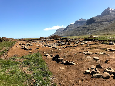
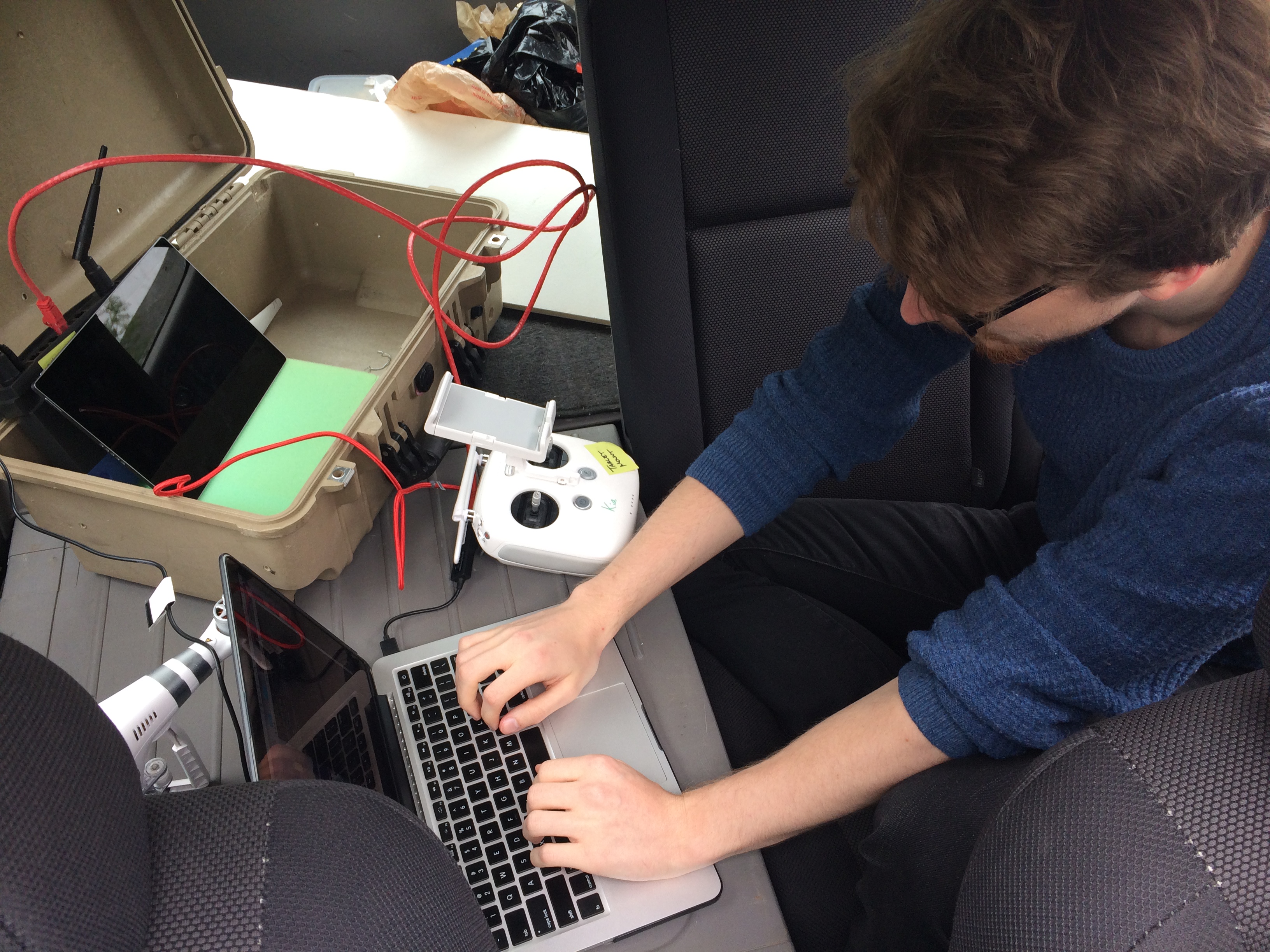
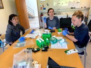
After we were all caught up we parted ways, separating into teams. We had Porter, Lilli, Jordan, Li, and Mubi working on drones–flying the flight plans and collecting visual data on the site (the first batch of photos were high definition photos which will later be used for a 3-D display of sorts; the second half was with the NRA camera, to help see if there is anything below the surface by capturing the UV light from the plants). Another team (E, Katherine, Joyce, and Sydney) was in charge of the soil samples we collected at Solo. Meanwhile, C ran around answering questions and helping as the Jack-Of-All-Trades and vehicle driver. And I was left to soak up as much information about the site and feed my passion–getting a feel for what a dig looks like, meeting everyone, asking questions, and observing the excavation as it is and what it will hopefully turn into.


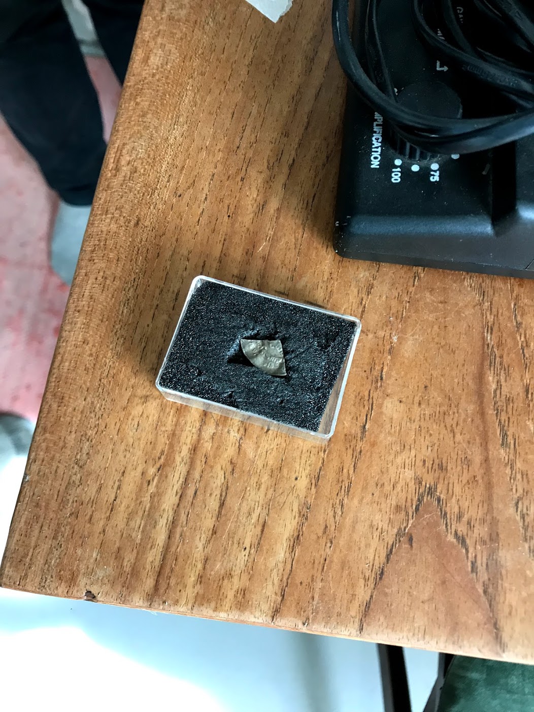
Since it was a holiday (Wit Monday, following Pentecost), the Stöd team was not digging today, however, they were available for questions and willing to share information. By about lunchtime I had been shown the artifacts (AMAZING! There are stones, a nail head, a part of an Arabic coin, some beautiful beads, etc.) and I had discussed the finds in their newest test pit (they found a bit of a wall and a hearth); while also asking some basic questions about identification of settlement and what the work looks like on a normal day.


Again, it was a holiday so all the businesses were closed today. Except, there was a wonderful restaurant/gift shop called Brekkan which welcomed us in and served us lunch. It was a fabulous meal! Baked Fish with a cream sauce, fries (or chips), some sweet dark bread, and salad with grapes. It was all delicious and very much appreciated. Everyone at the table had their fill (maybe even a little too much–I certainly felt like I had to be rolled out the door afterward) and sat, very satisfied. 

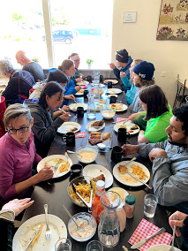
We came back to the schoolhouse to gather more layers (the wind was biting cold and the sun was just not warm enough to make up for it like our previous nine days) and to split up again. This time Lilli stayed behind to work on uploading the available drone photos, while the rest of the drone team headed back out to take the NRA photos. Soil people stayed behind to continue their diligent work in the dining room area of the schoolhouse kitchen (you gotta do what you gotta do).

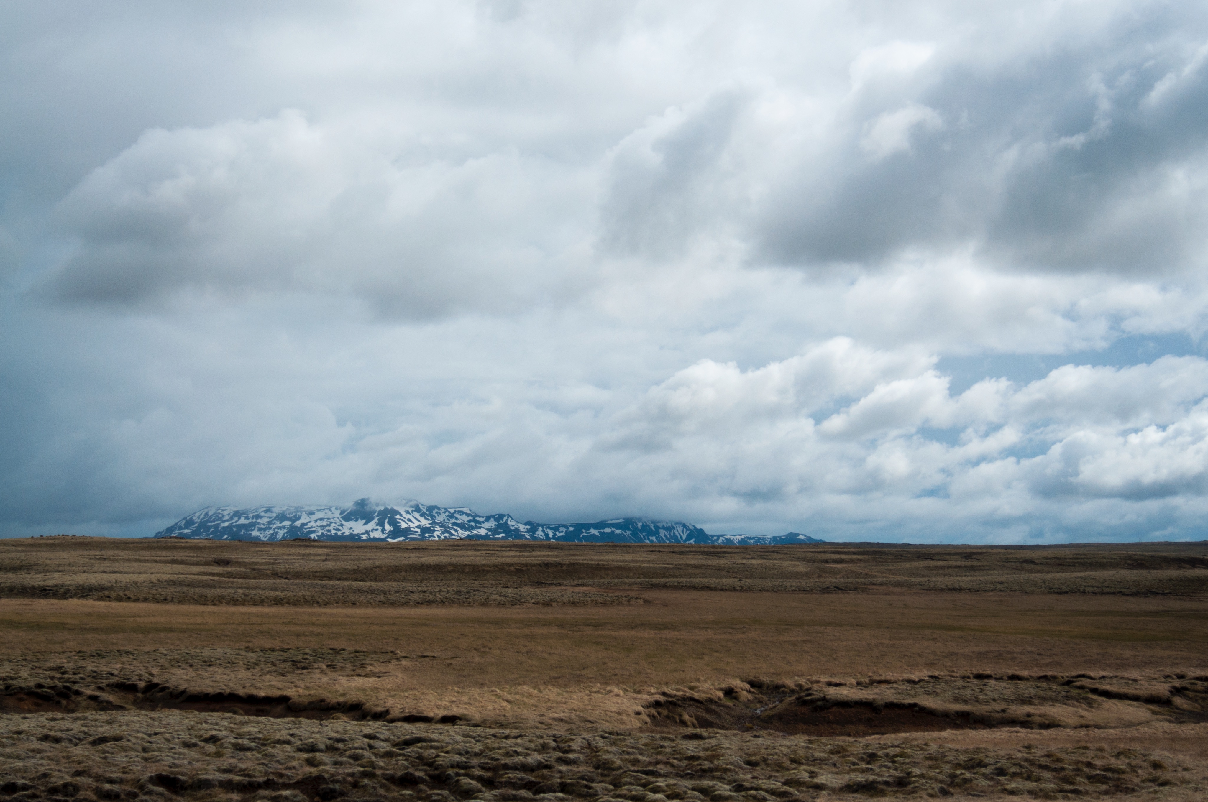
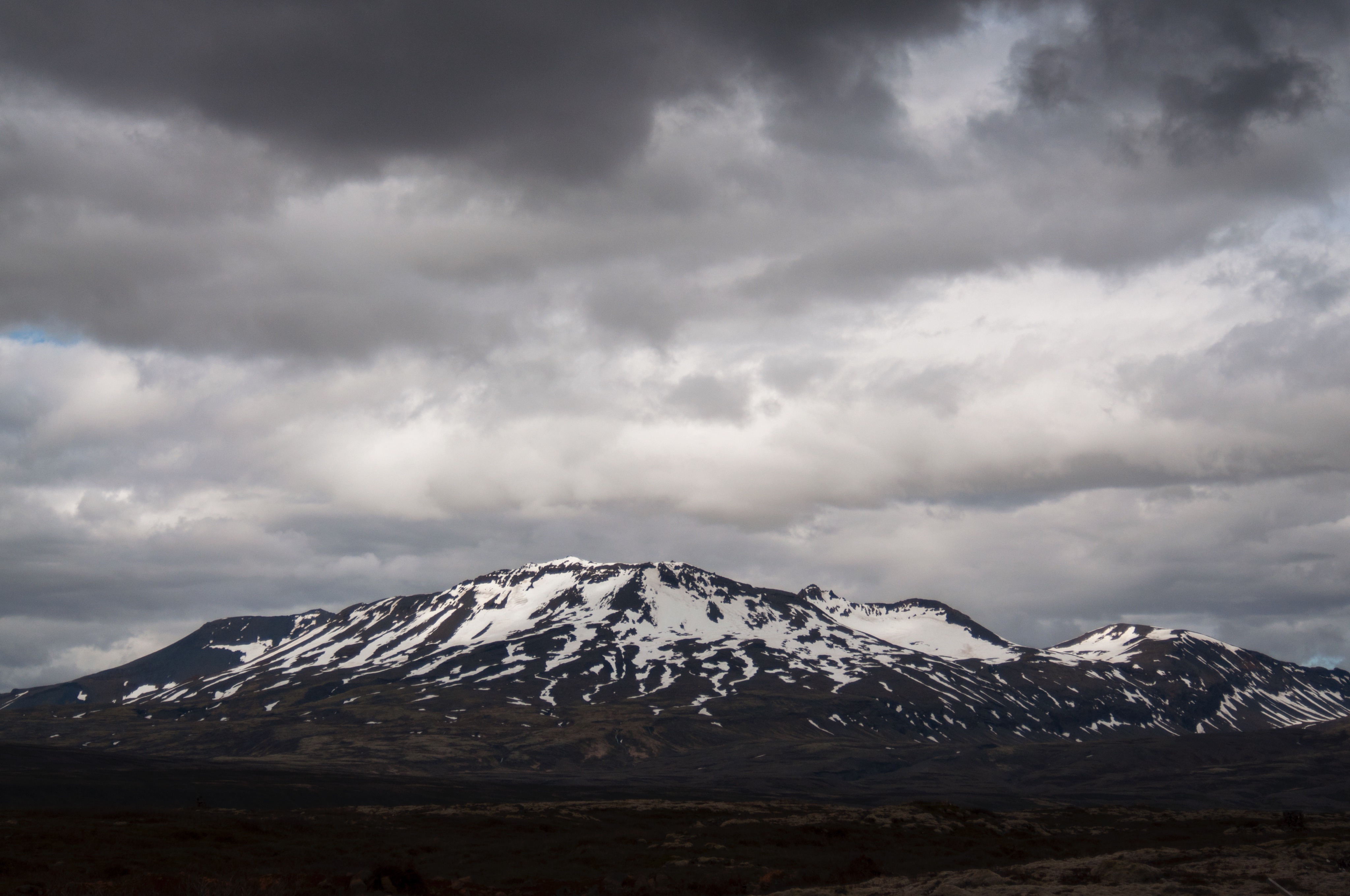
I left with the drone group to continue my archaeology observation. I worked for a time creating a (ROUGH) sketch of the site, sitting in the grass and feeling the brisk cold wind. I certainly appreciated the blanket scarf I had picked up after lunch and the warm sun on my back. As I sat I heard unique bird calls, though I was unable to identify where they were coming from and what species was calling out. It is fascinating to observe the variety of birds that live in Iceland, so many species that are different from the ones I am used to in the States (in addition, I’ve grown up in Alabama and Indiana my whole life, which limits my avian knowledge to a limited area).
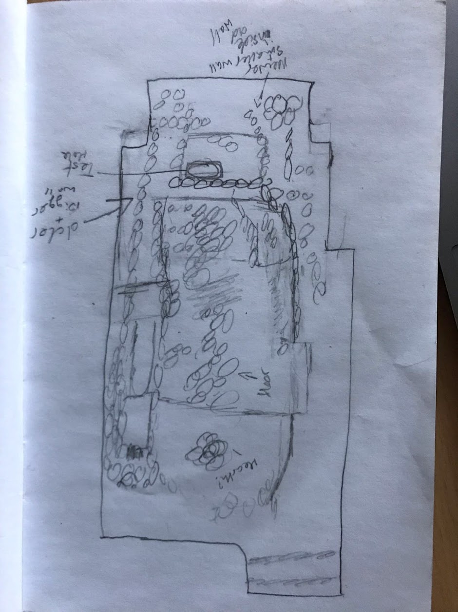
After sketching, I sat in Rannveig’s “office” (the back of a huge van, with camper chairs and a tiny table). This is where we discussed the different sections of the site (using my sketch as a reference), how it compares to other sites, the work she has done in the past, my research knowledge of Norse raiding and settlement in Ireland, and about the different jobs and activities Rannveig has done or is a part of throughout a year’s time. It is interesting to note, there are several positions open for archaeologists to become consultants for the government or building/electricity organizations, but it lasts about half the year due to weather constrictions.
The drone group finished up around 3:15pm (15:15) and we packed up. We were all eager to take showers in the pool facility and looking forward to taking a dip into the hot tub or swim in the pool. 
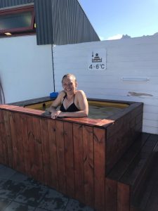
The facilities did not disappoint. We were all able to rinse off and enjoy the hot tub or pool, whichever suited the fancy. I noticed Joyce, Roger, C, Mubi, and Katherine floating around in the pool– while Sydney, E, and Lillian lounged in the hot tub (Rannveig joined the hot tub later–as did most of those swimming in the pool).

It took a bit of encouragement from Sydney to get me out in the open–the wind was still freezing, but this time I was wet from the shower and in a bathing suit. The hot tub appeared way too far away and when I opened the door the first time, and the wind hit me like a wall of ice. E later commented on how it appeared as if watching a cartoon– the door opened, I yelped, and the door was quickly closed again. However, nothing was colder than the 4-6 celsius cold tub. Sydney dipped inside first, staying in long enough for a photo! She later said it was as cold as the glacier runoff she had waded through at Solo (after dipping into the tub myself, I have a newfound appreciation for the determination Sydney, C, Jordan, and Porter had to science that day, at Solo– jeeeeez, it’s cold!). After a bit, most of us at least tried the cold tub– including Lilli, C, Rannveig, and I– which, honestly, really added to the whole swimming in Ice(land) experience.
In a minute, we are going to be treated to Grilled Cheeses and Tomato Soup made by Lilli and Porter. And C has recently collected all the NRA photos and pieced them together–now we wait for the code to be able to adjust the light according to the native plants.
Exciting new developments in Archaeology!!! Hopefully more is revealed as we continue to explore and experiment.


Rebuilding Kia

with No Comments

This post is meant to be a fairly general outline to repairing the gimbal on DJI P3As, containing links we used (Rei and Dan) while replacing the arm on Kia after an unfortunate encounter a very breezy day. Will also contain some notes on working on the body and replacing the landing gear.


To repair cracks in the body we used different glues based on the size of the crack. For small hairline cracks, we used Bsi super thin (blue lid). Be careful you only need a little bit and it’s easier to add more than take some off. For larger cracks, we used Bsi gap-filling medium (purple lid). When repairing the body be careful not to glue the frame together, if you don’t want to separate the top and bottom, you can slip a piece of paper in between to prevent supergluing the body together.


After futzing with the ribbon enough times we wore out the adhesive, to replace it we used auto/marine sealant.


Open the shell using a T-6, T-8, and T-9. Every screw that doesn’t connect the legs needs to come out. There are 8 locks that hold the top and bottom together, one on each of the arms, and one along each face of the body, think a compass with the ordinal as well as cardinal directions where the ordinal are the arms and the cardinal the faces on the body.

Slide a propeller in the space between the top and bottom of each arm, take care to get the propeller under the wire connecting the motor to its board. Move the propellers together, unlock each of the arms catches before starting on the body catches. Be careful with the body catches as they’re close to the delicate electronics.

https://www.youtube.com/watch?v=py2fXSvV40I   

Gimbal repair(ribbon cable, arms)-Small Phillips head. Exacto knife, a small flathead, and the green squidge were all very helpful.

https://www.youtube.com/watch?v=A3vCvchnnv0

https://www.youtube.com/watch?v=gqEqu8tBg1g


To replace the ribbon start by attaching the camera connection first as it is the most difficult, and a real PIA to do when everything else is glued in place. Use exacto knives, fingernails, or small flatheads to pop the latch into and out of place, making sure that the cable is inserted all the way to the white line when installing. The cable has to be wrapped around the connection twice, which is what makes this step the most difficult. If you have to undo the connection the easiest way is to put an exacto knife between the outside of the camera case and the cable, with the blunt edge touching the wire as it enters the camera case, and twist the knife in the direction of the cable.  We found it easiest to take the cover off each tape as we did it instead of all at once.

MAKE SURE EVERYTHING IS FACING THE CORRECT DIRECTION BEFORE INSTALLING THE WIRE.


-Rei and Dan

Long Day’s Journey Unto Ice

with No Comments

Today began at 7:30 when Charlie and Emi left to pick up the rental van at the airport in Egilsstaðir, roughly 30-45 minutes away. Sanne, who runs and maintains the house at Skalanes, drove them – and as much luggage as we could pack in – out to the parking area where we had one rental car waiting. They transferred people and luggage into the rental and drove off. The rest of us ate breakfast, cleaned up the house as best we could to help out Sanne and the others who run Skalanes (a group of 30 is arriving at Skalanes tomorrow!), and began to load up Sanne’s vehicle with all of the luggage we had not been able to send with Charlie and Emi. Once the luggage was loaded, we began walking out the drive while Sanne drove the luggage to the parking area and then turned around to pick us up and drive us the rest of the way. At the parking area, we were faced with a cold and windy wait as Charlie and Emi drove back. We amused ourselves with word games and hypothermia dances until finally they arrived.

Loading up the vehicles with luggage and humans took only a few minutes, and then we were off on our long drive back to Vik. We stopped for a few minutes at Glacier Lagoon so Marketing could get some nice picturesque footage of us in Iceland and briefly saw a seal – they occasionally swim up into the lagoon, which is apparently close to 200 meters deep due to the icebergs. Other than that, the drive was long and pretty uneventful, with stops only for restrooms and other necessities. At one of the gas stations we learned that today is a holiday here in Iceland (Whit Sunday, the day before Pentecost), and we were concerned that the grocery store here in Vik would be closed, preventing us from getting groceries for tomorrow. We made a short detour to Klaustur, where we knew there was a gas station/convenience store that would have some basic groceries available, and picked up materials to make some quick Mac and Cheese for dinner tonight and sandwich materials for lunch tomorrow.

When we pulled into Vik we discovered that the grocery store is in fact open today and we needn’t have worried, but the early shopping trip did allow us to begin working on dinner much sooner after we arrived. Everyone was tired and hungry, since we pulled into the hostel at 7 pm and had left Skalanes at 8:30 (or earlier) this morning. It’s after dinner now, and Charlie and Neil are working on getting the elevation platforms and drone ready for tomorrow, when we’ll be returning to the Sólheimajökull glacier. Rather than collecting soil samples like last time, we’ll be climbing on the glacier itself to collect geographical and volumetric data we’ll use to chart its recession over time. Nic is down with a nasty cluster headache, which is preventing him from helping get the drone ready. Yesterday I finished modifying and debugging the elevation platforms’ code, but now Charlie is trying to debug an issue with Field Day, the Android app we use to gather data from them. All in all, it’s a pretty regular night for us here, with a group playing Euchre in one area and tech gear exploded across another space.

Tomorrow we leave the Puffin Hostel at 9 am to meet our glacier guides at 10 and begin collecting data on the ice.

Indiana Jonesing For Some Sun

with No Comments

The day began like many others at Skalanes, grey and rainy. Despite the dreary day Emi, Neil, and I set off to visit an archaeological dig a few fjords south of us. The relentless rain kept the rivers high, forcing us to make the trek out to the parking lot on foot yet again. Conditions were slightly better today, and we kept a quick clip, arriving at our car in under an hour, hitting the road at around 8:30. Along the way we got to go through a 6 km long tunnel dug through a mountain, which I found far more impressive than the tunnels of my native Pittsburgh. Apart from the tunnel we arrived without incident, and were greeted by the sight of several heavily clothed figures kneeling in the dirt.  We were then introduced to Bjarni, who explained the goals and methods of the dig, and took us to several holes pointing out the various tephra they were using to date the soil. It continued to rain. After the tour we enjoyed some excellent pizza and fries in Brekkan, a restaurant in the town of Stöðvarfjörður with the dig team. Following lunch we stopped in Egilsstaðir to pick up Mark and Susana, Earlham photographers who will be recording the rest of our travels, and returned to the house on Skalanes. During the afternoon the rain let up enough that Oli was able to ferry us  and all our gear, back in a single trip! And the sun came out! Although briefly. But it was much appreciated.

Meanwhile back at the ranch, porpoises were spotted in the fjord. Also various bug fixes in software, progress.

Day one on the Solheimajoekull glacier

with No Comments

Today we drove from Reykjavik to the Solheimajoekull glacier on the south coast of Iceland to take soil samples and try-out flying our remote piloted aircraft (AKA drone). Groups of Earlham students & faculty have been working here for a couple of years measuring the shrinking extent of the glacier and taking soil samples on which we do 16S rRNA sequencing to characterize the development of soil microbes as the soil develops after being exposed by the receding glacier.

The red circle on the image is the area we work in, for a sense of scale the circle is about 2km in diameter.

Solheimajokull glacier, we work in the red circle (roughly).

This picture was taken from the ridge on the East side where we were sampling. We are almost always wet and cold when we are working here, but all a person needs to do is look around and take in the amazing view to feel pretty good about being there.

Panorama from the East side.

After finishing we piled back into our vehicles and drove to Vik where we will be staying for the next two days. Emi made a great dinner for us and now we are organizing the samples and data we collected today. Tomorrow we go to Heimaey, an island off the South coast to hike the two volcanoes located there and test our new elevation platform.

And so, we landed!

with No Comments

Today marks our fist day here in Iceland.

Events started in a bit of a disarray with the airlines misplacing some important biology items and Charlie attempting new fashion trends,

but nevertheless after collecting our things from the baggage claim we soon found the members of our group who had arrived ahead of the main party. 

Dan was our fearless leader of the day and we organised into groups to get some errands done such as getting an emergency SIM card, going grocery shopping, and getting dry ice. At this point everyone was feeling the effects of tiredness, jet lag, and the every present brightness special to Iceland.

The day was far from over though, for our first real taste of Icelandic scenery the group went off to Þingvellir, a national shrine and home of the first parliament in existence, that lies directly next to the Almannagjá canyon which is made by the separation of the north American and European tectonic plates.
In such a short time, we have already been met by so much beauty here in the land of fire, ice, and trolls, we are all excited for what the next couple of weeks have in store for us.

Taking the LiDAR out for a spin

with No Comments

We took the LiDAR out for a spin on Friday. We had a beautiful (read: high tech) rig that consisted of Neil driving, Kellan holding the LiDAR out the sunroof, and Nic spread out across that back seat with the drone (Kia), laptop, and router, collecting data from the LiDAR. We re-learned that Kia doesn’t like having a lot of metal around, so our plan to collect GPS data was challenged, more on why GPS data is important below.

This is us trying to get a good GPS signal on Kia, not us actually driving with Kia sitting on the roof…
Note: Kia is the drone not that we are in a KIA car


After a lot of indoors practice with the LiDAR, we determined that the best way to set up Kia when in Iceland is to have a balanced rig with weight evenly distributed to the sides. The elements that we have to consider are the LiDAR, a wifi transmitter as well as battery packs for both. Neil and Charlie are working on getting these built in a reliable prototype.


Our ultimate goal is to create point clouds from the LiDAR data based on GPS coordinates. During our test run on Friday we collected data but are still mapping this data based on time instead of GPS. Our plans for Monday are to pull the GPS data from our Friday test run from the Kia and align the GPS/telemetry data with the LiDAR data in a point cloud. This will allow us to correctly map the data in a point cloud. We can’t map the LiDAR data using time because the LiDAR spins faster than our time readings and time is linear and our flight most likely won’t be linear. If we were to create the point cloud using time, we would have a straight line where the data would be stretched out and repeated.

Driving, of a sort

with No Comments

This is the first of a couple of short clips from the GoPro dashboard cam that we used in 2016 (we plan to again this year). The wheat-to-chaff ratio is pretty low, but the kernels you do find tend to be gems. In this clip we are driving down to the red sand beach on the West coast of Iceland. It’s near the end of a long day of driving from Akureyri, Nic is at the wheel with “support” from Erin, Deeksha, and the Talking Heads.

Catching-up

with No Comments

In some sense the amount of activity going on is inversely proportional to the posts we’re making here to document it… Here’s a quick summary of what we’ve been working on since my last post:

o LiDAR – We have new unit which is much more capable. We built a test-rig in Hopper to simulate having it on Kia, we’re just starting to collect data. Nic and Kellan are working on the algorithms/workflow to analyze it. Charlie is working on mounting it on Kia.
o Image processing – Kellan and Nic are working on a workflow for extracting features from the images. Charlie built a map (headed to QGIS) with marked known POIs on the Skalanes peninsula to use as part of the training data.
o Glacier forefield sampling – Tara and Charlie are developing a sampling plan and 16S RRNA workflow for processing the soil samples.
o Benchmarks for registering multi-modal data collected by sensors on the RPA.
o Discovered Siggi’s yoghurt.
o Kristin and Charlie are working on Field Day, mostly on the BLE plumbing.
o Checklist App – More news to follow.
o Gail and Charlie have done lots of logistics and planning.
o Emi is working on the avian surveys and the MinION workflow for processing glacier forefield soil samples
o New ambiance platform (single chip) is designed, construction to follow.

More regular updates to follow, we’re all psyched.

Some set backs

with No Comments

This week has been a bit frustrating, but it all seems to be looking up now.

After taking some test images with the UAV last weekend I realised that there was image fragmenting going on with the camera. This meant that one of the cables was either lose, dirty, or damaged. So, after quite a few hours of hardware debugging (cleaning plus some cable re-seating, etc) Im reasonable certain the ribbon cable that transfers the actual image to the tablet receiver needs to be replaced. I still have no idea what caused the actual damage in the first place, but thats a little beside the point. Unfortunately that means until that comes in the camera will be out of order. (…Charlie ordered two just in case…)

BUT FORTUNATELY, that gave me an excuse to take the whole camera gimbal off which means its time to fly without the camera and stress-test how much of a payload it can carry! *cough* I mean, purely in the interest of knowing our payload total for the UAV+CAMERA+LIDAR.

In other news, after setting up a physical router I was able to solve the uplink problem. Essentially it turns out that having complete control over your ports when trying to control ~6 different java servers worth of information transferring all at the same time is really useful.

1 2 3 4 5