Highlights of an amazing trip

with No Comments

Today is the last day most of us are in Iceland for this trip. As I started this post, we were completing a tour of the Golden Circle after a few days in beautiful Reyjkavik. Now we are preparing for departure.

Our view of the volcano

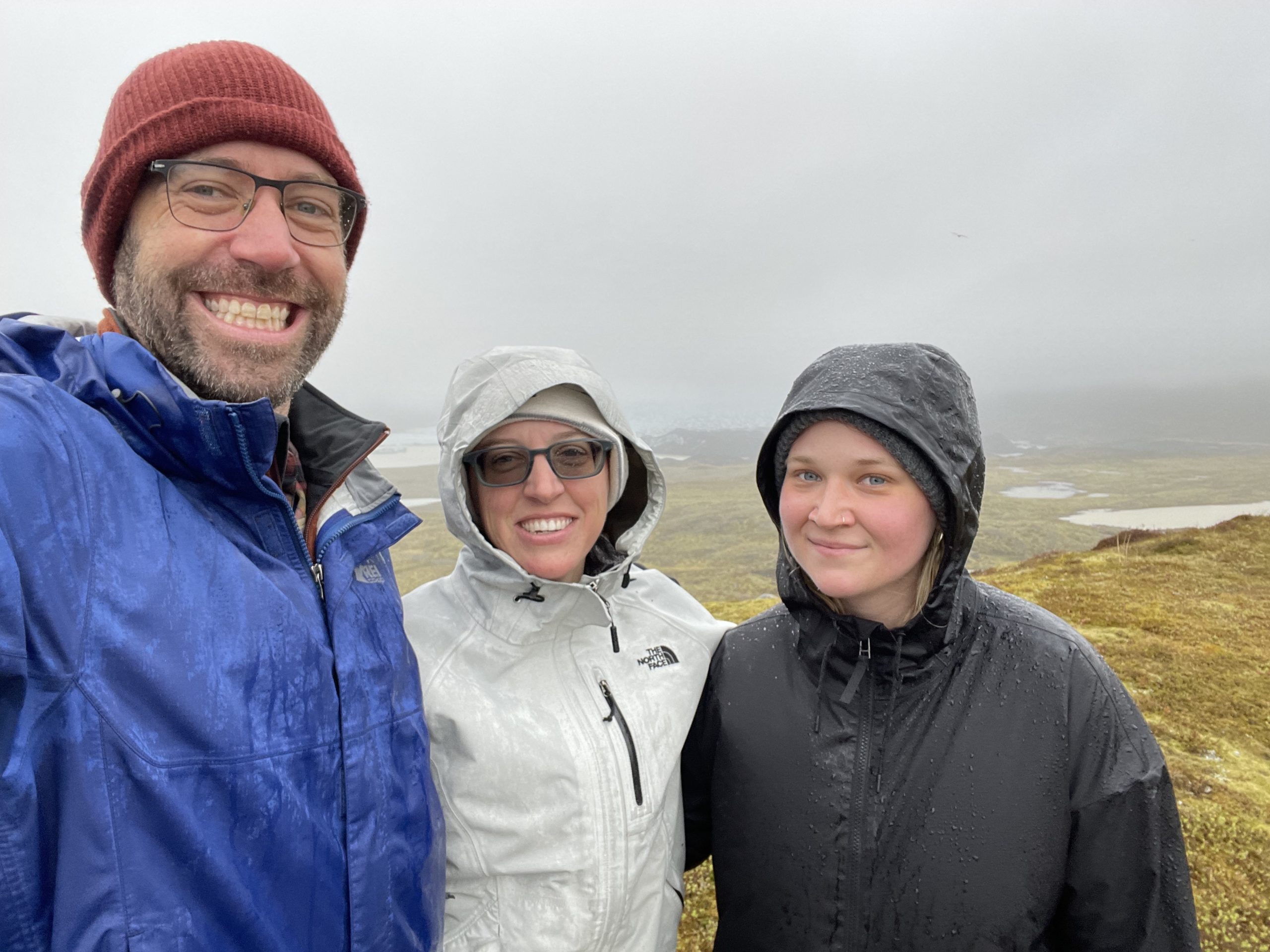
I wanted to post some of the highlights of our trip. There’s a rough order to them, but don’t take the numbering too seriously – it’s been a great experience all-around. Without further ado:

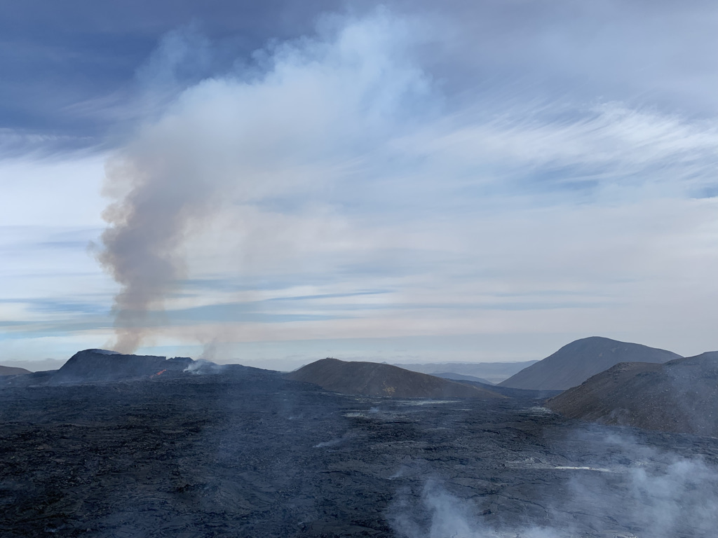
  1. The volcano is truly incredible. It was not uncommon for people to spontaneously shout “Wow!” and “Oh my god!” as the lava burst up from the ground.
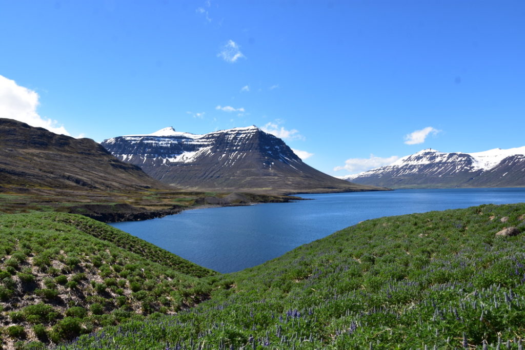
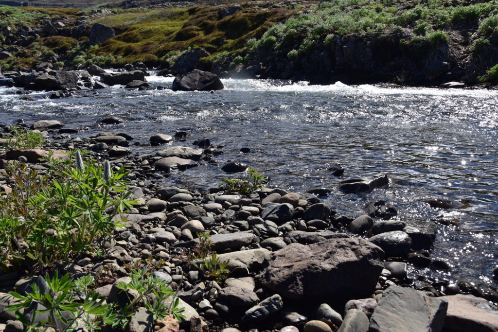
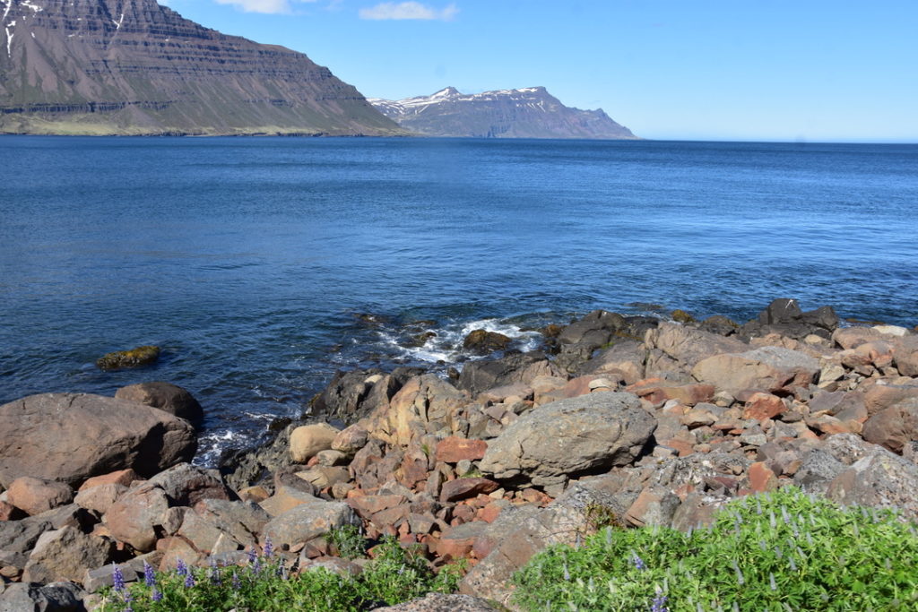
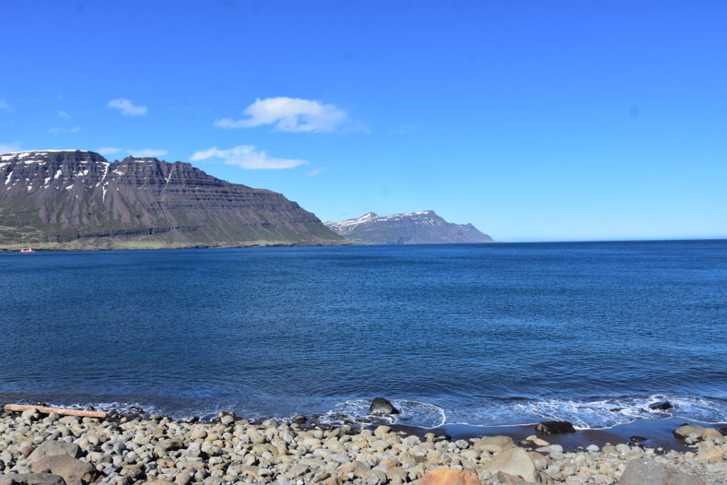
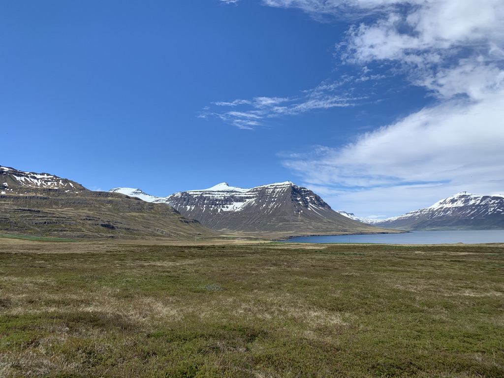
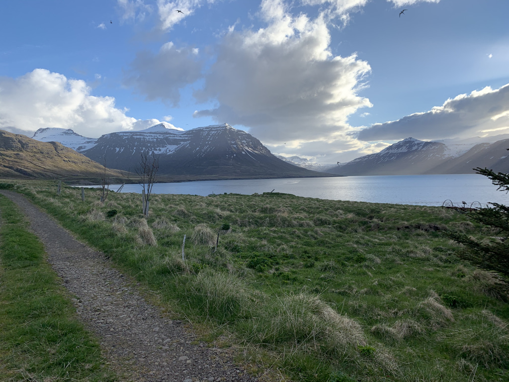
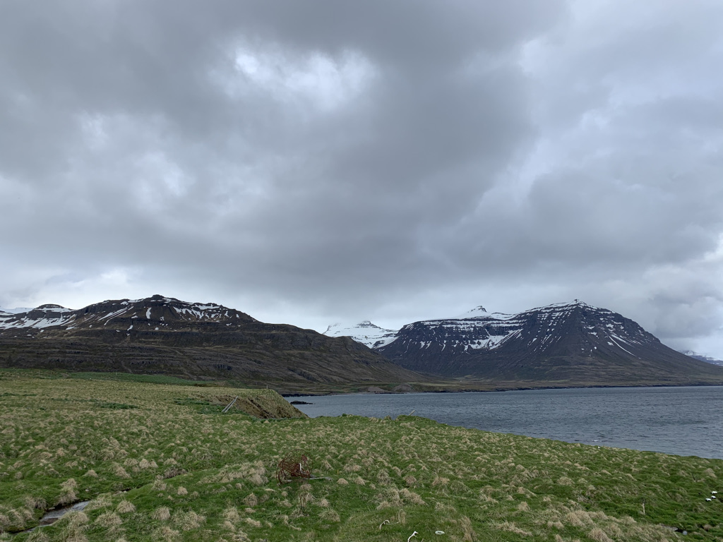
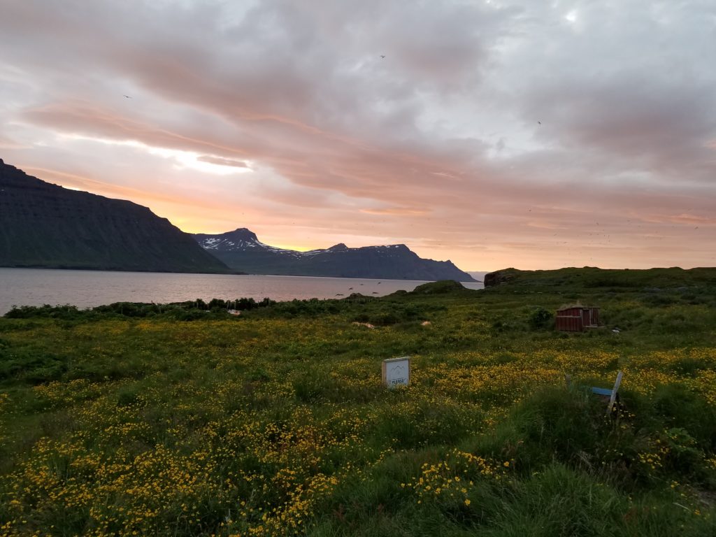
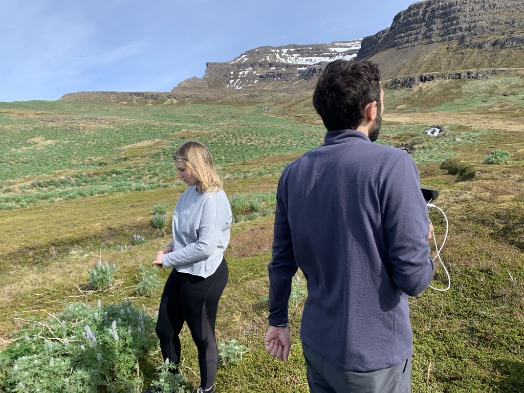
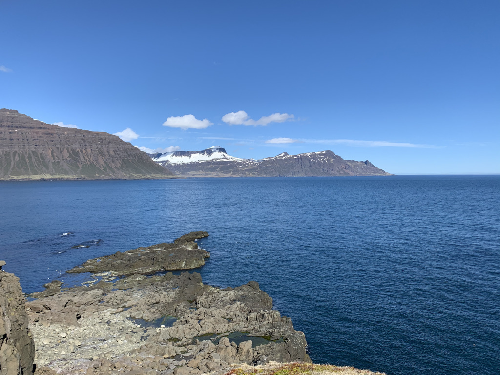
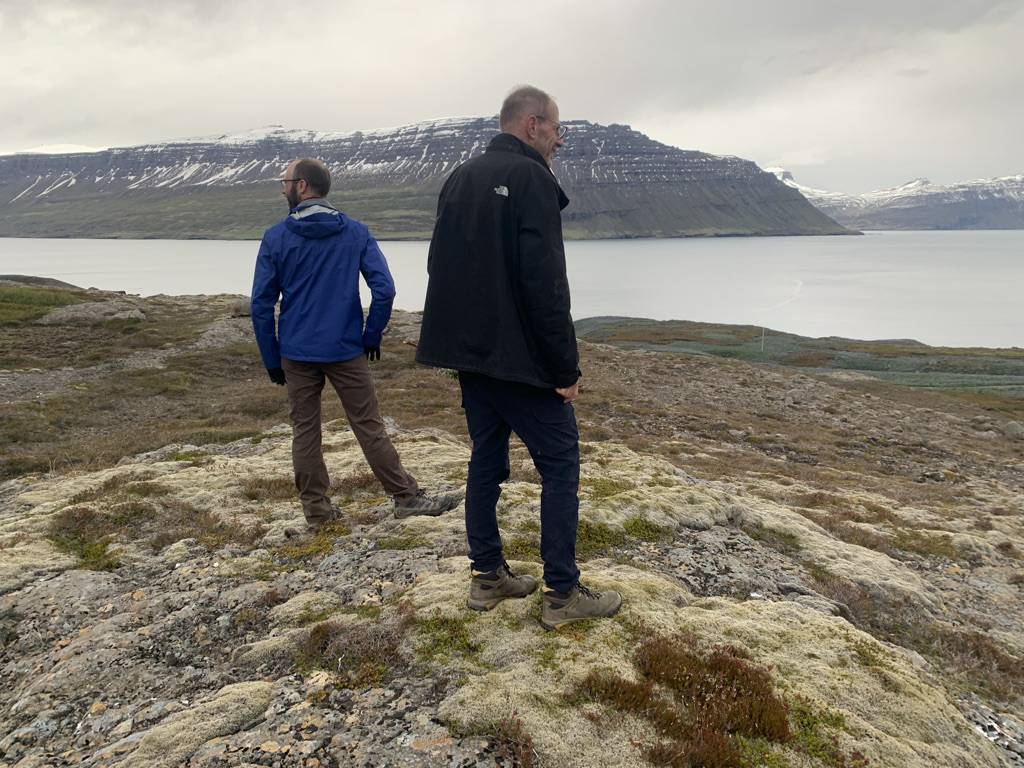
  2. We woke up every day for a few weeks with a view of a fjord.
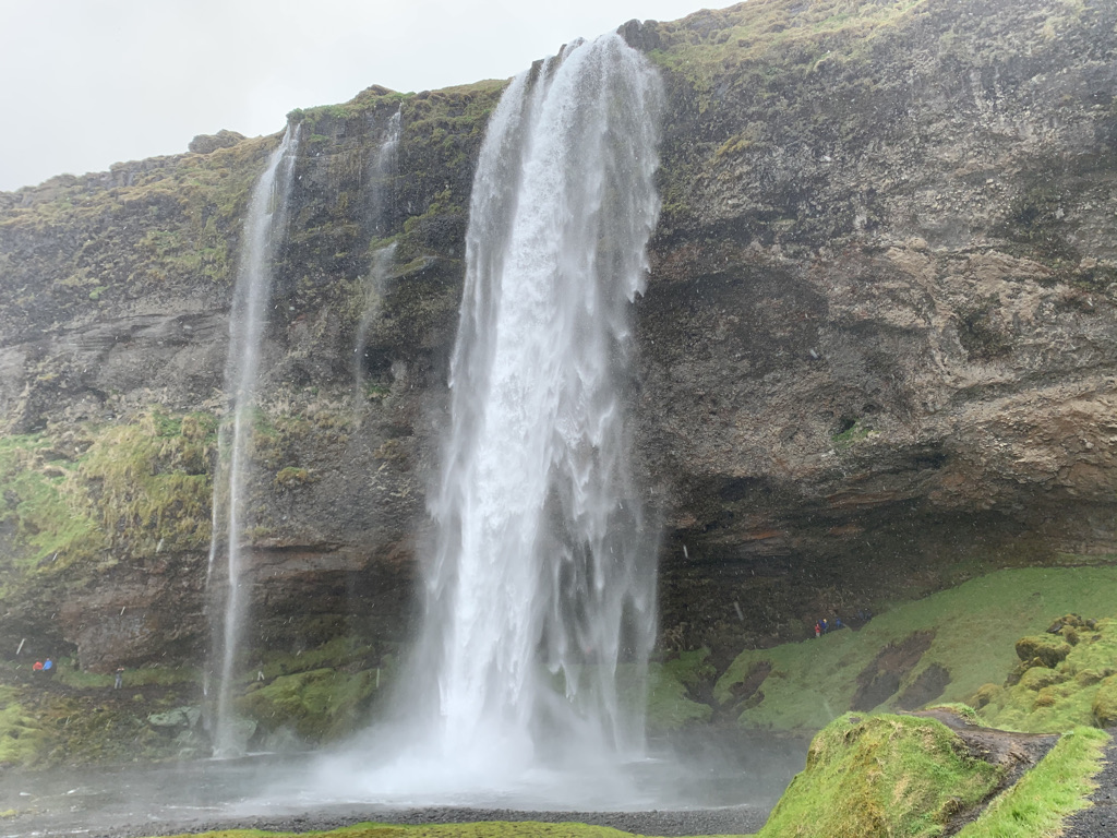
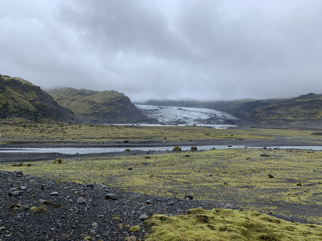
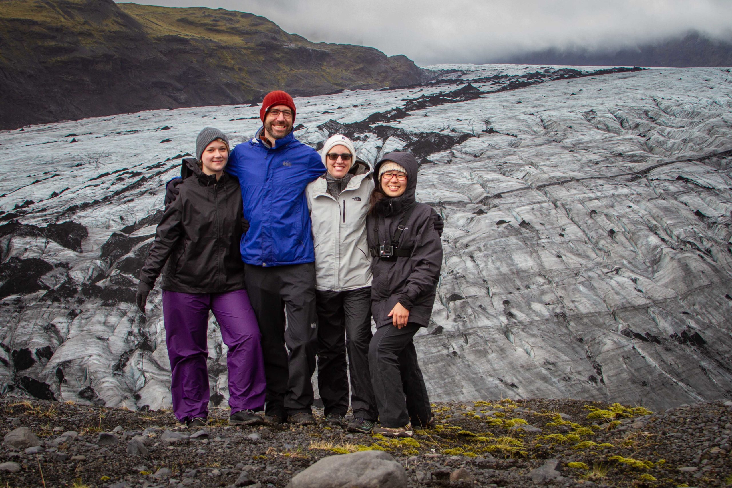
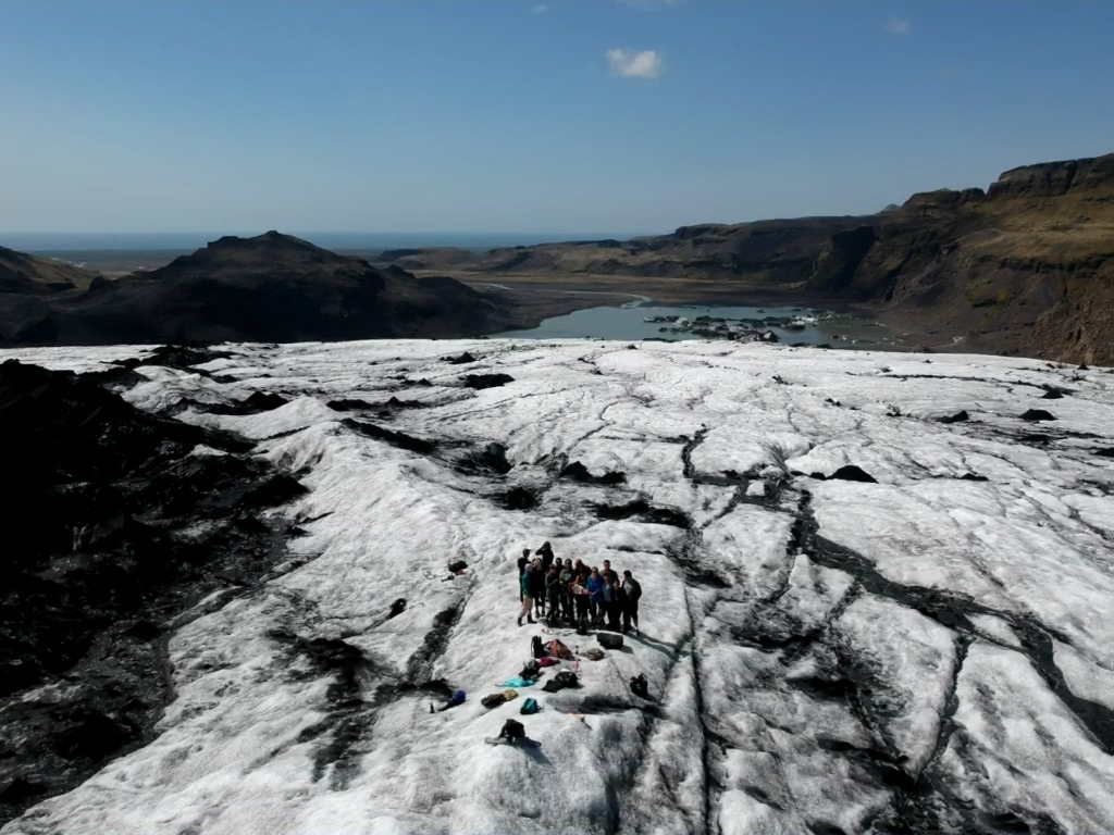
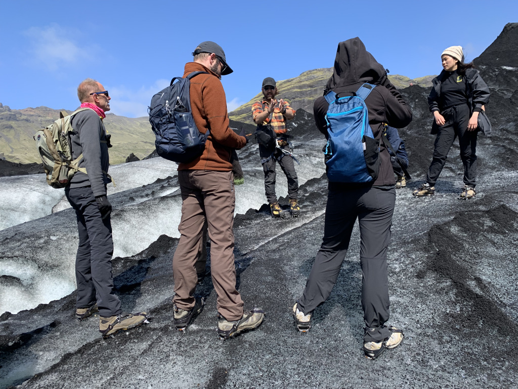
  3. We did a glacier hike on Sólheimajökull, with two awesome guides.
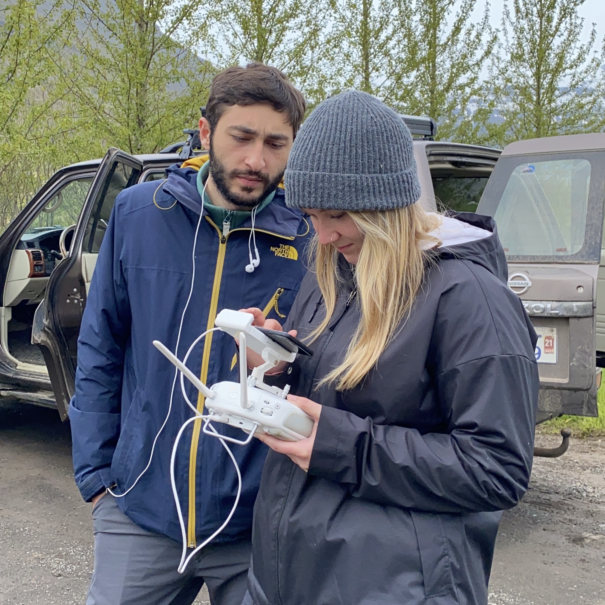
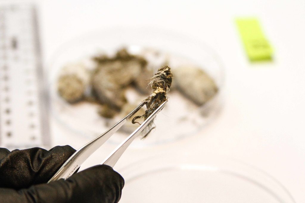
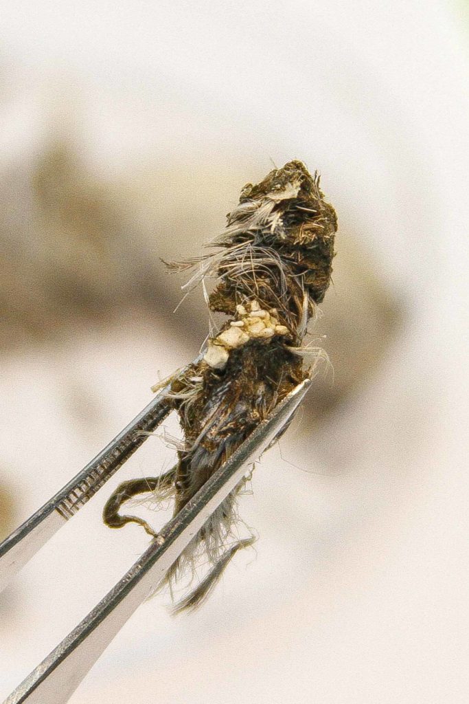
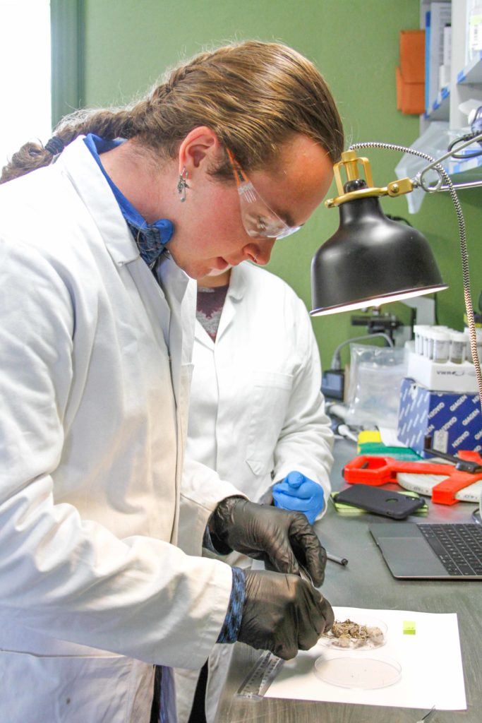
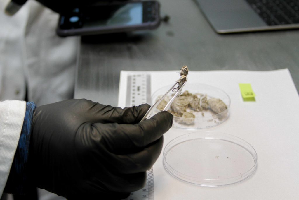
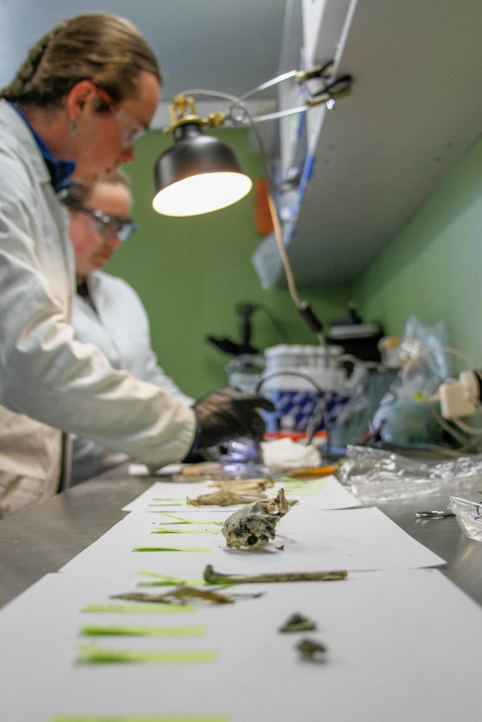
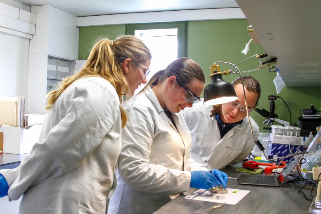
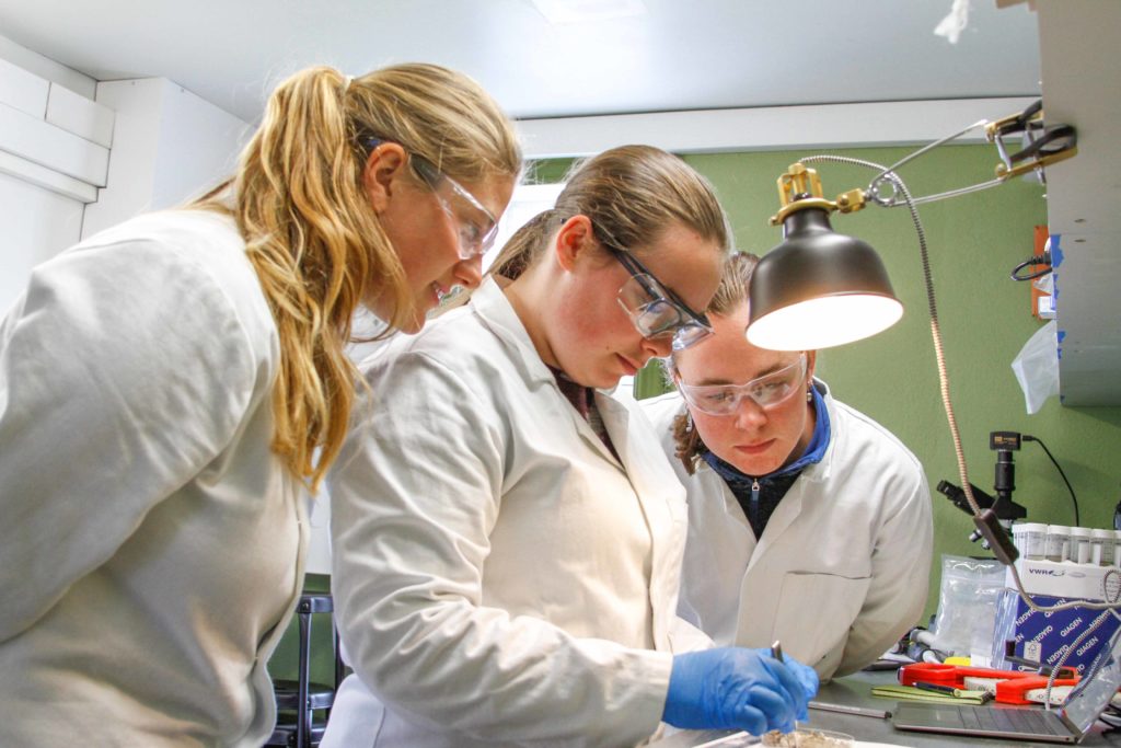
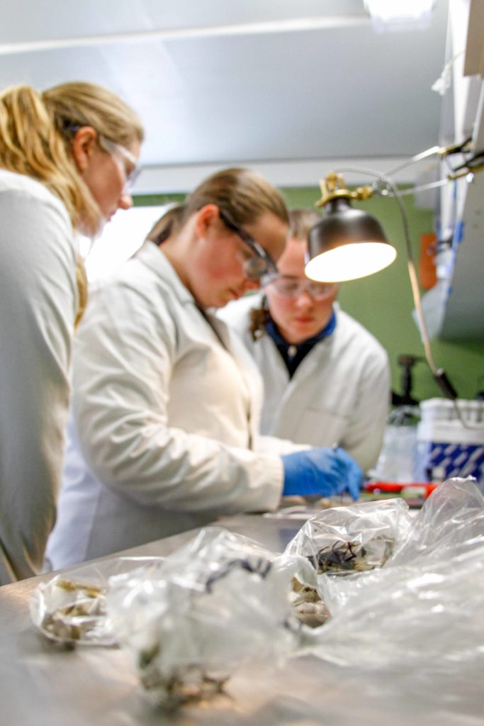
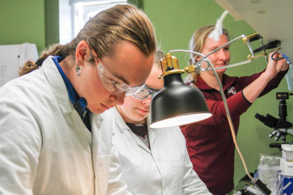
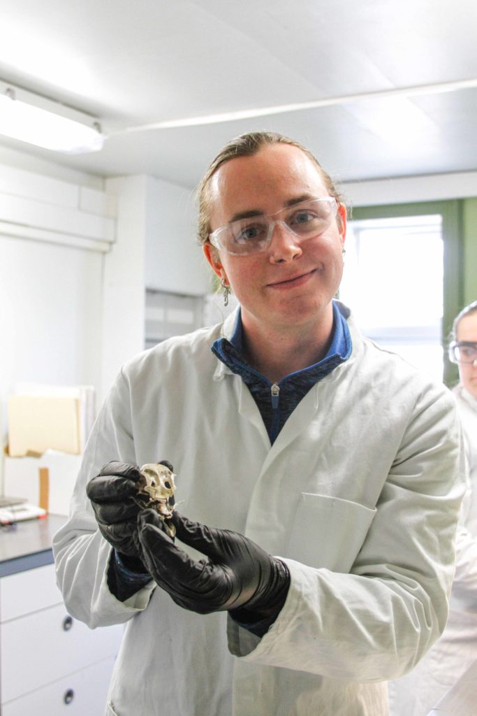
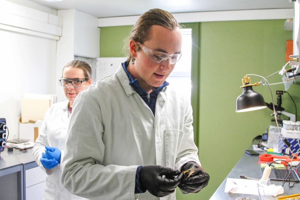
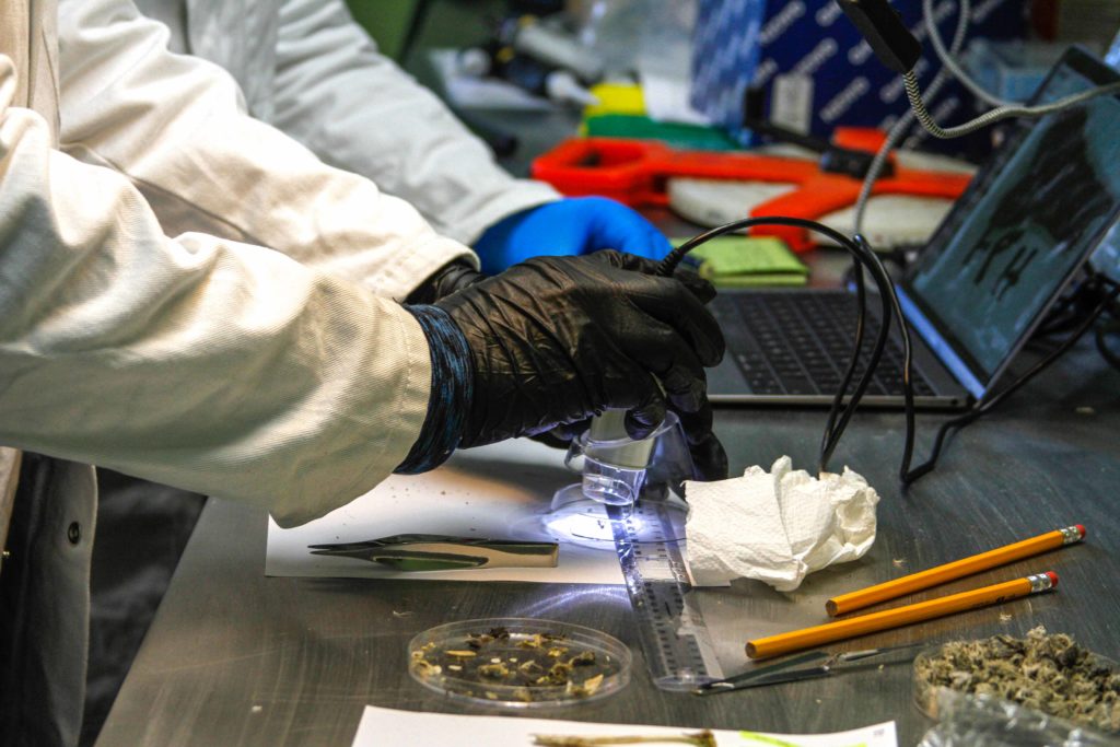
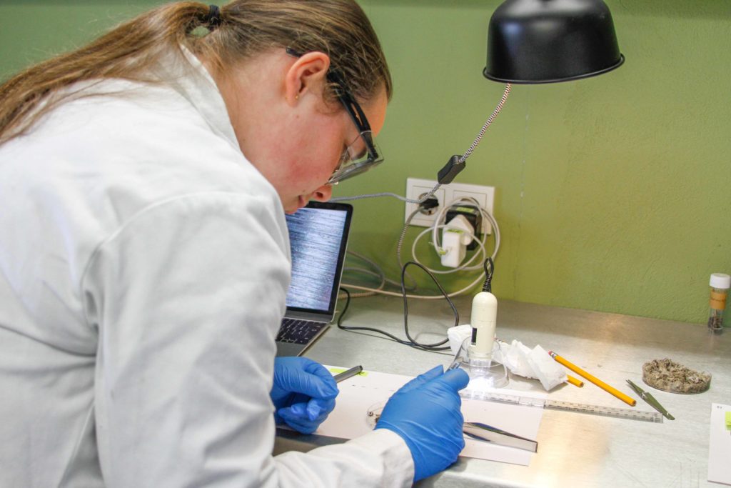
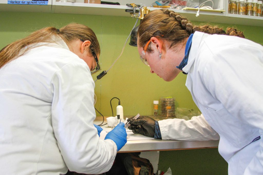
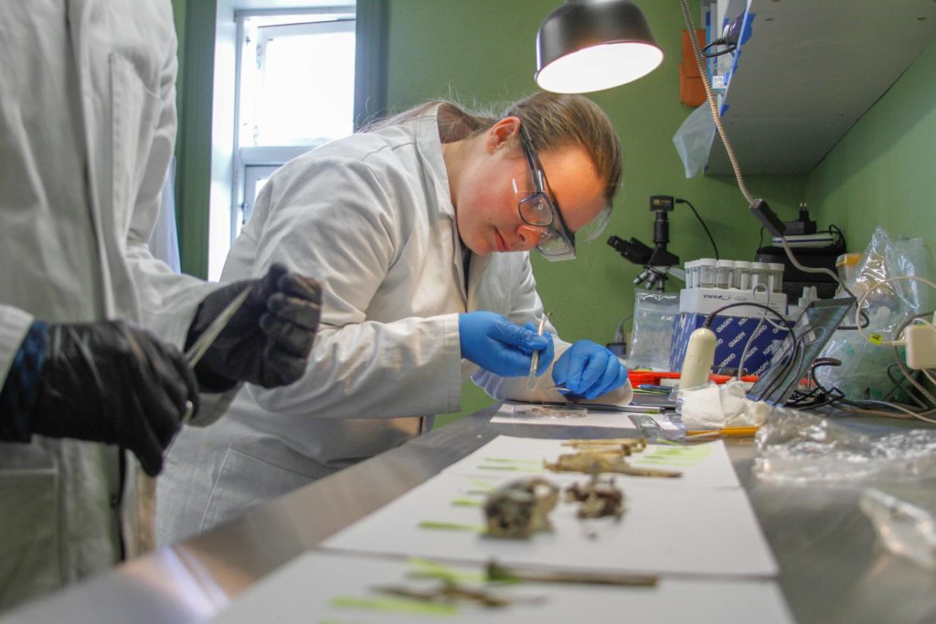
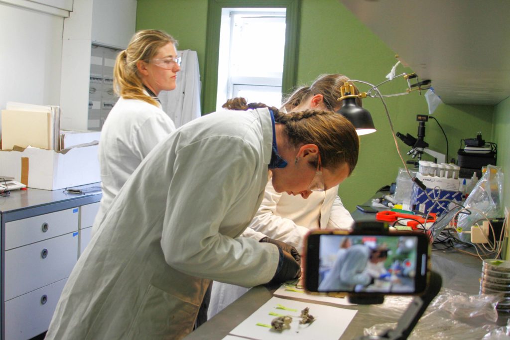
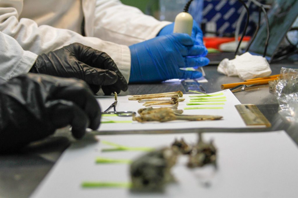
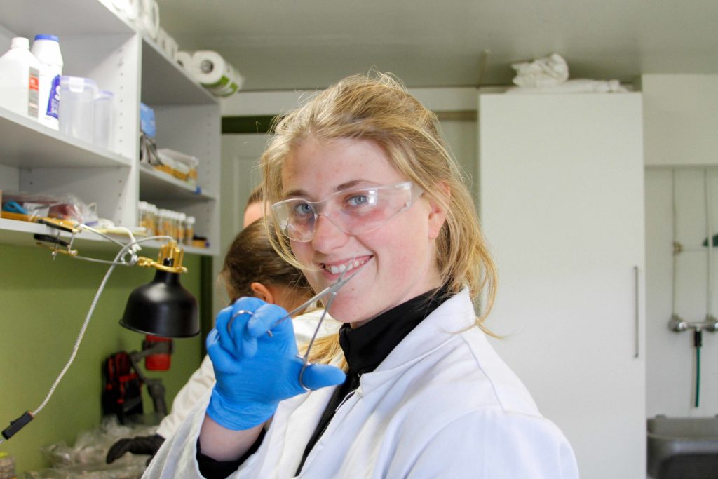
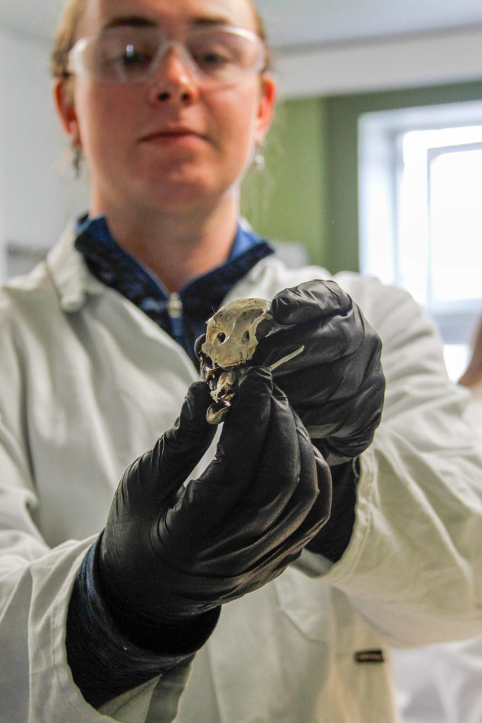
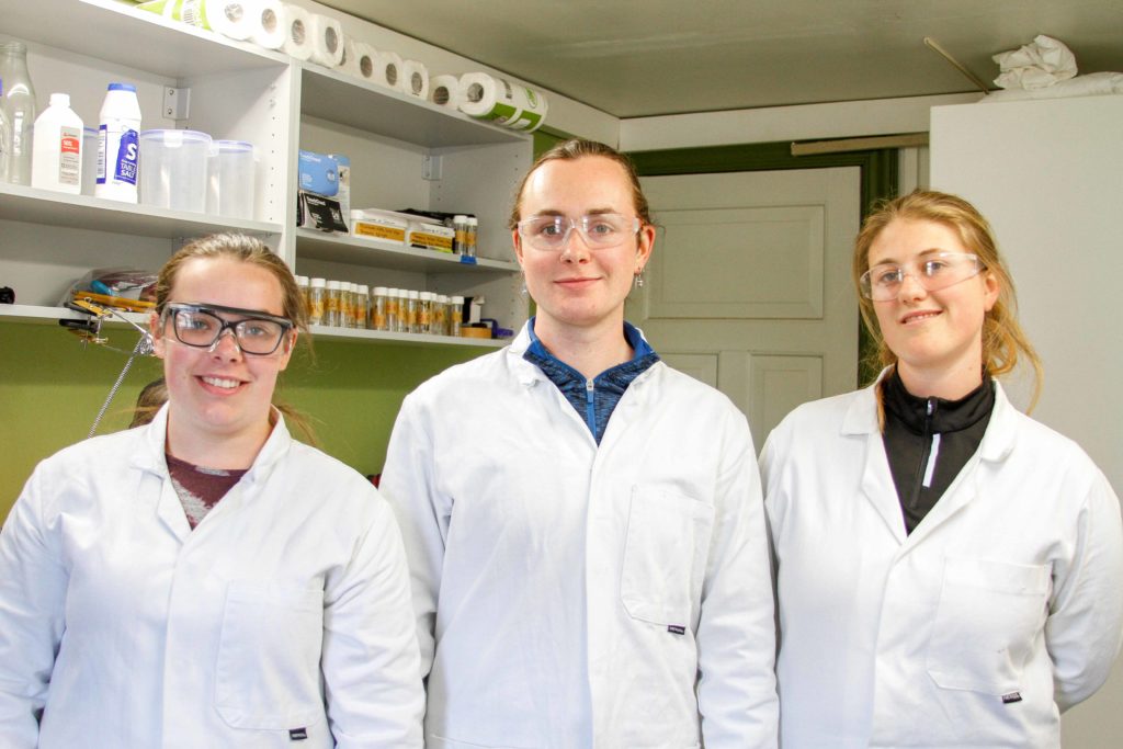
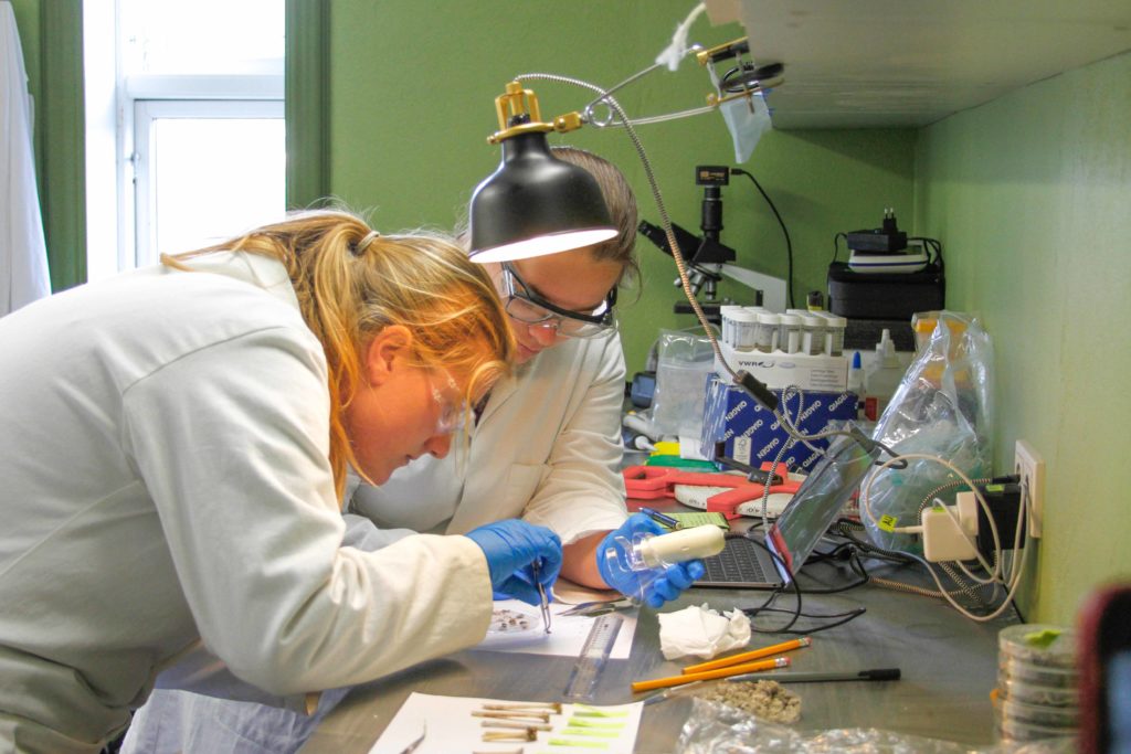
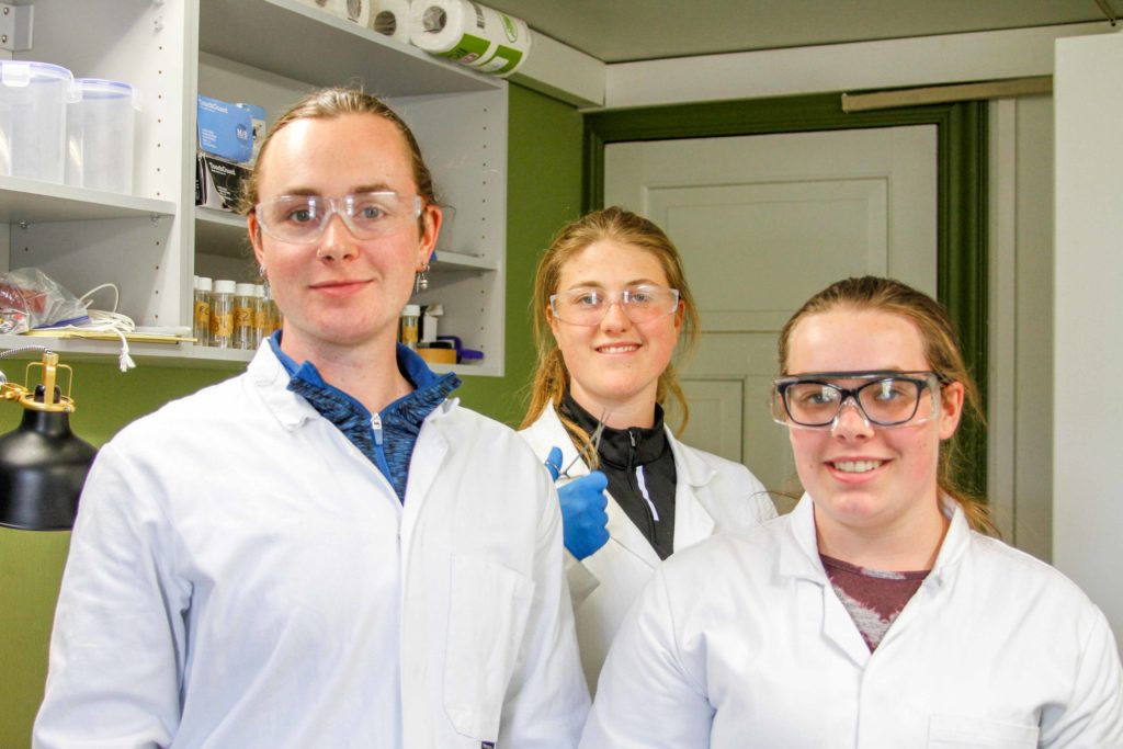
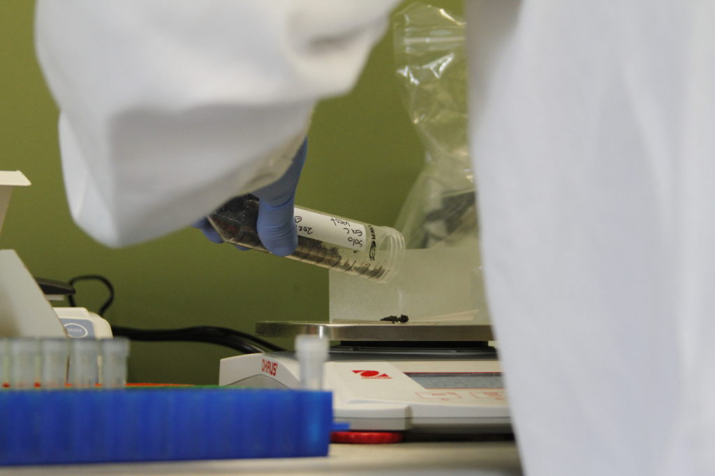
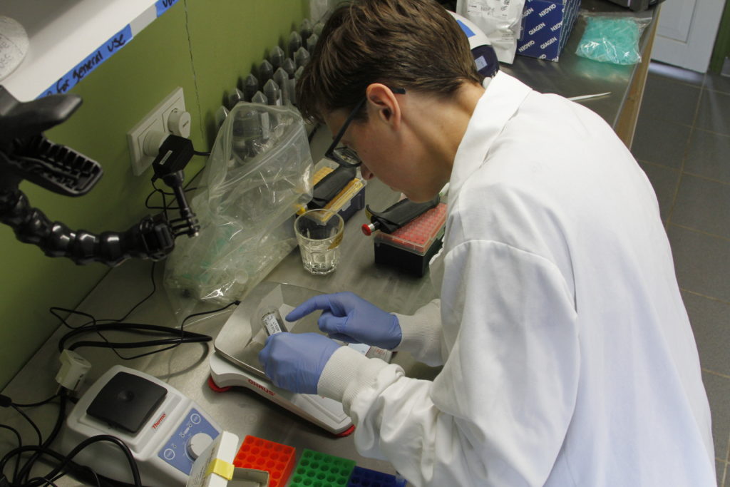
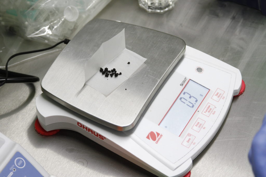
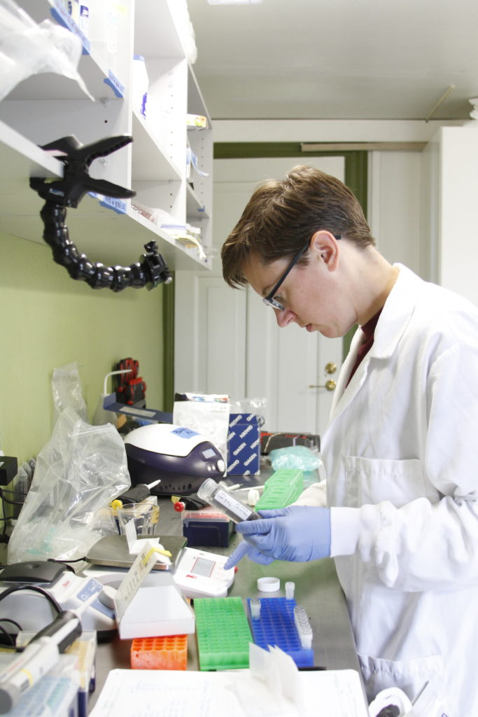
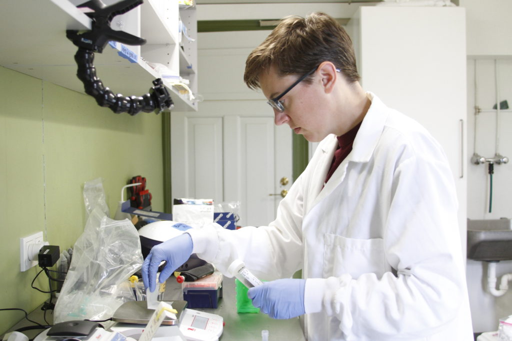
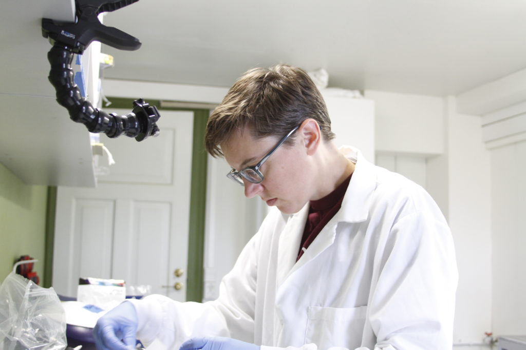
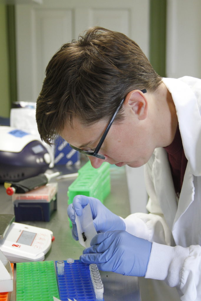
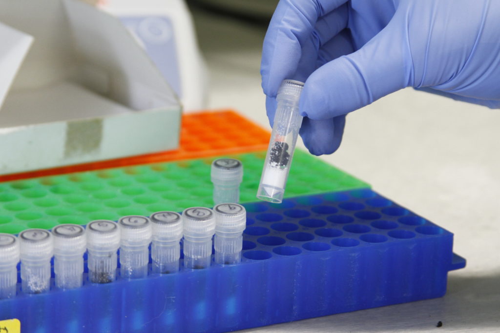
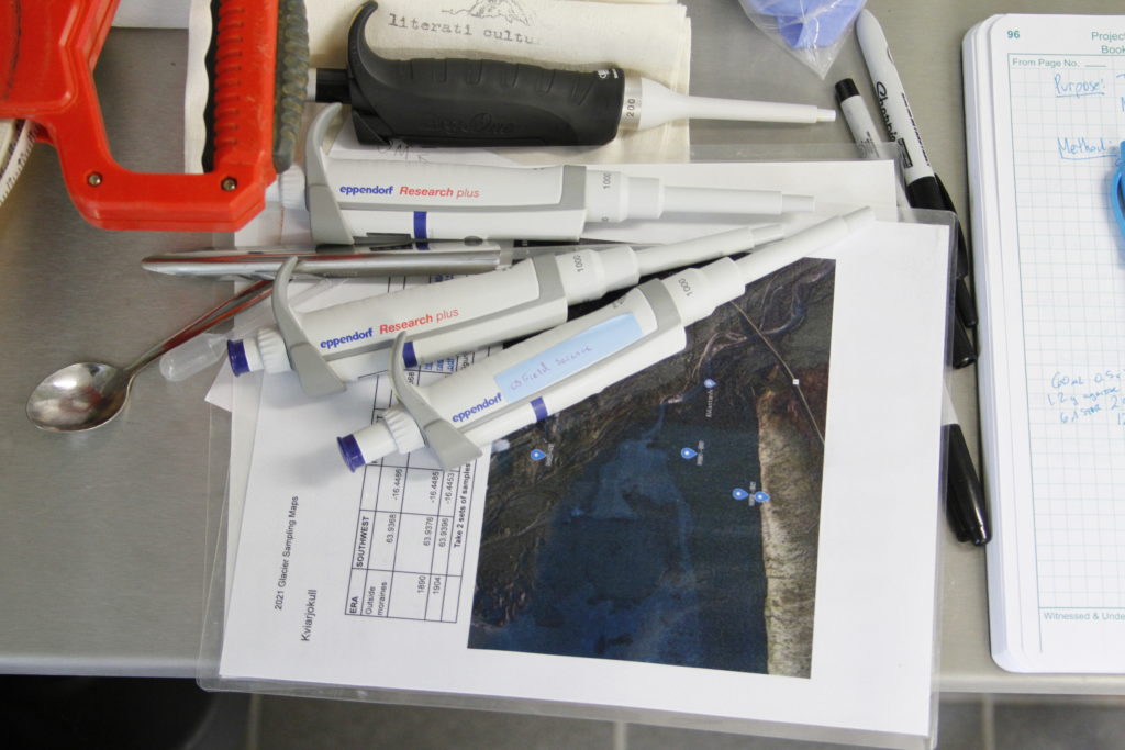
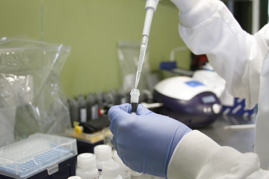
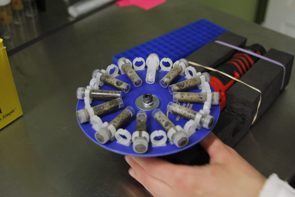
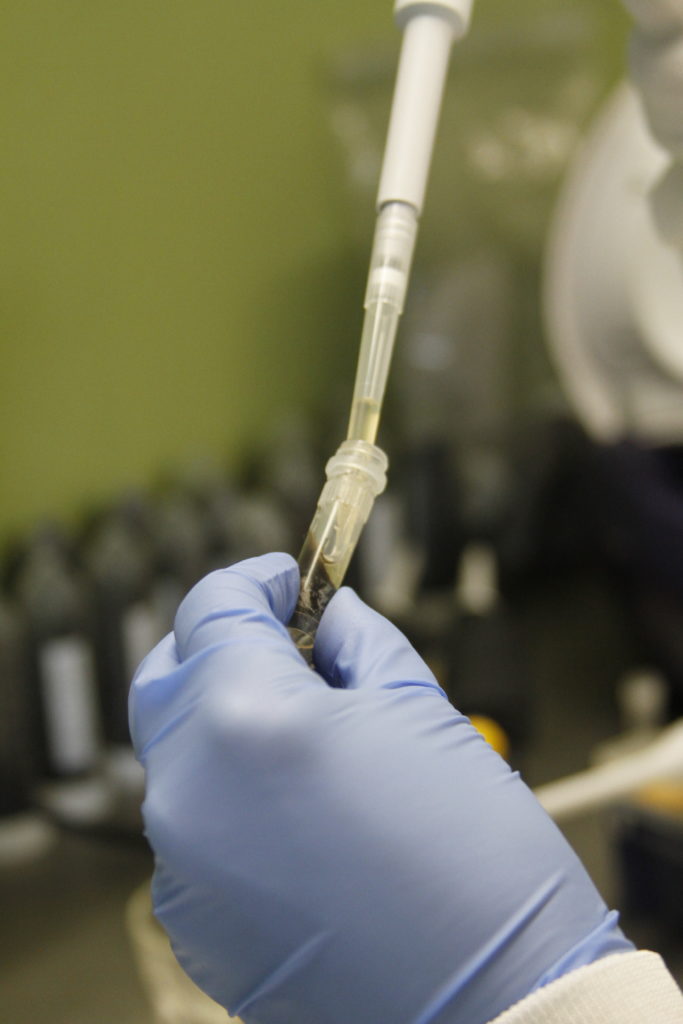
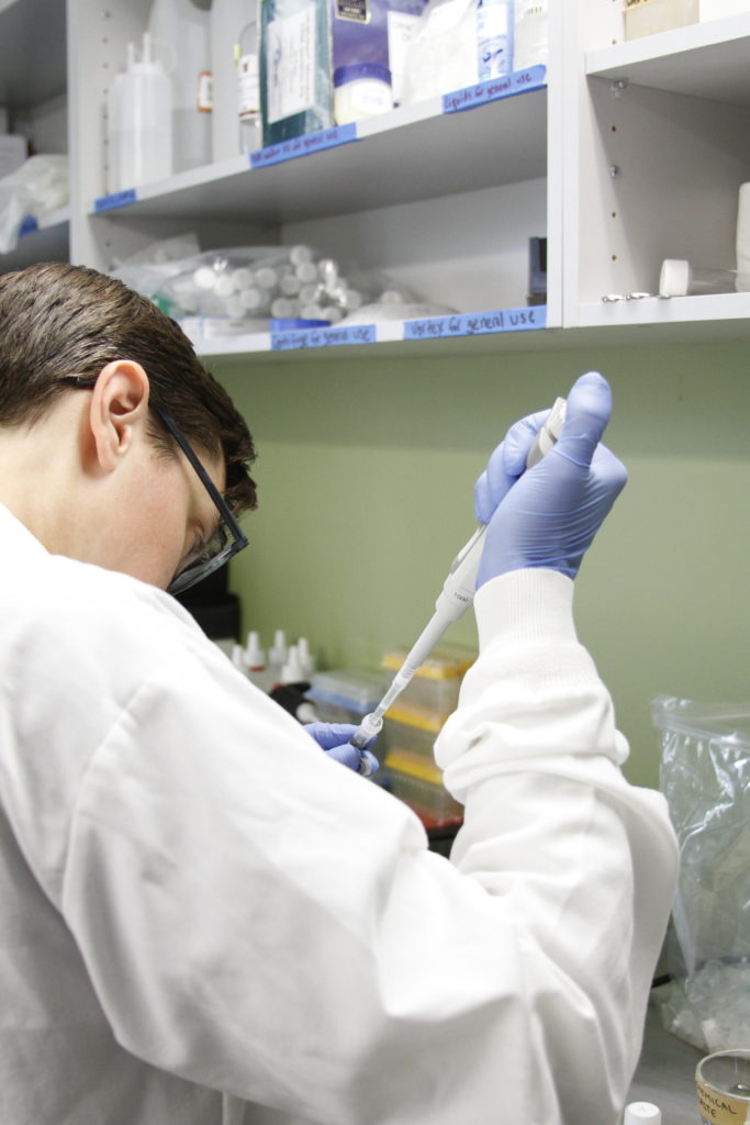
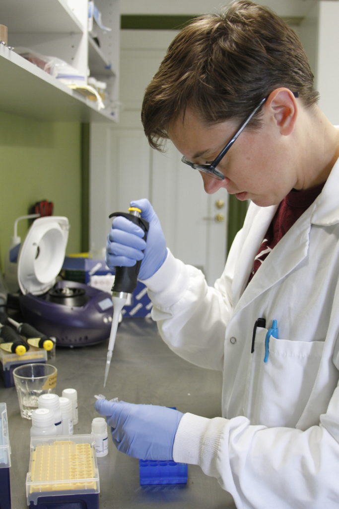
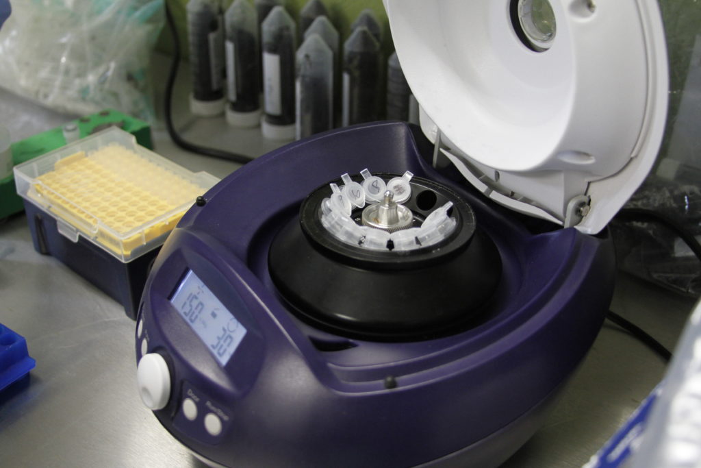
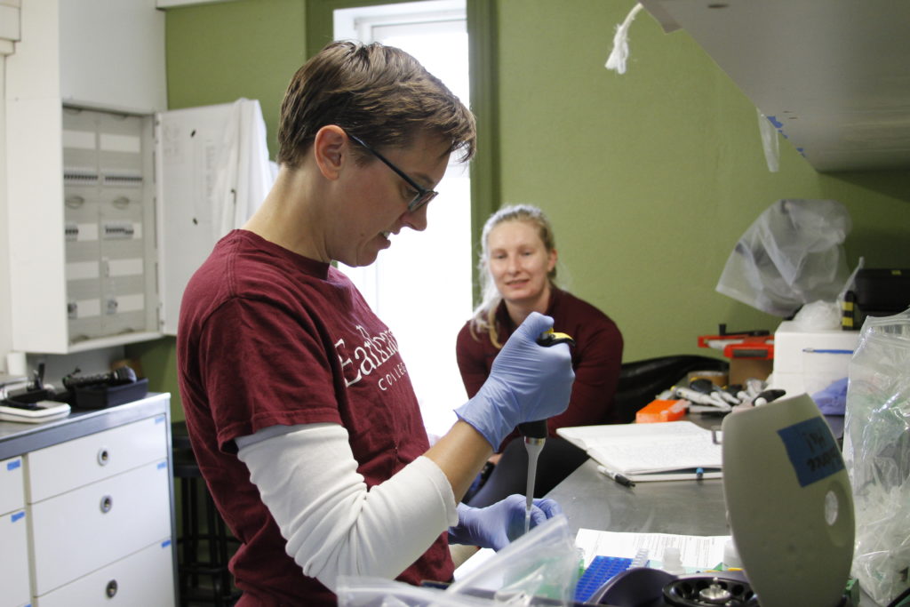
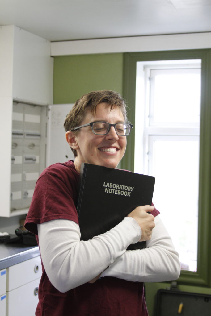
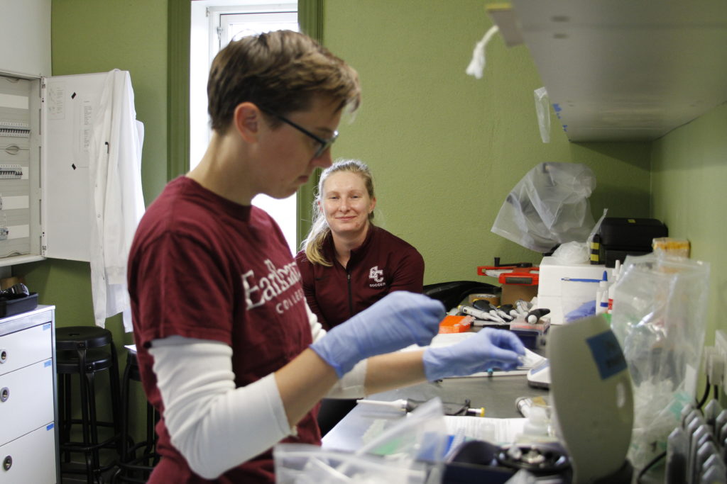
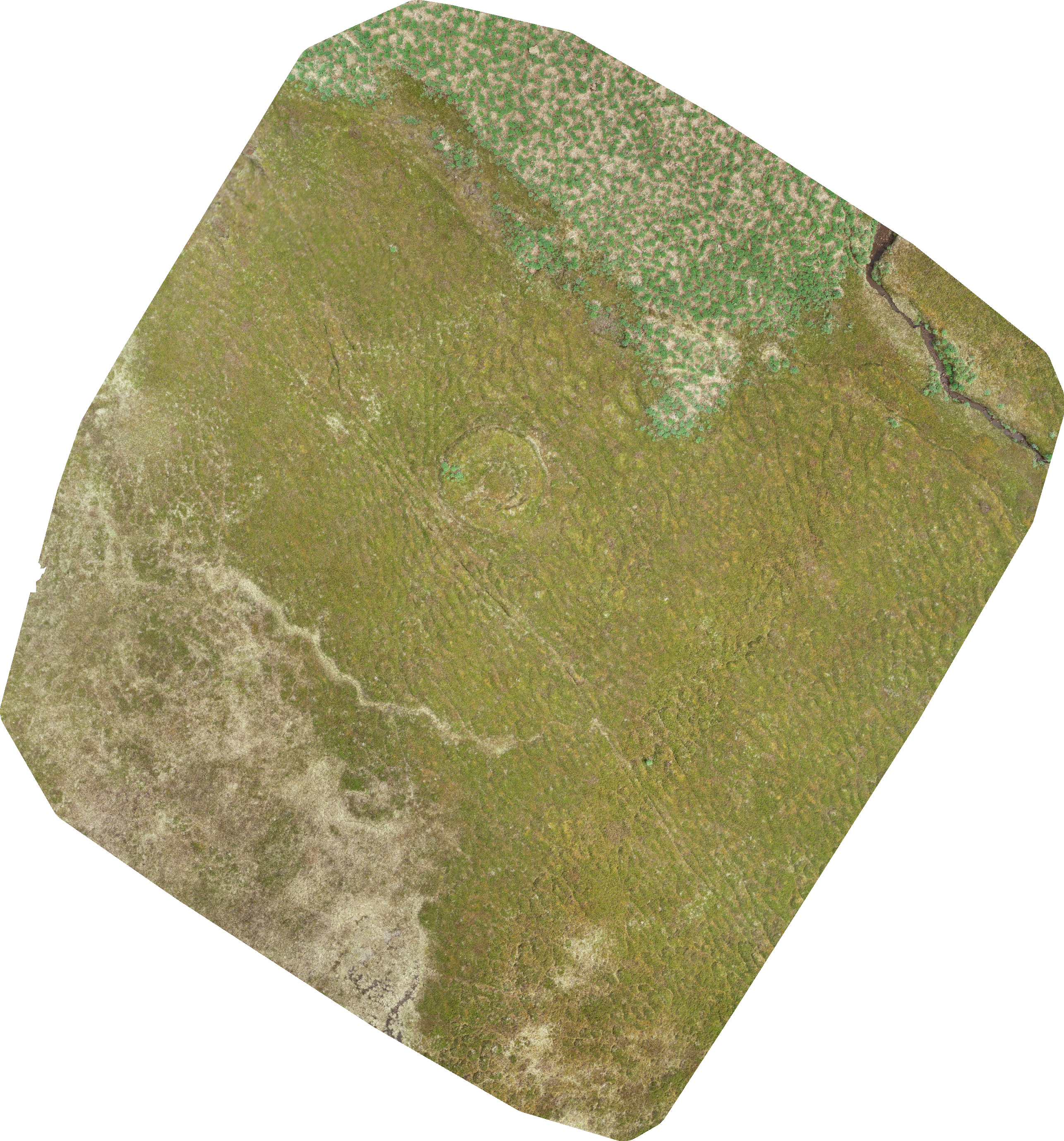
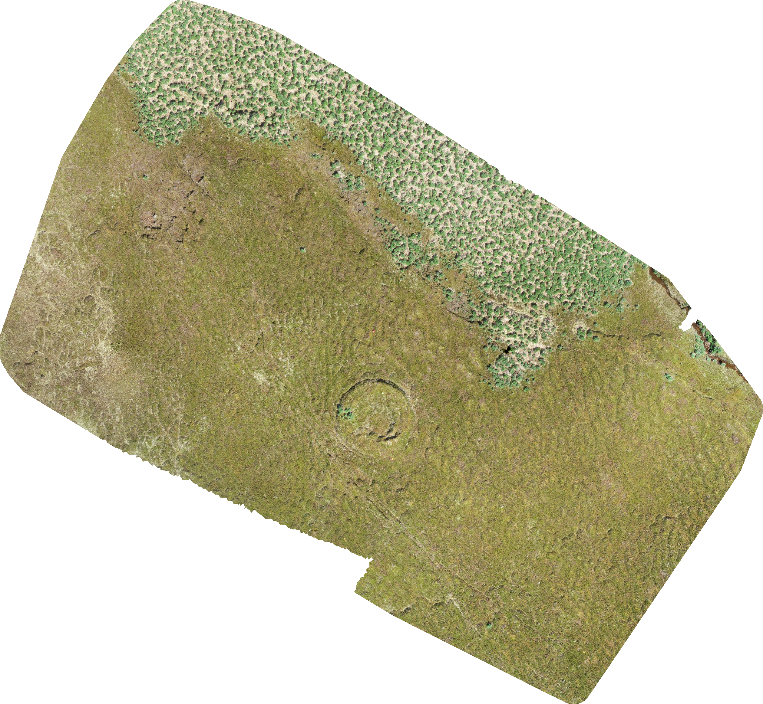
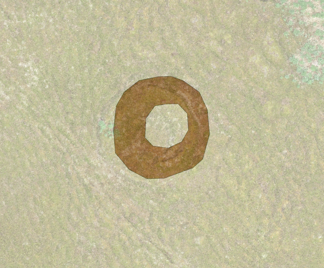
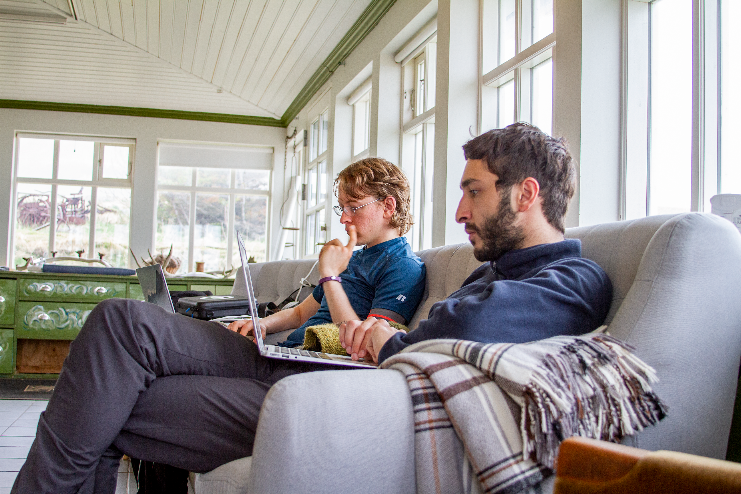
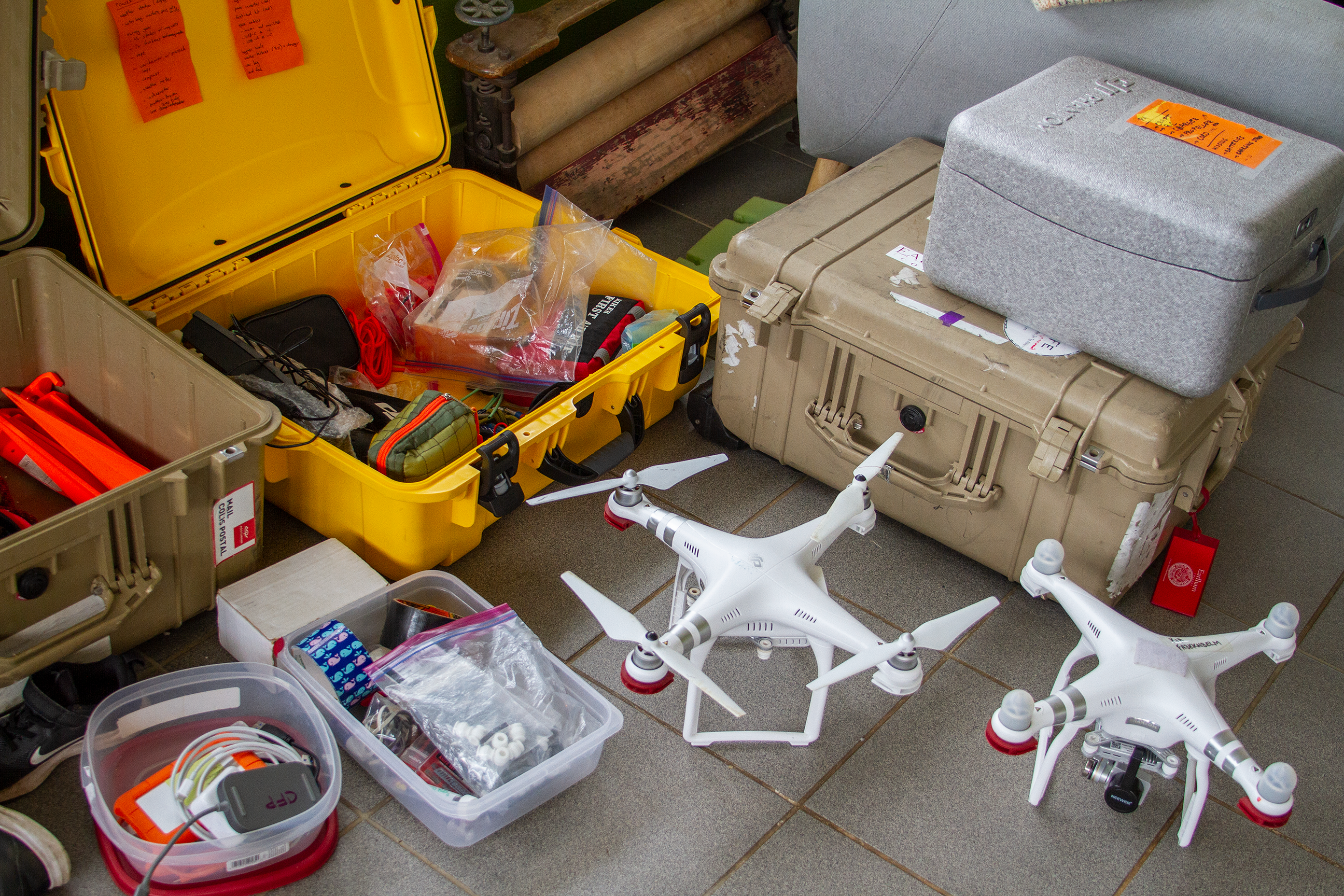
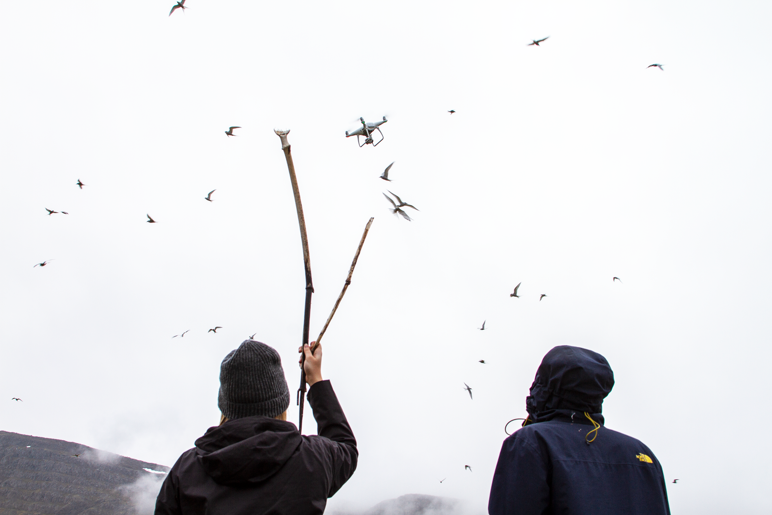
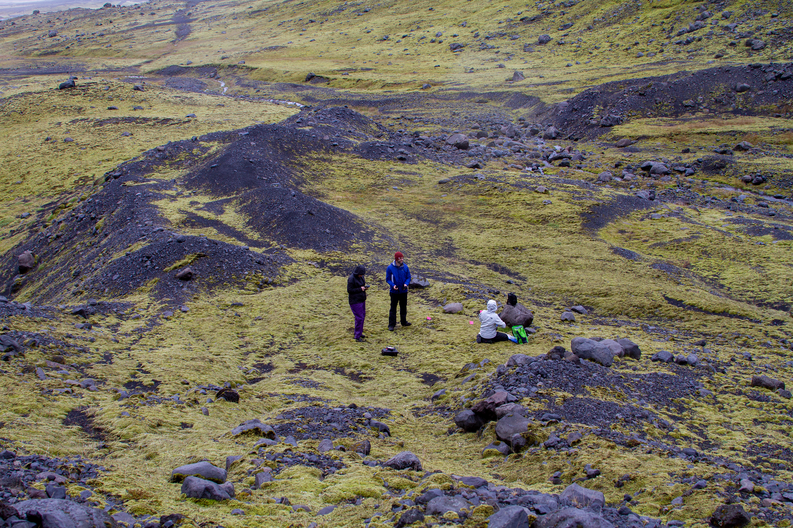
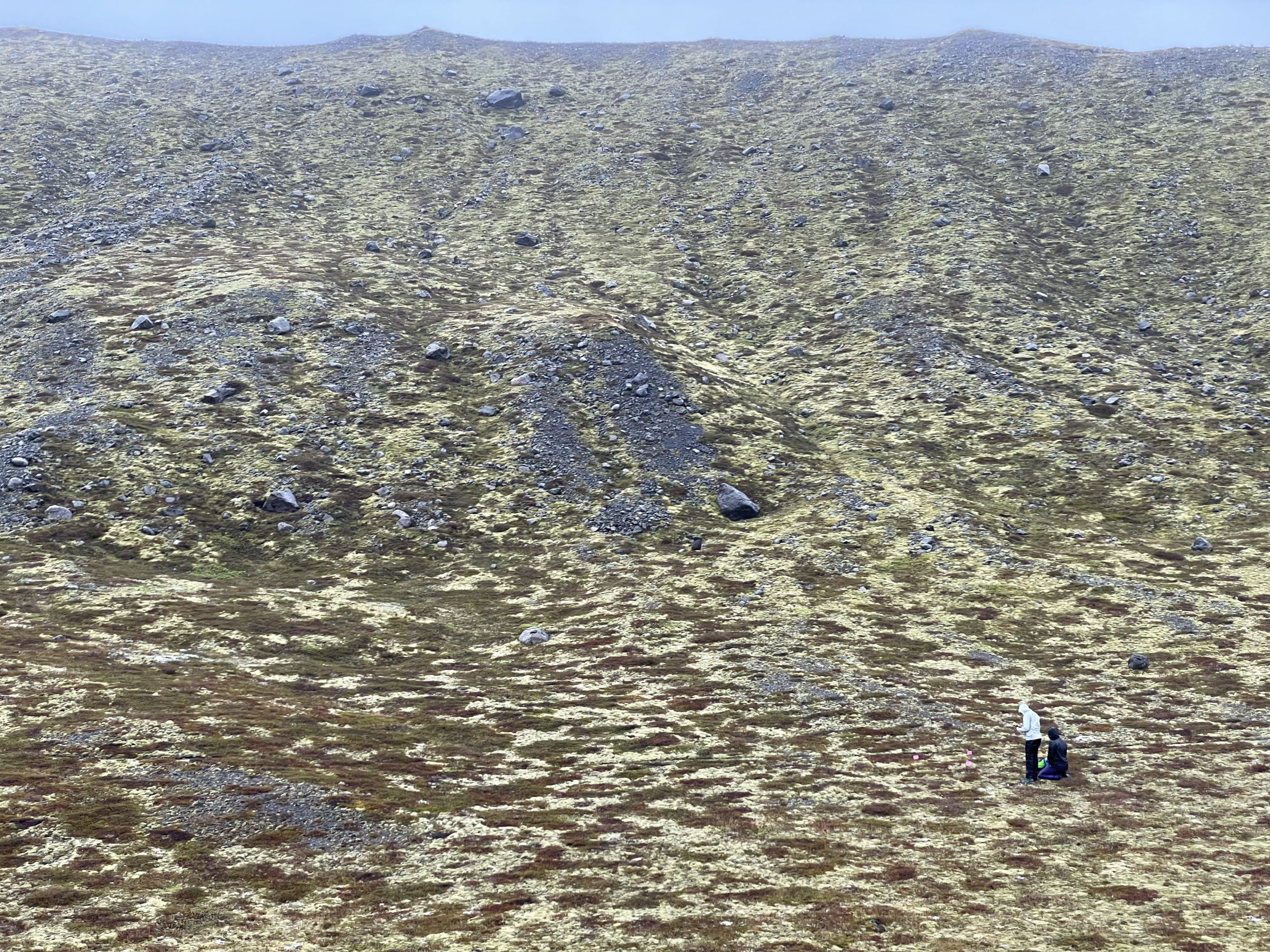
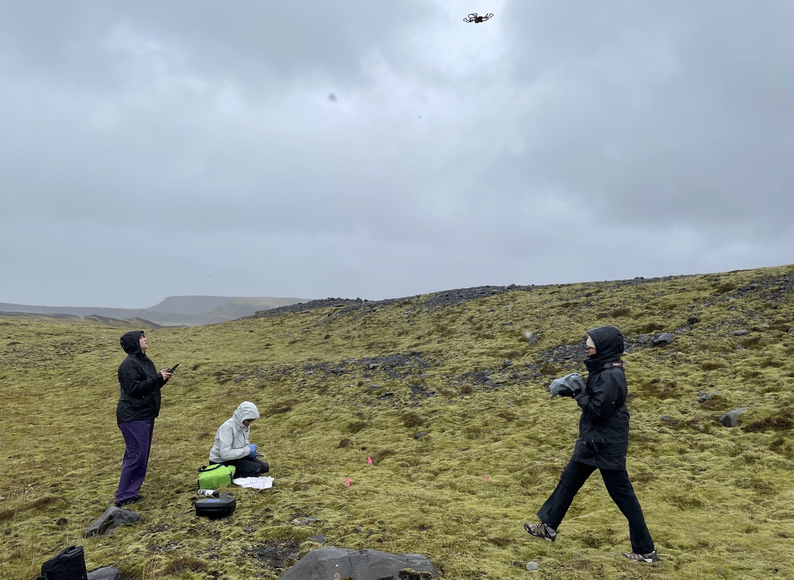
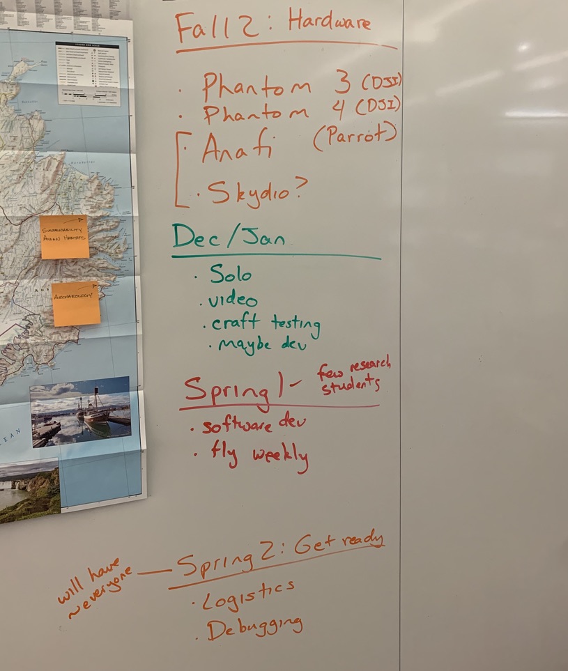
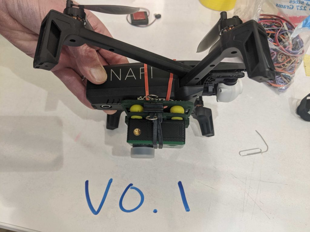
  4. This was a historically successful round of data collection, both on the drone side and on the biology side. We’ll write and share a lot more about this in the next few months.
  5. We shared space with the group of phenomenal students from the University of Glasgow. We also collaborated with them on multiple occasions, learning a lot about different ways to study wildlife and local sites.
  6. THE FOOD – you probably don’t associate Iceland with food culture (I certainly didn’t), but our meals were delicious.
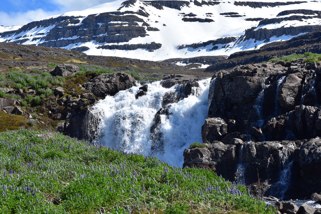
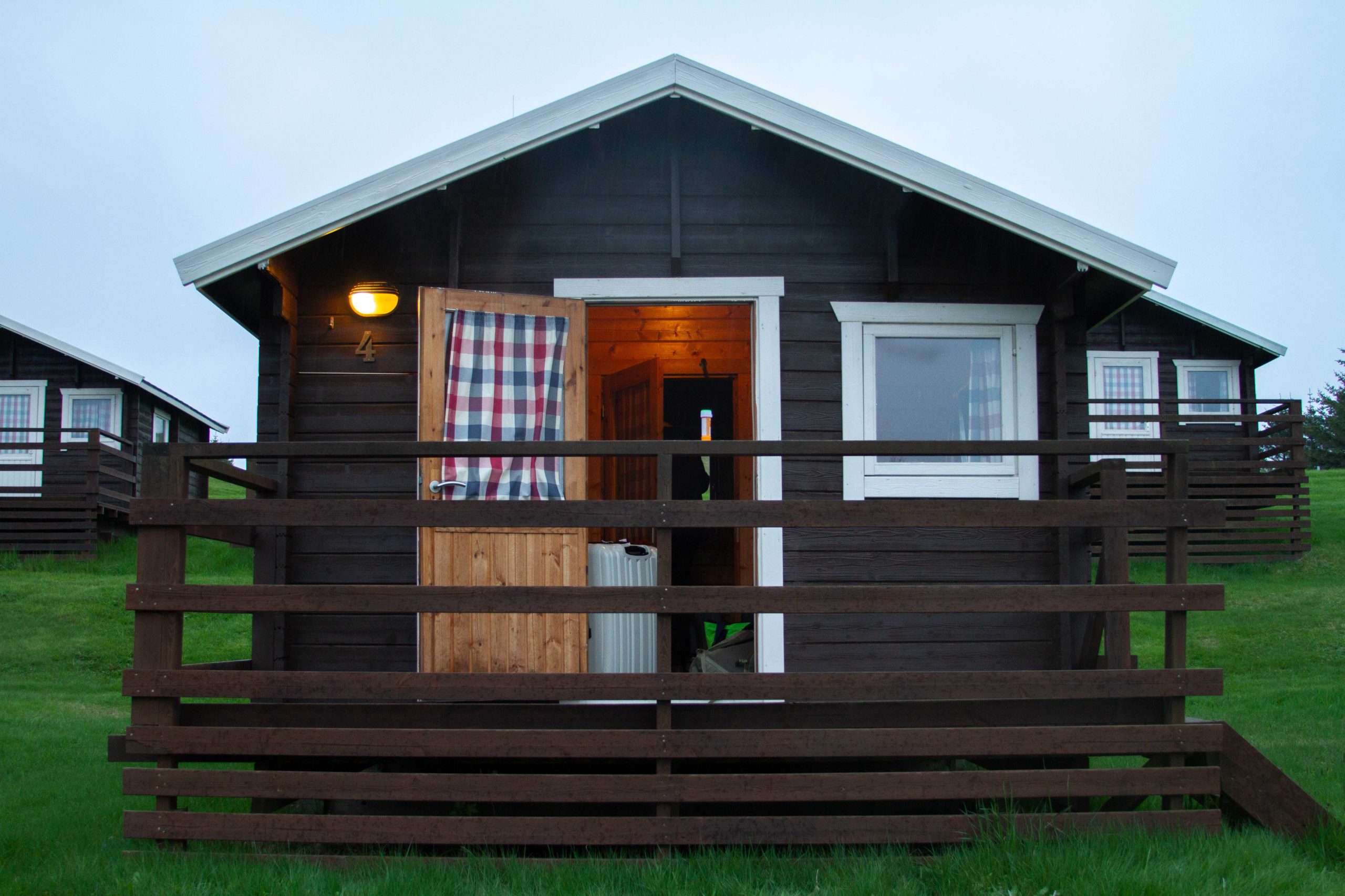
  7. The architecture and decorations are so distinctly Icelandic.
  8. Amazing photography and video – in high quality and high quantity.
  9. Walking along the boundary between the North American and European plates.
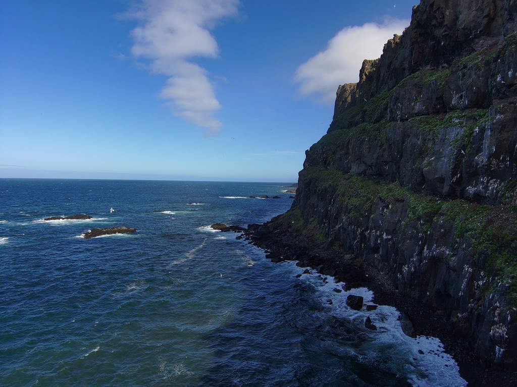
  10. Guided tour from our Skalanes hosts – who incidentally are awesome people – of a stretch of eastern Iceland.
Getting the rundown about glaciers at Solo

Some of my personal honorable mentions include:

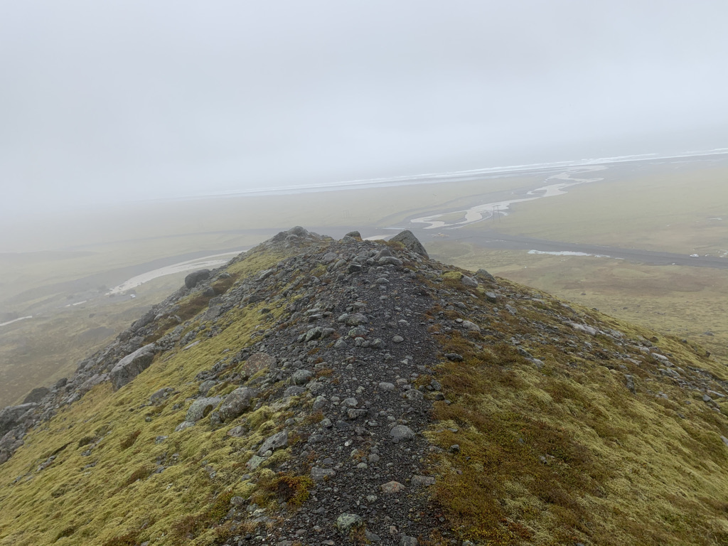
  • Trail running at Skalanes is breathtaking.
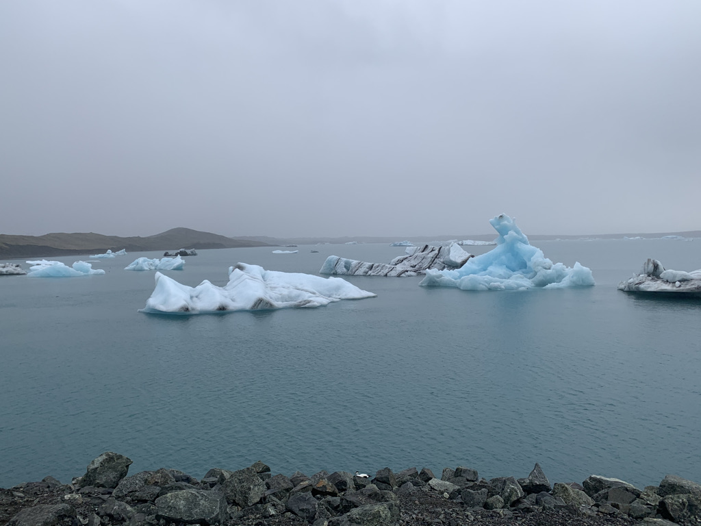
  • Blue glacier ice is real neat.
  • The National Museum of Iceland is fascinating and well-done.
  • Rainbow roads in both Seyðisfjörður and Reykjavik highlight what a welcoming place this country is – also perfect reminders of Pride Month in the U.S.!
  • My first-in-my-lifetime tour of a beautiful country happened alongside people I admire who teach me things every single day. What more could I ask for?
A drone photo of the coast by the fjord

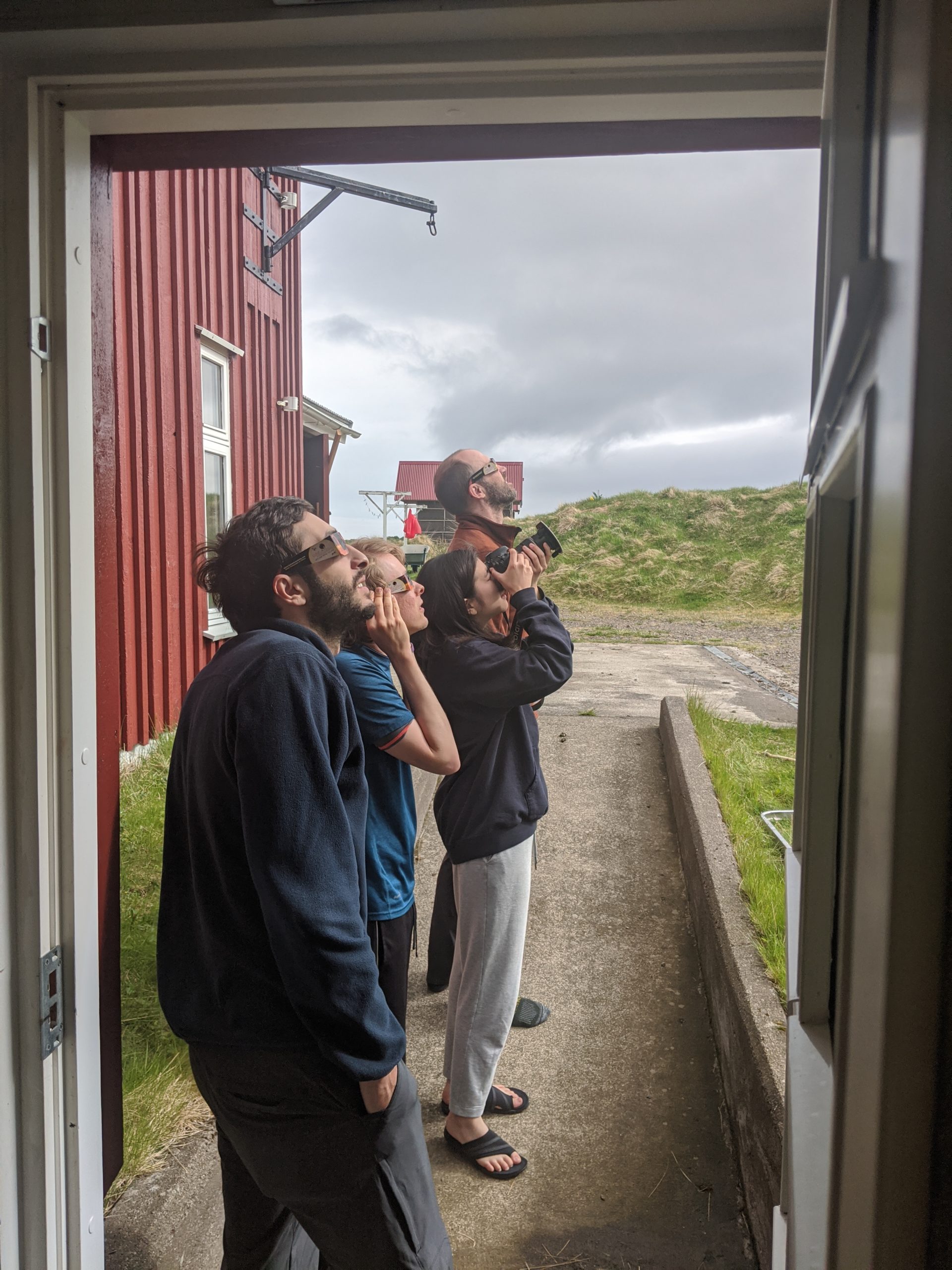
If you haven’t already, check out this interview with Charlie and Emmett, conducted by Cincinnati Public Radio.

Davit and Tamara flying

In addition to our success this year, we’ve also set up some great new opportunities for future years. With our long-time friend and collaborator Rannveig Þórhallsdóttir, we’ve added the cemetery in Seyðisfjörður to our list of sites to survey. We believe there may be historically-significant artifacts to be found there, and our drone work lends itself well to finding out.

The fjord at Skalanes

Finally, here’s the trip by the numbers:
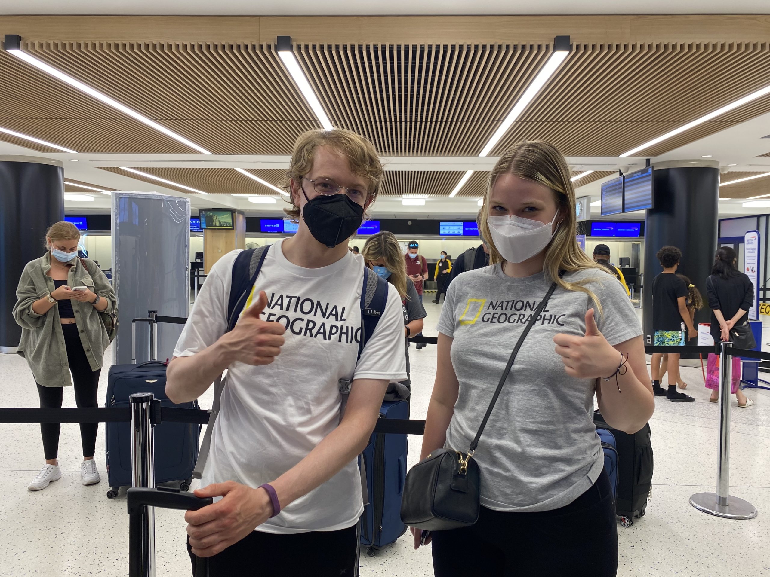
  • 7 Earlhamites
  • 26 days
  • 183 GB of initial drone images and initial assemblies
  • 2 great hosts at Skalanes
  • 6 outstanding co-dwellers
  • 4 guides at 2 sites
  • 1 perfect dog
  • N angry terns
  • 1 amazing experience
Admiring the view

And that’s a wrap. Hope to see you again soon, Iceland!

The will of the drone

with No Comments

In this blog post, I would like to explain further our work in Iceland and reflect on the experiences we are having regarding drone flying. There are two main archeological sites that we are surveying in this year’s expedition. One of them is close to the home we are staying in at Skálanes. It is both an archaeological site and a nature reserve/bird sanctuary. Our wonderful host Rundvig is the lead archeologist and is very interested in learning more about the place. We are hoping that our drone images will help her understand the area better. The second one is at Stöð, and it is an important archeological site for understanding the first settlement of Iceland.

DJI Phantom 4 Series drone that we are using to capture VLI imagery


This year, our mission is to take aerial images of as many areas of interest as possible that we were pointed to by our archeology friends. We are trying to take as many structured flights as possible, which means using external software to produce a flight plan. Flight plans are basic instructions for the drone, so it knows exactly what area it needs to cover without the pilot needing to fly it manually. We are using a new Android application for making flight plans called Pix4D Capture. This app lets us draw a rectangle in the world, and it sends the information of the flight plan based on that rectangle. We can choose the elevation of the flight plan, how fast the drone will fly, the overlap of the images, and the angle of the camera. We choose to use this app because our previous flight planning app was not compatible with drones other than the Phantom 3 series. We also wanted to use software that would be accessible to everyone.

Davit and Tamara flying a drone


Our experience of flying drones in Iceland has been full of ups and downs. The will of the drone is very unpredictable. Many things can upset it, such as high wind speed, not enough satellite coverage, or maybe an app running in the background on our phone. Because of this, we have learned always to expect the unexpected and to make the best that we got. The only issue is that bad weather and miss-behaving drone makes unfortunate drone pilots. However, over time we have become better at understanding the mysterious behaviors and what helps to make the drone act in the way that we want. Although, we will probably never fully understand the will of the drone.

Davit captured in NIR while trying to make a drone work in Stöð

Glasgow Students at the Skalanes Field Center

with No Comments

At the Skalanes field center, we live with another team of researchers from the University of Glasgow. They are a group of 6 students who self-organized and funded the trip to Iceland, following the precedents of student researchers in previous years. Some projects they work on in Iceland include observing puffins, eider ducks, and foxes. The photos below include Avery, Abi, and Clara examining, recording, and photographing bone samples collected from various locations, including bird and fox feces. I will be interviewing some of the Glasgow students in the next couple of days to learn more about their work, so stay tuned! [Photos by Yujeong Lee]

DNA Extraction at Skálanes, Iceland

with No Comments

On June 14th, Emmett Smith (he/they) and Faith Jacobs (she/her) successfully extracted DNA from soil samples. This lab is located at the natural and heritage science research center in Skálanes, Iceland. To learn more, read Emmett’s blog post here, and follow us on Instagram!

Scroll down to see the best photo of Emmett hugging his lab notebook 😚

[Photos by Yujeong Lee]

Flying cameras are good

with 1 Comment

We recently chose not to use ground control points (GCP’s) as part of our surveying work. This is a departure from standards and conventions in the near-Earth surveying space. However, we believe we have made a sound decision that will support equally effective and more time and cost-effective research. In this post, I’ll explain that decision.

The short version: drone imagery and open-source assembly software (e,g. OpenDroneMap) are now so good that, for our purposes, GCP’s have no marginal benefit.

We have high-quality information about our trial area from an established authority – the Cultural Heritage Agency of Iceland. Their 2007 report of finds is the basis of our trial runs here at Skalanes. Surveying these predefined areas, we’ve now flown multiple flights, gathered images, and then run three assembles with OpenDroneMap.

Here’s a simple run over the area with no GCP’s:

Here’s a run over the area with GCP’s, adding no location metadata other than the craft’s built-in GPS coordinates (you’ll note that the ground footprint is slightly different, but the roundhouse in the middle is the key feature):

We also manually geocoded the GCP’s for one run.

In the end, we observed no meaningful difference between an assembly with GCP’s and an assembly without them. Adding the images as raster layers to a QGIS project confirmed this to our satisfaction:

With GCP:

Without GCP:

In summary, ground control points just don’t help us much compared to just taking a bunch of good photos and using high quality software to assemble them. They also cost us in portability: even four GCP’s are difficult to carry, occupying significant space in airport luggage and weighing down walks in the field. For scientists interested in doing work over a large area, potentially multiple times, that inconvenience is not a trivial cost.

The ODM assemblies are outstanding by themselves. We have good technology and build on the work of a lot of brilliant people. That frees us to be more nimble than we might have been before.

It wouldn’t be a post by me if it didn’t end with a cool picture. Here’s a drone image from a cliff near the house where we’re staying:

got milk?

with 1 Comment

We woke up to snow-covered mountains surrounding the fjord. Iceland is beautiful because of its contrasts, and the starkness of white snow on black rock is no exception. After marveling at the view through the window, it was time to get down to business.

Me in the Skalanes Lab Area, working on DNA extraction. Photo by Yuejong Lee.

Yesterday, Faith Jackobs ’18 joined us from Houston, TX to work with us for a week while we’re camped out here at Skalanes. Faith has been on a previous EPIC Advantage Iceland trip, and joined us in 2019 to help with our ancient DNA project. Today we tackled DNA Extraction from Icelandic Soils, a protocol that has been in development since 2017. We have never had much success getting the DNA out of the soils of Iceland, because the type of soils we collect (brown andisols) are very good at binding DNA, and not very good at releasing it! I spent a lot of time in the fall of 2019 attempting to improve the DNA extraction protocol, and stumbled across a winning recipe. The secret? Skim Milk!

In 2005, Hoshino and Matsumoto published the following paper: “Skim Milk Drastically Improves the Efficacy of DNA Extraction from Andisol, a Volcanic Ash Soil.” In this paper, skim milk was added to a DNA extraction protocol during the first, important bead-beading step. This step is where the DNA is removed from the soil, and removed from any organisms living in the soil. It typically involves 10 or more minutes of intense vibrations in a small tube containing specialty beads and a buffer that protects the DNA from any enzymes/cellular debris present in the sample. I decided to incorporate the skim milk into our method. Back at EC, I meticulously added 10 mg of powdered skim milk to all of the bead-beating tubes in our kit to prepare them for the protocol.

The other piece of the puzzle that fell into place was creating enough of a vibration that the bead-beating step could properly do its job. Charlie and I created a device we’re calling the “Porta-lyzer” – see my previous post for a video. It seems that, in combination, this device and the addition of the skim milk worked like a charm. We’ve gotten the best DNA extraction results ever here at Skalanes.

Need proof?

2017201820192021
Average:4.227.252.766.83
StDev:2.6714.8242.1547.04
StErr:1.204.2812.1710.79
Table of DNA Extraction Performances for the past 4 trips to Iceland. Note that 2019 samples were processed at Earlham, with all the best lab equipment, not here at Skalanes.
The Porta-Lyzer! Photo by Yuejong Lee.

Needless to say, I’m thrilled. We even collected DNA from the elusive Solo era A – which has only been out of the ice for ~20 years, and is always an era that gives us lots of trouble.

Now it’s time for a celebratory adult beverage and a walk out to see the puffins. Cheers!

SCIENCE! Photo by Yuejong Lee.

To see a condensed video of Faith and I working on the extraction protocol, click here!

A reflection on awe

with 2 Comments

The Greater Good Institute at Berkeley considers awe one of the keys to well-being:

Awe is the feeling we get in the presence of something vast that challenges our understanding of the world, like looking up at millions of stars in the night sky or marveling at the birth of a child. When people feel awe, they may use other words to describe the experience, such as wonder, amazement, surprise, or transcendence.

That’s the feeling I have at least once a day, every day, here in Iceland.

And it’s difficult to write a blog post about awe. Almost by definition, it’s an emotion that defies easy explanation. It has a mystique that risks being lost in the translation to plain language.

But if I can’t describe the feeling, I can describe why I’m having it.

Unique among my traveling companions, this is my first-ever trip out of my country of origin (🇺🇸) The sliver of gray in this image is the first thing I ever saw of a country not my own:

When we arrived, I got a passport stamp and exchanged currency – both brand new experiences. However mundane, they were novel for me and began waking me up to the new world I’d entered.

Our first few days were chilly, windy, and rainy. I was much happier about this than were my traveling companions. If our weather wasn’t pleasant, it was nonetheless exactly the immersive experience I was hoping for when I signed up for this trip.

In those first few days, I got to see this amazing waterfall:

I got to participate in collecting soil samples at a glacier —

Solo!

— and in howling wind on the side of a moraine:

The right side of the moraine was calm and quiet. The left was much less so.

For good measure, I saw floating blue ice for the first time:

All this was great, and to me they made this trip worth the months of planning and days of travel difficulties it took to get here.

Then we got to Skalanes, where I’m writing this post, and its landscapes exist on a whole other level. Here are ten views here, drawn almost at random from my photos:

This is a country that absolutely runs up the score on natural beauty.

I’ve taken hundreds of pictures here and they’re all amazing – but none does justice to actually being here. That combination is the signature of an awe-inspiring experience.

Awe puts us in touch with something above and beyond our daily worldly experience – call it the divine, the sublime, whatever speaks to you. It’s an experience you can reproduce if you try, but I believe it connects most deeply when it emerges organically from the world you enter. That’s what’s happened to me here.

It is remarkable that this is what we get to do for work, and I am so glad we have some more time to spend here in this awesome country.

Capturing Solar Eclipse in Skálanes

with No Comments

Today June 10th was the day of the solar eclipse. The sky was so cloudy when we woke up around 8 a.m. that we thought we wouldn’t get to see the eclipse at all. Just when I had given up on the idea of photographing the sun, I heard Seth calling my name, “Yujeong, Yujeong, come see this outside!” And there it was, the sun slowly revealing itself as the clouds started clearing up around 9:30 a.m. Only the partial eclipse, not the annular eclipse, was visible in Iceland, and the maximum eclipse happened around 10:17 a.m. (although the sun was not visible during the time due to clouds).

Davit, Craig, Yujeong, and Seth watching & photographing the eclipse. Photo by Charlie Peck.
Camera gears, solar filters, eclipse SUNglasses. Photo by Yujeong Lee.

Seth came prepared with a set of eclipse sunglasses for the whole team to watch the eclipse. He also handed me two solar filters to cover my camera lens with. I am familiar with the solar filter that gives yellow-orange color to the sun, but it was my first time interacting with a white light solar filter. Seth also taught me today that I should set my camera focus to infinity to capture astronomical images. Although I am holding my camera in the photo above, I soon brought out a tripod for more stability. Here are some results of the shoot, and they are beautiful.

Solar eclipse as seen in Skálanes, Iceland. Photo by Yujeong Lee.

Besides the eclipse, Tamara and Davit had a mostly successful day flying the drone in two different locations (one in the roundhouse and another near the research center). Just before dinner, we tried going swimming on the beach, but we went to the wrong one where there were lots of birds poop ;- ) For dinner, Emmett and Beth (a student from Glasgow) made us pasta with fresh vegetables, not to mention the sourdough bread Emmett prepared & baked since yesterday! 🤯

Concentrated Tamara 🧃 Photo by Yujeong Lee.

Finally, in Skálanes

with No Comments

Writing’s not really my forte, so I’ve been postponing writing a blogpost for quite a while now. I guess it’s the right time to introduce myself, the work I’m doing in Iceland, and some highlights from the past couple of days.

My name is Davit. I recently graduated from Earlham with a degree in Computer Science. I’ve been involved in Icelandic field science research since my junior year. Our plan to go to Iceland in 2020 failed miserably because of the global pandemic. We all waited patiently (or not) for one full year, and then a week ago we drove to Chicago, flew to New York and then to Keflavík. In reality, the trip was way more complicated and tiresome than I just made it sound; but arriving at Skálanes flushed away all the annoying details of getting here.

Me and Craig, working side by side. Photo by Yujeong Lee.

Wet, exhausted and frozen, we made the final 2 km hike on foot. As we walked, our path took us through a permanent tern colony, which is an important part of the preserve. At Skálanes we were greeted by our host – Olí who had already prepared a hot meal for us. He told us that the next day would be sunny – an Icelandic luxury that we had to take advantage of. Next morning, we got up early and started working on using our drones to survey areas of archeological interest.

The craft. Photo by Yujeong Lee.

A few details about how I’m involved in this research:

Most of the work that I did on campus involved refining the workflow of surveying to ensure that everything would go smoothly in Iceland. This included familiarizing myself with the drones and practicing flying them manually. I also built a web interface for the visualization of the near-infrared (NIR) images taken by the drones. I have been a sysadmin at Earlham for almost 3 years, so I was also helping in plumbing up different software and tools that the research depends on.

The last two days the clear weather has allowed us to fly the drones. We have tried to make the most out of it! After Charlie picked the first spot for us, Craig, Tamara and I went to the surveying site. We have been using a Phantom P4 drone with PixD4 software to make automated flights. By taking a good amount of photos from 50 meters of elevation we will be able to build 2D and 3D models of the terrain.

Waiting for the drone to finish the flight mission. Photo by Yujeong Lee.

Unfortunately, we had a bit of bad news too. Our only drone with NIR lenses is a bit jet lagged and is stubbornly refusing to calibrate its gimbal. Once it starts raining again (it won’t be long!) we will be forced to work inside. Then, we’ll have the chance to focus and solve the NIR issue. Meanwhile, we are using the ordinary lenses to harvest as much data as we can.

Today, we flew the drones at a spot where the terns are nesting. They’re beautiful birds, but they were not at all happy to see us doing science nearby. They made continual short ranged attacks by pecking us, and also engaged in long ranged bombing efforts as they dropped their biological weapons on our heads.

Drone in the sky, angry birds and poop on my jacket. Photo by Yujeong Lee.

Soil Sampling & Staying at a Cabin in Hofn

with No Comments


After the very long day(?) of waiting in various airports, landing in Iceland, then immediately hiking for several hours to collect soil samples, I had almost forgotten what it means to feel tired, and our team lost track of time and day. And of course, Iceland’s never-setting sun wasn’t of much help. :- )

Remote shutter release after soil sampling at Sólheimajökull. Photo by Yujeong Lee.


Our first official temporary housing was at Höfn Cottages. The small cabin was equipped with a small kitchen/restroom area and a room tightly packed with bunk beds for four. The wooden beds were quite beautifully built into the cabin with the lower bunks wider than the top bunks. There was enough space for one person to move through in between the bunk beds but nothing more. The restroom had a toilet and a sink without hot water. The small kitchen area was packed with a small electric stovetop and a sink on the left and a round table with two chairs on the right. Laminated instructions and cabin rules on the wall informed us that 3 minutes of hot shower would cost 100 króna at the common shower facility. Tamara and I walked to the common shower late rainy evening and each successfully took 3 minute showers.

The cabin I stayed at along with 3 other people. Photo by Yujeong Lee.
Davit and his bubble. Photo by Yujeong Lee.


Charlie made us fabulous oatmeal for breakfast the next morning, and we were soon on our way to Kvíárjökull. Just like the first day of soil sampling, we split into 2 teams to go to different locations. Having photographed the team with Emmett, Seth, and Tamara already, I followed Charlie, Craig, and Davit this time. Walking on the endless mossy and dark soiled land, I thought I would encounter a battle in Narnia, then another moment I felt I was a character in a game of battle royale.

Emmett, Seth, and Tamara at a soil sampling site. Photo by Yujeong Lee


After collecting 2 sets of samples in the various locations Emmett had planned out for us, we finally reached the research center at Seyðisfjörður after 4 hours of driving!

Put your back into it

with No Comments

We are in Iceland! It’s been an adventure getting here with speed bumps at almost every step. But, we are excited and already have two days of field science in our rear view mirror.

Emmett and Tamara in a giant valley created by the glacier Kvíarjökull

Friday, 6/4
Richmond, IN -> NYC

We met at EC at 4:00 AM to start our drive to Chicago. The (very generous) Doug Harms came with us so he could drive the Earlham van back to Richmond. Difficulties began during our first flight from O’hare to JFK. Weather grounded the flight in Buffalo, NY. By the time we got back in the air and landed in NYC we had missed our connection to Iceland. While Seth, Emmett and Craig went to find lodging for the night, Charlie, Tamara, Davit and Yujeong stayed at the airport to ensure we were got booked on the next possible flight.

Craig and Tamara showing off the NatGeo love. They’re funding our trip!

Saturday, 6/5
NYC -> Iceland

After waking in a very swanky Best Western, we confirmed our (rebooked) 8:30 PM flight to Iceland. We spent the day at the recently refurbished TWA hotel, which is connected. Played Carcassonne. Ate crepes. Would recommend.

Seth and Emmett chilling in the TWA Hotel. 1960s Swank.

Saturday evening we finally boarded our flight to Keflavik, the only international airport in Iceland. An uneventful flight left us arriving in the country at 6 AM local time.

Sunday, 6/6
KFK Airport –> Cabins in Höfn

Iceland has only recently started lifting Covid-19 travel restrictions. We each brought vaccination cards and recent negative test results. Then, after going through customs we each had (shockingly painful!) COVID tests. We were released with the personal responsibility to quarantine. Within 6 hours we had each received negative results and were free to move about the country.

During our quarantine we met up for a (socially distanced) breakfast with our friend Gummi
who lives in Reykjavik. Since we couldn’t enter stores or restaurants Gummi helpfully acquired delicious local food to sate our each grumbly tumbly.

Breakfast at Gummi’s

Fed and hopped up on coffee, we were ready to finally get on the road. In our fully packed rented van we took off for our first destination: Sólheimajökull (AKA Solo), a beautiful glacier that is among the easiest to access on the island. Undaunted by the rain and wind, we were ready to engage in some first class field science!

Emmett dwarfed by Sólheimajökull

The work at Solo is part of Emmett Smith’s research into the changing microbiome diversity of the region. The glacier has been receding for over a hundred years with the location of its leading edge being well documented over the years. Areas closer to the present location of glacier have been exposed to the air for less time than those further away. As such, they have had less time for moss, flowers, soil, etc to grow. On Sunday we took soil samples at about 10 locations. We will use the samples to meaure soil properties (pH, Nitrogen/Potassium levels, etc). Additionallty, we will sequence DNA at each site looking for particular signatures. (More details in the upcoming paper!) We have been returning to the same sites since 2014, investigating how the soil has changed through the intervening years.

At Solo: Tamara flies a drone while Emmett collects samples. Yujeong is taking photos for documentation.

The field work was cold and wet, but we knew we could do it! We put our backs into it! We piled back into the van and drove four more hours to Höfn where we had reserved two very tiny and very dry cabins. It was time for our first good night’s sleep since being in Richmond.

Monday, 6/7
Höfn -> Skálanes

It’s Seth’s mom’s birthday. Shoutout! Happy Birthday Mom! 🙂

Turns out these little tiny cabins don’t have everything! We all had to share one teeny-tiny-itsy-bitsy towel … not all at once. But still!

Loaded with oatmeal and more coffee it was time to return to the field. So, rainier, colder and windier than Sunday? But you know our motto: Don’t stop, get it, get it!

Seth, Emmett & Tamara at Kvíarjökull atop a giant moraine

So, we drove back along the ring road in the same direction we had just come (I know … but trust me, this itinerary makes sense). This time we were collecting samples near Kvíarjökull.
Another spectacular glacier, Kvíarjökull is a finger of ice splitting off of Vatnajökull (the second largest ice sheet in Europe). We split into two teams (as we had done on Sunday) to get to the sample site more quickly. This was our first year visiting this site, so it’s just the beginning of a much longer study! We braved the elements, collected soil from 12 sites and ran back into the van to strip off our soaking rain gear.

As I write this, we are headed toward Skálanes where our friend Olí is going to make us some delicious stew! (Oh my! We just saw our first reindeer!) It’s certainly been a rainy and tiring beginning to the trip, but Iceland is so beautiful, our spirits are quite high. Speaking of spirits, we’re about to stop at the local vínbúðin. (look it up …)

Team introductions: Tamara

with No Comments

Hello! My name is Tamara Blagojevic, and I am an upcoming senior at Earlham College. I am a Computer Science major and a Data Science minor. I come from Belgrade, Serbia. My interest in Computer Science started when I got a scholarship to represent my country at an international high school in India. I am passionate about using computing for social good, and I am interested in the role technology can play in social progress.

What is my role in the Iceland Field Science Research? One of my main delegations is managing all the drones and surveying. Currently, we are using drones from three different manufacturers: DJI, Parrot, and Skydio. Our research must be as replicable as possible, and covering different types of drones gives us insight into how anyone can do this without access to what tools they have.

Before departure, we have been working on organizing all our gear and ensuring that we are documenting everything well. Drones are very moody, so it is essential to understand all possible issues that might come up while flying before the trip. We need to be ready to collect data as smoothly as possible when we reach Iceland.

Iceland here we come!

The Porta-Lyser (TM) And Other Wins

with No Comments

Today Charlie and I had a few wins – seems like the 4th trip to Iceland is the charm. We’ve been continually working to streamline our DNA extraction procedures so they can be done reliably in a makeshift lab at Skalanes. Today we took another step toward creating that reality.

One of the major steps of extracting DNA from soils is to physically separate the DNA strands from soil particles. This is not as easy as it might seem. Many soils strongly attract DNA, and the specific soil type we are working with in Iceland, a Brown Andisol, is one of these strong DNA attractors. In order to separate the DNA from soil, we need to mix a bit of soil with specially-made beads. We also add a bit of powdered skim milk to help keep the DNA from re-binding to the soil particles once it unbinds. However, the mixing step, or “bead-beating,” is critical. It needs to be done using a special vortex adapter for 10-20 minutes. We have a small vortex in the lab at Skalanes, but we’re not sure if the adapter will fit it, or if it goes as fast as we need. Therefore, Charlie rigged up what we are calling the “Porta-Lyser.” Here is a video if it in action – looks like it works a treat.

Other wins for today – we were able to reduce our checked baggage quota by one; we have almost all of our gear ready to pack into the van (which means we get a late start tomorrow morning!); and we were able to score some great NatGeo t-shirts to wear while working in Iceland!

Tonight we will gather for some Gulzars and watch an Icelandic documentary at my house. Tomorrow we will finalize our checklists, print and laminate them so they are ready for the field, and pack up the van that will take us to Chicago early Friday morning for the first leg of our journey.

D-4 until Iceland

with No Comments

This summer I have the honor to join the team in Iceland to document the research. And what a time to travel with the team under the National Geographic Society grant! With my background in computer science and experience working with Earlham’s marketing, my role in Iceland as a storyteller includes updating our WordPress site, creating a social media presence, interviewing current and previous participants, creating videos, taking photographs, and producing writings from time to time.

I came in with a good amount of experience in photography and social media management, but most of the work I did for the research team has been a learning experience. I learned to get around WordPress by adding a few design updates to the Field Science site, especially the importance of producing a responsive website (those that don’t break with zoomed in or zoomed out) for the users on different devices to effectively gain information. By interviewing Charlie P. and Craig E., I gained a better understanding of the history and development of Icelandic field studies. Interviewing Gail Connerley was especially interesting with her knowledge of wilderness travel and enthusiasm for the research. Gail had traveled twice to Iceland with the research team and introduced effective wilderness travel methods like assigning a different leader each day.

One of the best things about being a storyteller is all the gears we get to use for the research. Many drones, a few GoPro cameras, and a smartphone stabilizer provide a lot of space to create and be creative.

I often ask myself “what am I not doing right now that will make my future self regret?” I think I will regret not having made as many videos as I can and not having learned to fly the drones if I don’t.

We’re on track for summer

with No Comments

Discussions are ongoing about the viability of summer travel given the pandemic. However, as Charlie has blogged recently, we are “acting as if”. As such, we are trying to maintain our original calendar.

Lo and behold, we have:

Imagine a “You are here” arrow by Spring 1

Here’s the full breakdown of that schedule and our progress:

Our plan for the fall was to find and test alternative UAV’s. This proved prudent, as the federal government banned DJI craft late last year. We are happy with both the Parrot and the Skydio craft, for different reasons which we’ll undoubtedly cover here on this blog in the future.

December and January, which were effectively a long winter break for a subset of us, were dedicated to testing the craft, capturing initial video, and possibly beginning development. This was a success as well. Additionally we have begun spinning up a more sophisticated web presence for the stories we’re telling – changes we will be prepared to publish soon.

We’ve now started the calendar for the spring, term 1 of 2. We are moving into scaling up our operation of the craft and developing software to automate that work. It’s a tough problem but one we can solve in the time we have.

We’re optimistic about our ability to meet the moment. If the world continues to make progress on COVID-19, we should be in shape to have a successful research trip.

Cross-posted to craigearley.com

The year in review

with No Comments

For the first two months of 2020 we planned and worked as though we would be working in Iceland during June; once we realized that the Covid-19 pandemic would prevent that, and much else, we re-organized ourselves and our work in the new normal. This included accommodating people working remotely from a wide range of timezones and reprioritizing tasks based on a new timetable. Whenever possible we tried to make lemonade, for instance we were able to re-organize our data storage structures, something we could not have done without the long timeline available this past year. Here is a summary of the other ground we have covered, future posts will have more details about each of these bits.

Craft research – One of the challenges of doing system integration in this space is the fast pace at which the hardware is evolving. We refined our requirements and resurveyed the market, ultimately deciding to add the Parrott Anafi and the Skydio 2 to our kit. In addition to craft-mounted multi-spectral lens we are also working with a MapIR NIR equipped lightweight camera which we will use as payload on the Anafi.

The Anafi with the MapIR camera payload. Image credit Charlie Peck.

ODM configurations – With time and computational resources we have been able to read and experiment with the ODM options that apply to our analysis workflow, and there are lots of them.

GIS integration – Our workflow now incorporates QGIS, this gives us the ability to use the powerful georeferencing plugin to accurately merge each of the data layers (sensor modes).

Storytelling – For many years we have been taking a fairly ad-hoc and often random approach to getting the word out about our work. We realized that we could now take the time to make a more organized run at storytelling, so a few of us have.

Planning for 2021 – We are now deep into the logistical and science planning for the 2021 field season, as I write this in mid-January we are working with the College and our colleagues in Iceland to plan our time there during June. One of our field sites, the Skalanes Nature Preserve, has experienced a number of mudslides this winter, destroying parts of Seydisfjordur and making travel along the fjord very difficult.

View to the North over the Eider colony at Skalanes. Image credit Charlie Peck.

And we’re off, again, hopefully…

with No Comments

Today is the official re-start of our National Geographic Society supported near-Earth survey work in Iceland (Earlham’s press release). Like many other scientists we have been unable to travel to field sites since the onset of the pandemic, the National Geographic graciously gave us a one year deferral for our grant, and now we are beginning to plan towards working in Iceland this coming June. Our project is based on commonly available UAV technology, our group is designing and building inexpensive, open, software and hardware systems for domain scientists to easily measure a variety of Earth surface parameters. Our first two disciplines are archaeology and sustainability, both of which depend on a variety of sensing modes. A few details about the gear and workflows are below, and in subsequent posts we will describe them in more depth.

Our group is a collection of students, faculty, and professionals primarily based at Earlham College in Richmond, Indiana and at Skalanes, outside of Seydisfjordur, Iceland. Together we cover archaeology, biology, computer science, geography, storytelling, and sustainability. The faculty and professionals are: Emmett Smith, Craig Earley, Rannveig Thorhallsdottir, Olafur Petersun, and Charlie Peck (me). The students we are currently working with are: Dung (Kate) Nguyen, Tamara Blagojevic, Davit Kvartskhava, Pyone Win, and Yujeong Lee. Over the next year you will learn more about all of us as we write posts that describe the specific aspects of the project which we focus on. For the most part we fancy ourselves as generalists, but in reality each of us brings lots of domain knowledge and focus to our work where it is blended into solutions.

Our goal for this cycle is to make it easier and cheaper for archaeologists to locate subterranean points of interest within a known or suspected cultural activity area, and for environmental scientists to quickly survey large areas for e.g. invasive species measurement or erosion. Our approach combines three relatively recent advances in drone, sensor, and machine learning technologies. 

1) Consumer grade drones capable of doing basic field science tasks, at accessible costs. 
2) Significant growth in the types of sensors available, and at low cost. 
3) Powerful, relatively easy to deploy open source machine learning libraries, which can extract deep patterns from large, noisy, multidimensional data sets. 

These three trends can support an approach to subterranean feature detection that is faster, cheaper, and more accessible to a wider range of practitioners than existing methods. Rather than depending on a single very sensitive, often expensive and complicated sensor to detect subterranean features, e.g. satellite or aircraft based LiDAR; our Terrestrial Mapping Platform (TMP) makes it possible to do ground based surveys, in a combination of sensor modes, and then use machine learning algorithms to combine those data sets into a single analysis to detect subterranean anthropogenic features and characterize surface vegetation.

Lunch during a day of soil sampling and aerial surveying at Sólheimajökull, an outlet glacier of the Mýrdalsjökull icecap on the southern coast of Iceland, June 2019. Image credit Porter Libby.

Preliminary notes on the Parrot Anafi

with No Comments

After three extremely short flights, these are my notes about the Parrot Anafi drone.

We’re experimenting with different UAV’s as part of the Iceland terrestrial surveying program (we’re being optimistic about travel in 2021…). These are some notes with my initial observations.

This is based on the base case: taking the craft out, taking off, flying for at most a few minutes, and touching back down. As such, don’t take a single word of this as gospel – it’s just preliminary opinions for the historical record. 🙂

Short version of the review: holy portability! One thing I don’t like about the DJI Phantoms is that they are so heavy (both the craft and the RC-tablet unit). If it’s a pain here on-campus, where trips are short, I imagine it’s a pain in the field. The Anafi is ludicrously lightweight and doesn’t feel like a chore to carry around.

Video quality on the built-in camera is fantastic (4K etc.).

It’s not a perfectly seamless integration with our existing workflows. Within our group, for example, we usually use tablets, which are handy for their big screens. The Anafi seems built around the assumption of a phone. That’s true all the way down to the RC unit being designed to accommodate a phone but not a tablet. That’s different, but if we can only get this app for phones I am not necessarily sad about it.

There are many X factors I haven’t yet been thorough enough to review. For example: battery life, stability in breezes (heavy winds make most UAV’s hard to use), and the software/developer ecosystem.

These have been my extremely preliminary notes about the Parrot Anafi. It’s not even close to a comprehensive evaluation of everything we care about. Still, those usability factors are important if this is going to scale and be useful for others. So for now, I’m impressed.

This is a cross-post from Craig Earley’s personal website.