Welcome to the IFS 2019 blog. We will be tracking our progress on a (mostly) daily basis through our trip. To start here we are leaving campus.

Welcome to the IFS 2019 blog. We will be tracking our progress on a (mostly) daily basis through our trip. To start here we are leaving campus.
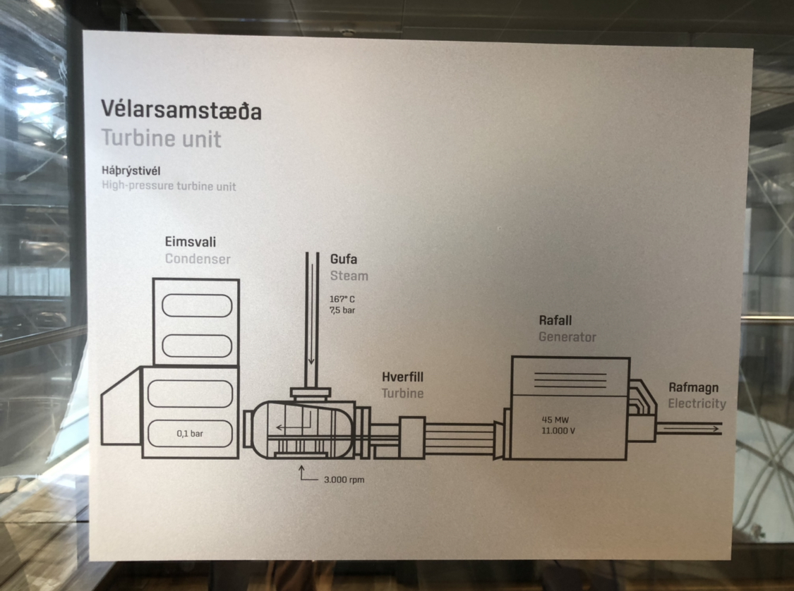
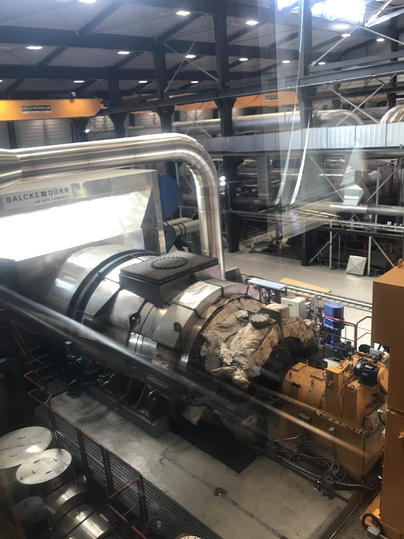
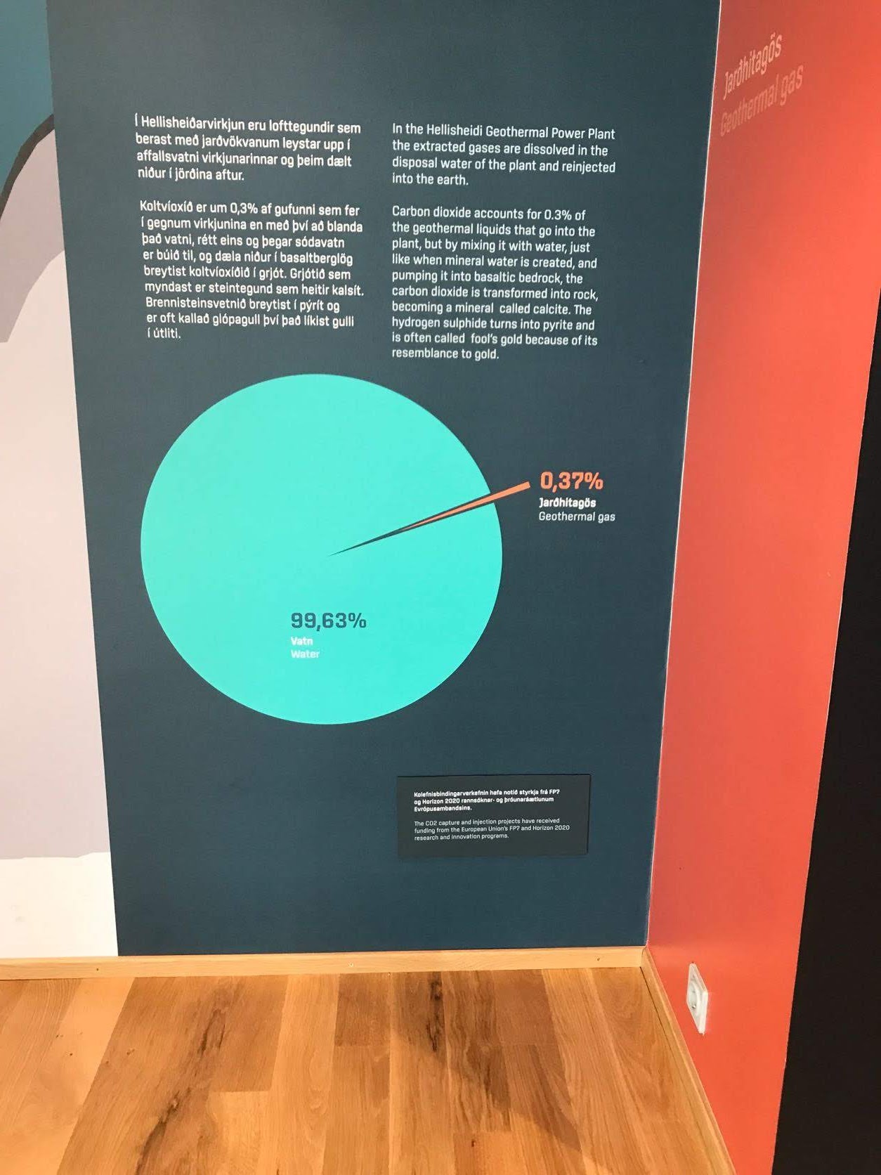
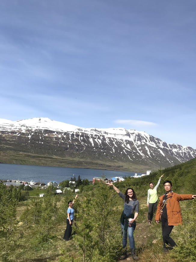
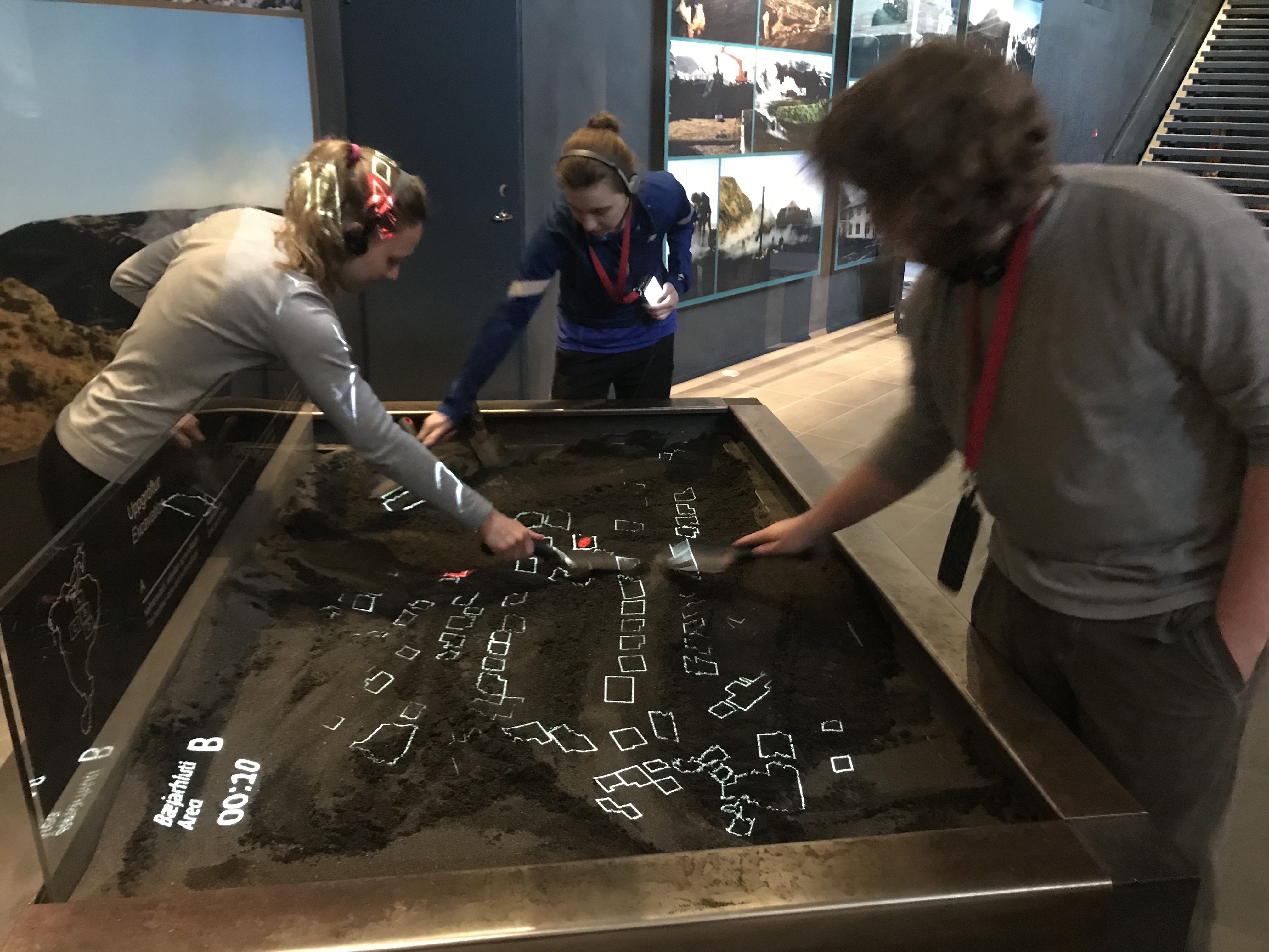
This is our last full day in Reykjavik and in Iceland. In the morning we visited the Hellisheiði Power Plant for the ON Geothermal Exhibition, which gives us a detailed introduction including the history of Iceland using geothermal energy and the significance of geothermal energy to Iceland.
To use geothermal energy, there must exist a geothermal area, which is created by groundwater flowing through hot layers of rock generated by volcanic activities. The geothermal areas are They are categorized based on the temperature of the water in the bedrock into high- or low-temperature areas. The locations of the high- and low-temperature areas is a result of the age and temperature of the bedrock, where production in high-temperature areas focuses on using steam to produce electricity. Eight power plants in total produce 30% of Iceland’s 100% renewable electricity. Whereas within low-temperature areas geothermal hot water can be used for space heating. Approximately 90% of people living in Iceland use geothermal energy for that purpose.
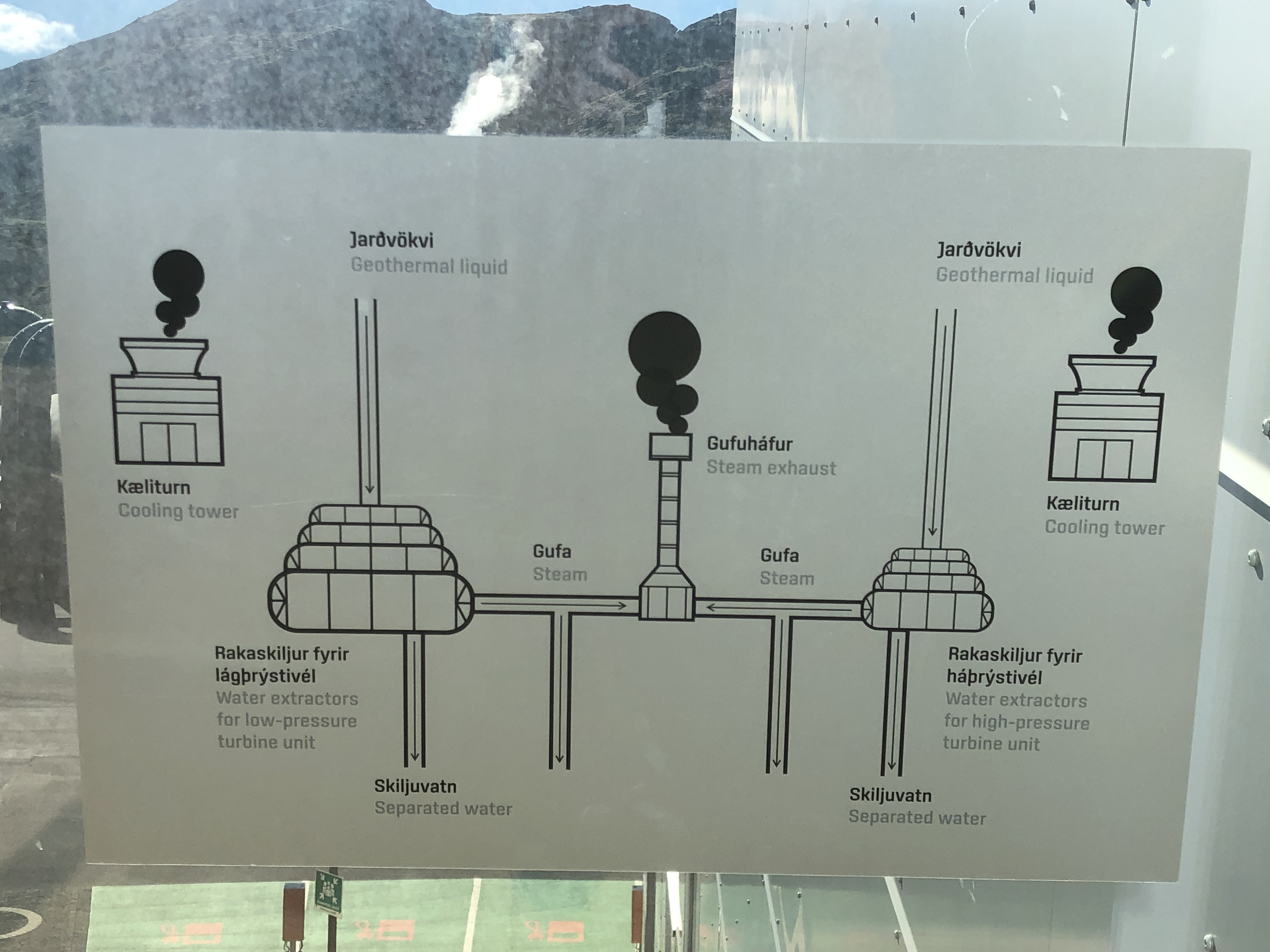

How they deal with the geothermal gas remaining in water such as carbon dioxide and hydrogen sulphide is also impressive. After the method of pumping the water back into the basaltic bedrock to let the gas turned into minerals by chemical combination is introduced, the percentage gets even lower.
We had a free afternoon again after we came back from the geothermal plant. Some of us went to the public pool (heated up by geothermal of course) to release the tiredness accumulated for three weeks. I personally walked around the main street downtown looking for souvenirs.
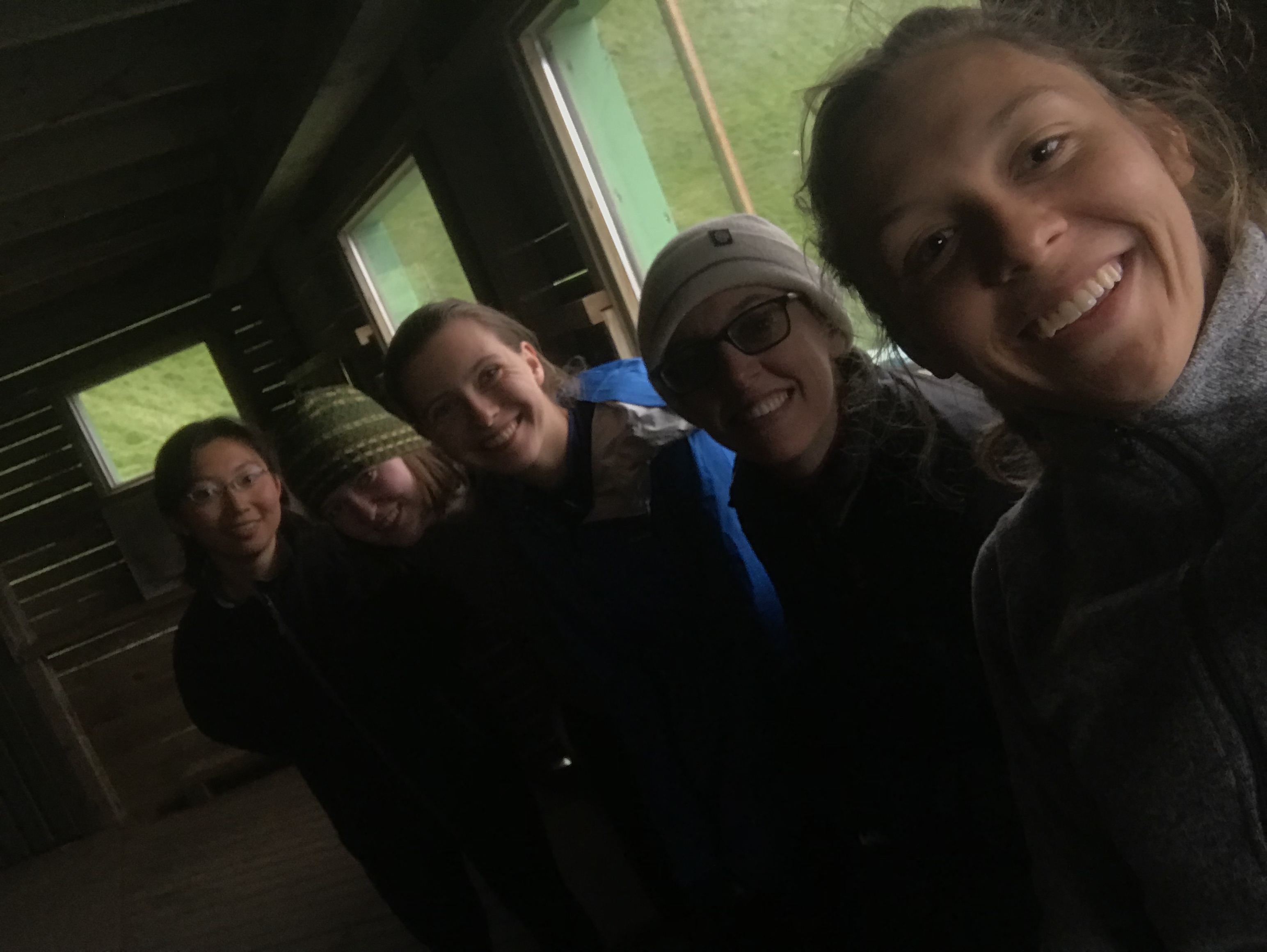
After dinner together, we all reflected on the whole trip. It is a pleasure to hear what people learned about Iceland from all aspects, how we grow by doing science and living together with each other and to think about what I achieved, accomplished and can do better.
I hope everyone can get some kind of sleep and ready to catch up the 8.30 am flight tomorrow. 🙂
Finally, freedom!
We were back in Reykjavik and each of us got the whole day free to do whatever the heck we wanted in the capital. I decided to stay in for lunch, made myself an omelette and some ramen, and then headed to the public pool called Laugardalslaug. Unfortunately, phones and cameras were prohibited in the pool area so capturing pictures was not possible. However, I ended up enjoying the place and the vibe quite a bit as I went around dipping in the hot tub and steambath, completing a couple of laps and then going down a slide (a definite spot of fun for the young ones). There was also a small hot tub in a corner that had geothermal seawater, extracted from a borehole near the coast and heated further. It also had a few interesting salts (6 different ones, cannot recall all of them) – you would be able to feel the difference in texture if you went for a dip in it.
Later, I decided to have dinner at this food court that was within a 10-minute walk from the hostel and I did not regret that decision at all since I got to enjoy some absolutely delicious salmon. It was also the summer solstice, so a lot of people were hanging out in downtown and around the city. I decided to go for a walk, hoping to catch a view of the midnight sun and I was served just right!

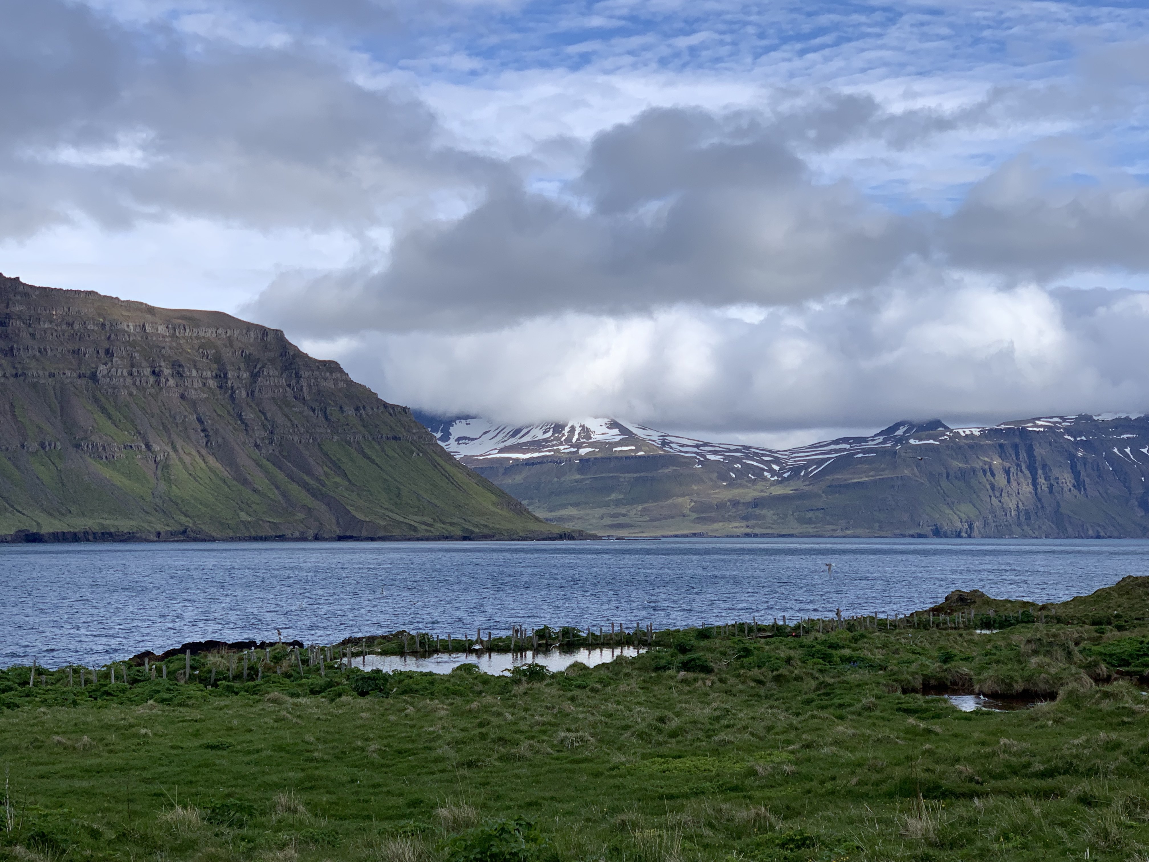
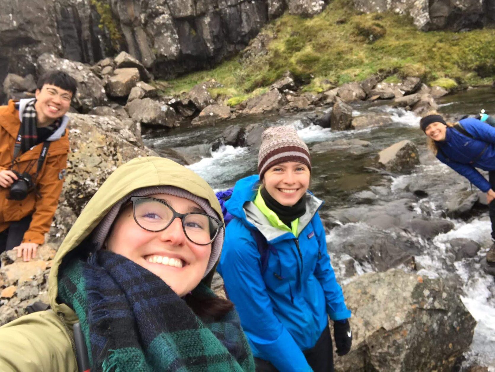
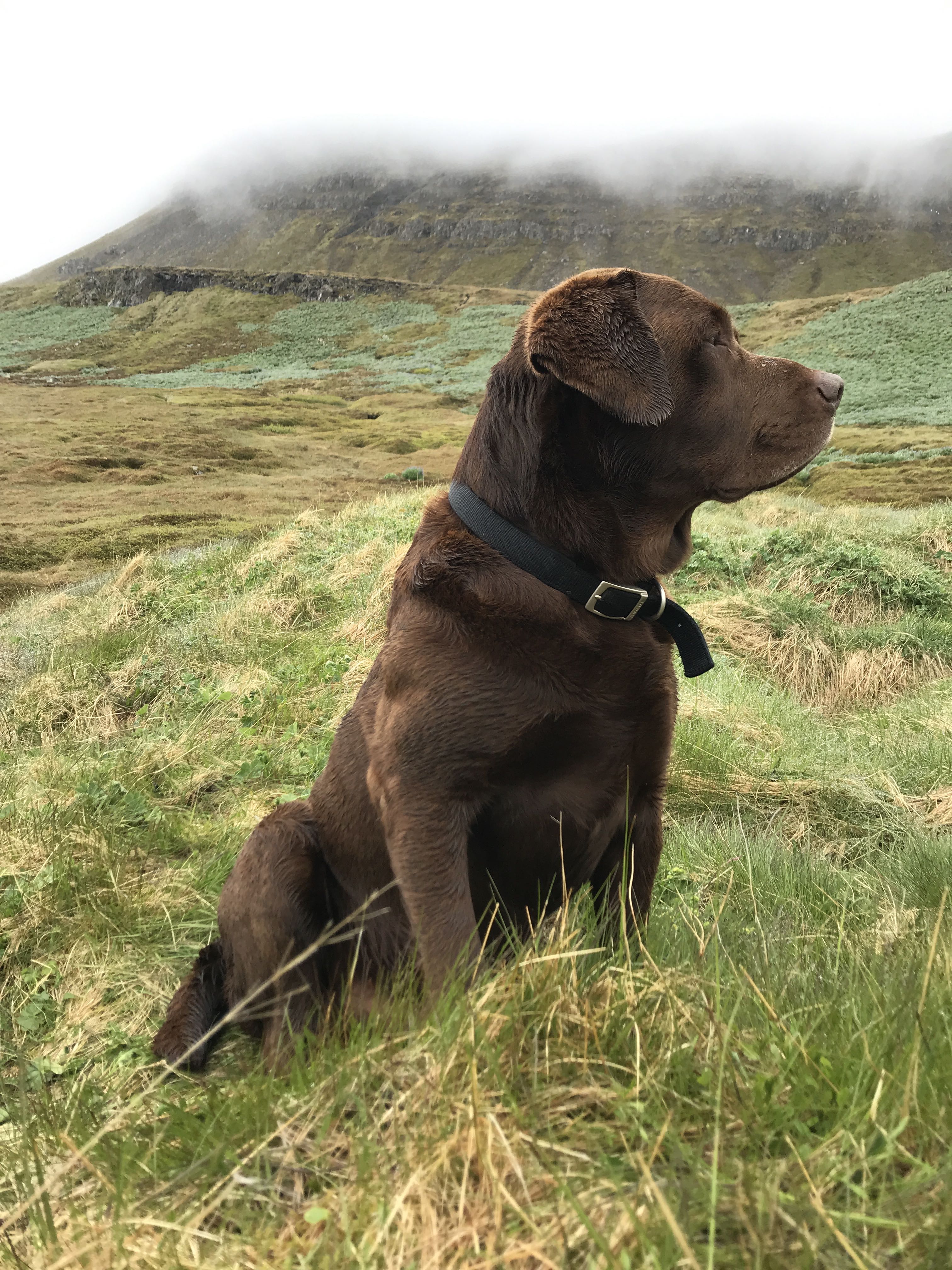
Today was our last day at Skalanes, which is always a bit sad. After spending a wonderful week here doing science, hiking, cooking, and eating together with a group of students from Scotland we are packing-up to head back West for a couple of days in Reykjavik before the program ends on 23 June. Did I mention Fyrir the amazing dog? And Oli and Rannveig the wonderful hosts? We also work with Oli and Rannveig on a couple of science projects related to ecology and archaeology.
Early this morning was a scrum of packing, eating, making lunches, cleaning-up, and saying goodbye. Our travel plan was a trucks to take the gear to the first river, people hiking there, and then a bus to Seyðisfjörðurand and over the Fjarðarheiði mountain pass to the airport in Egilsstaðir. At approximately 10:00 GMT the group found itself completely packed and ready to go, at which point they realized they did not need to leave until 11:00. One of the leaders, who shall remain anonymous, had never been ready ahead of schedule before and feinted from the shock. Hilarity ensued and we Euchre and Carcassonne until it was time to leave.
The trip was uneventful other than the bus trip from RKV airport to the hostel, construction at the hospital has changed the bus route so rather than knowing where to disembark (12 people with baggage and 10 cases of science gear and samples) we were a bit lost. Fortunately a very helpful local explained where we could get off that would be close to our lodgings.
And here are a couple of pictures from Skalanes, which is a place that pictures can hardly do justice to.
Fyrir, local security.
View to the North from the house.
Today was the last full day here at Skalanes, a bittersweet kind of day. It started out with a presentation from Òli, who is currently working on his dissertation on the subject of the sustainability of Skalanes. The work here at Skalanes has taken several years, Òli bought the property for tourism and conservation but it has transformed into a multidisciplinary project. They have planted trees in hopes to offer a habitat for further avian species and to offset carbon. They have included students in the efforts to converse, not just to take data but to use that data in order to pursue more sustainable living and offer a more holistic habitat for the wildlife. This place continues to pursue better ways of living sustainably, including pursuing measures now for future events (like global warming).
After the presentation, we split up. Drone people did some flying. Soil and bio people packed up our bio boxes, which was quick and painless. After removing some tubes and gloves that we are keeping here, it was surprising to see how much space there was in the boxes compared to the packing job coming here.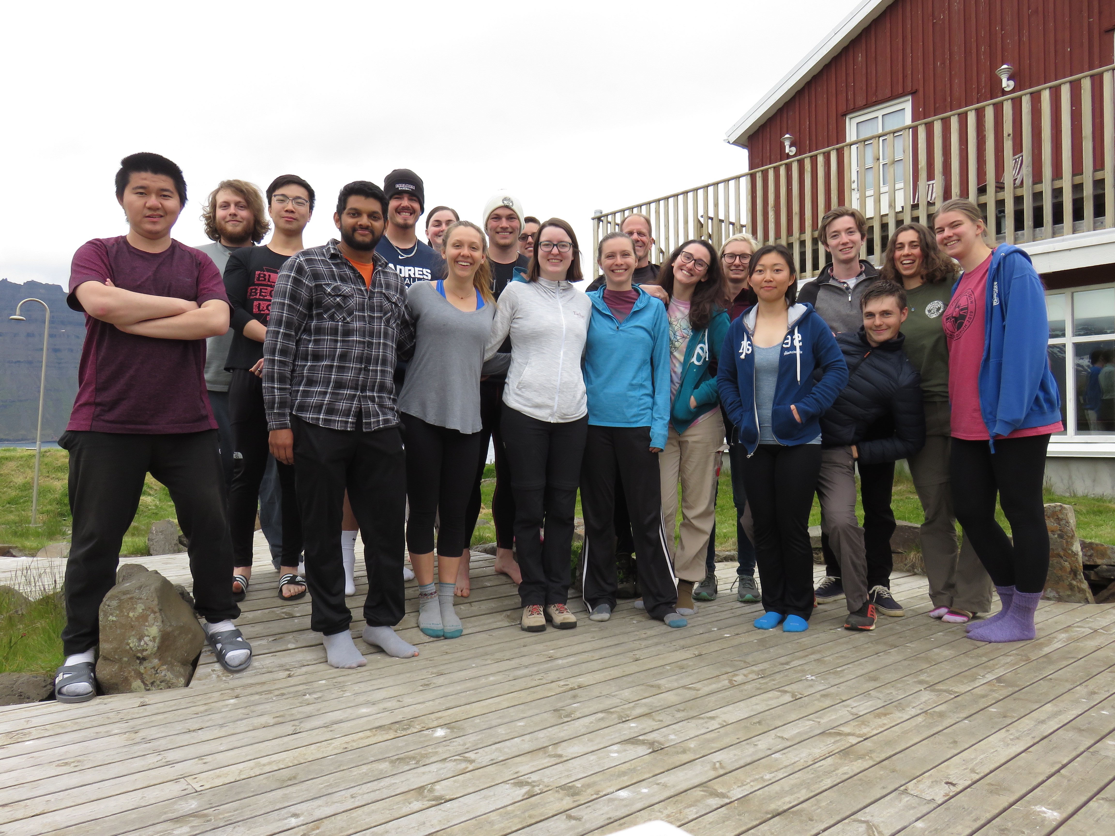
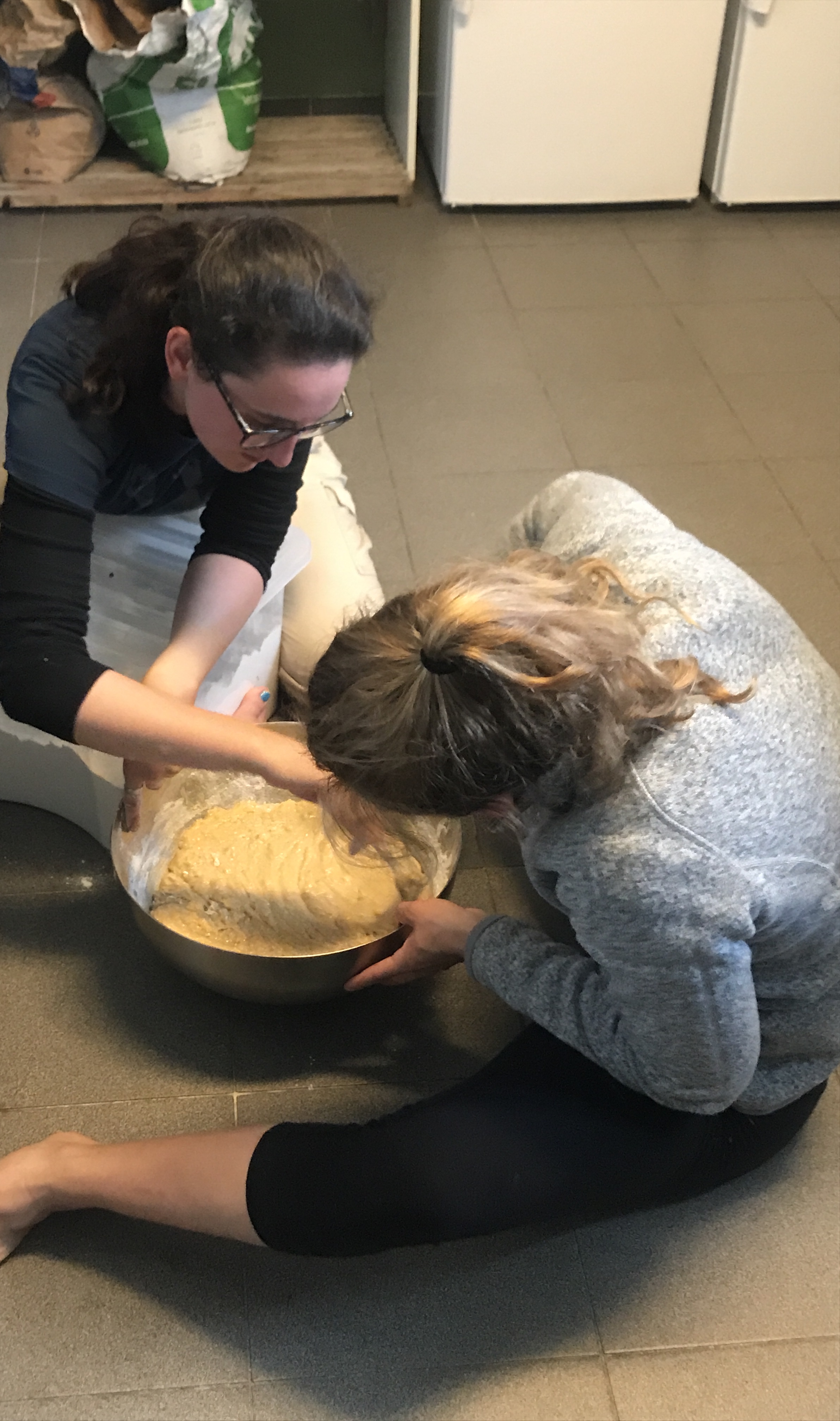
Then we all did our own things, it was a relaxing afternoon. Around 2-3 Sydney recruited me for another batch of banana bread. We had 19 bananas, resulting in two large regular pans, one gluten frene tinto pan, and another small pan (cuz I accidentally made the intended GF bread with real flower first). In the end, the bread ended up being delicious as dessert. Joyce madre Curry, which was so very good.
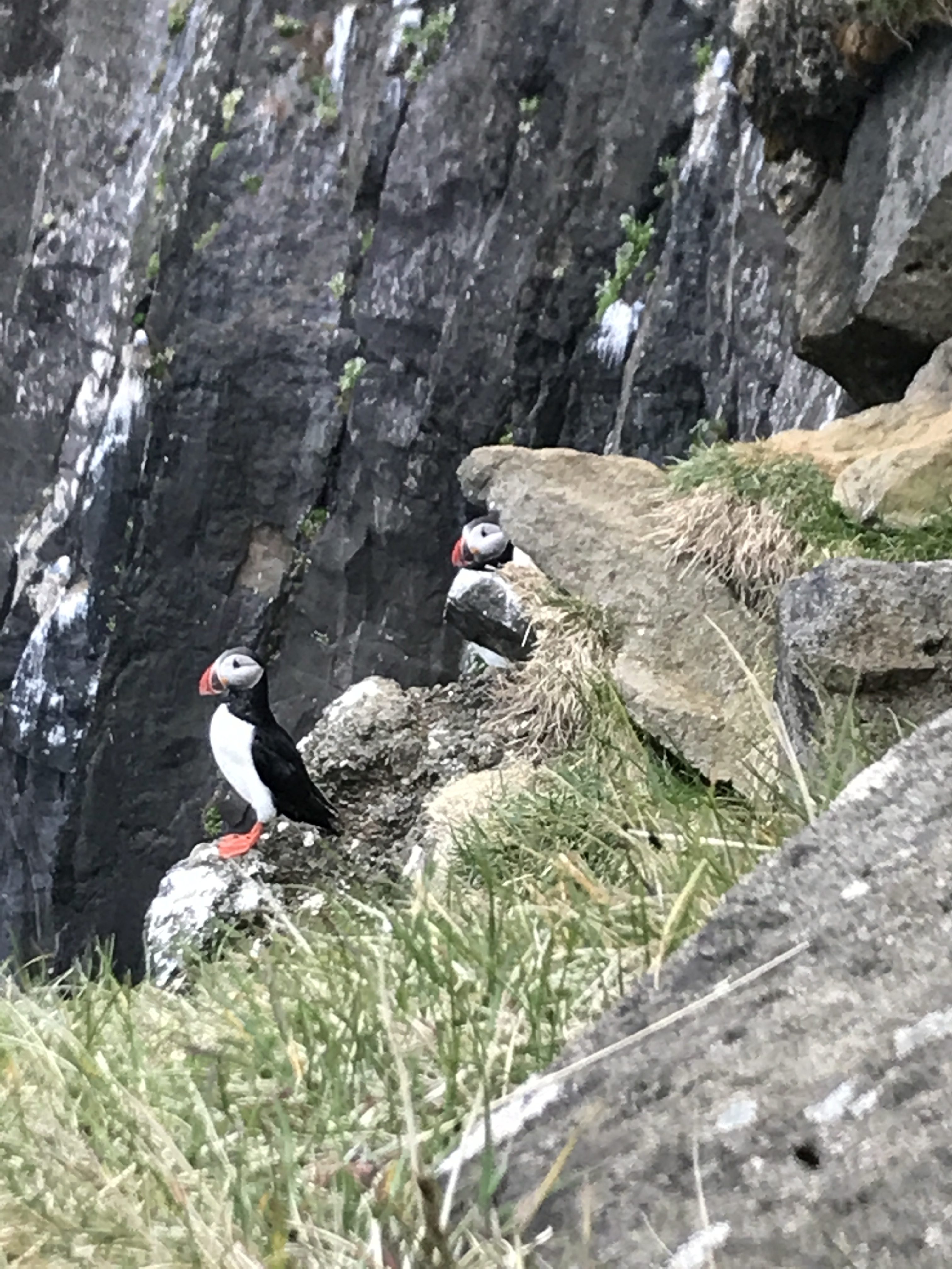
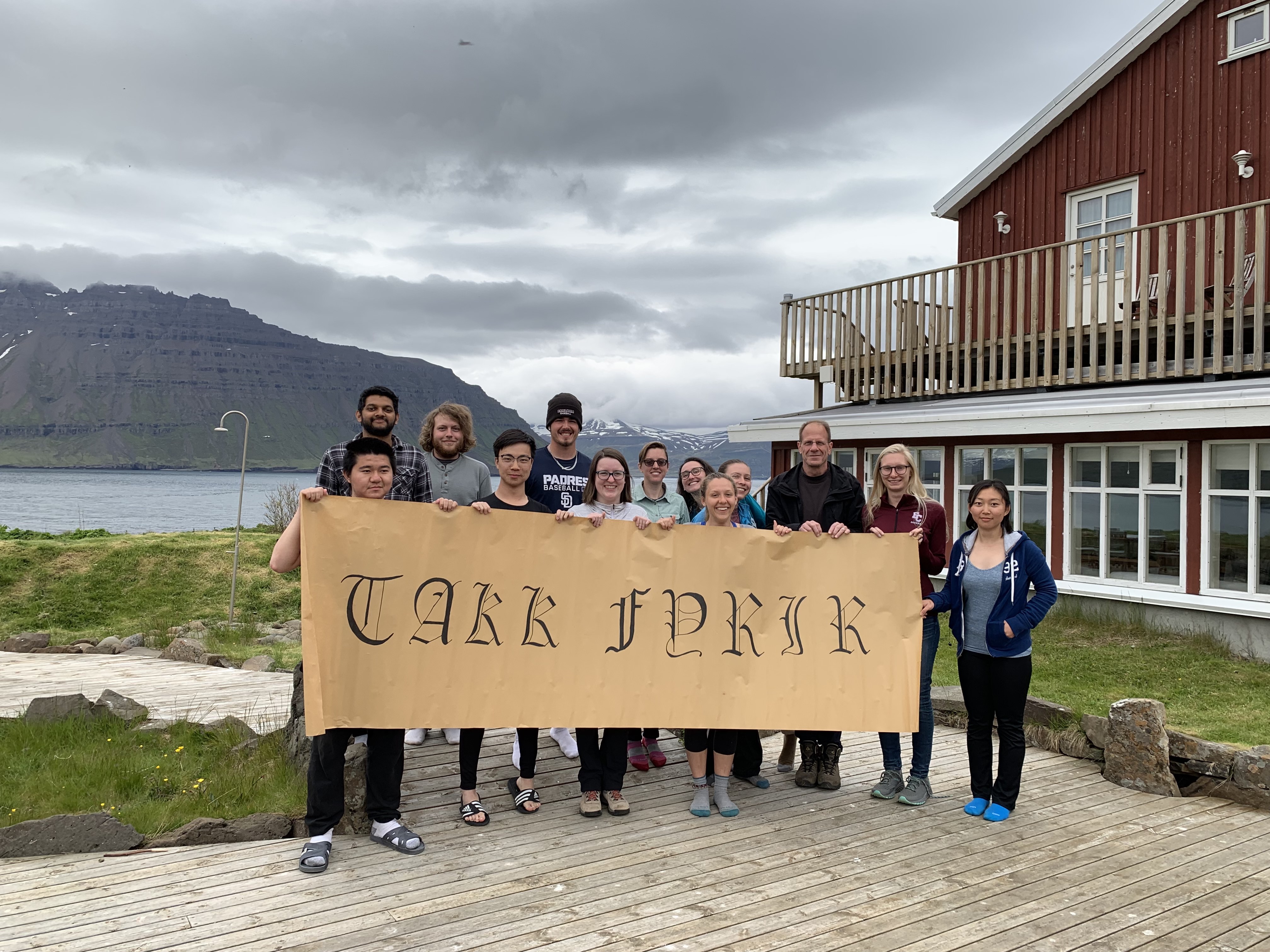 After dinner we all gathered together for group photos, a couple with the Glasgow crew and a couple with the gorgeous “Takk Fyrir” sign that Sydney drew to thank Òli and Rannveig. This was followed by our nightly group meeting (rest of trip logistics), then a trip to see the puffins by several of us. We were able to get quite close, they adorable creatures.
All in all it was a good last day. Excited to go back to Reykjavik, but going to miss this little piece of heaven.
Today is a quite busy day for everyone. After the script designing and drone flying, I experienced working in a group of four with Sydney, Kaela and Kathryn to take soil samples at two different spots. One next to the coast close to the birds’ habitat, the other one on both sides of the waterfall close to our camping site. The group work was divided efficiently, Kathryn and Sydney took all the samples, Kaela put the data into the database and I am in charge of taking bird view pictures of the sample site with Kari.
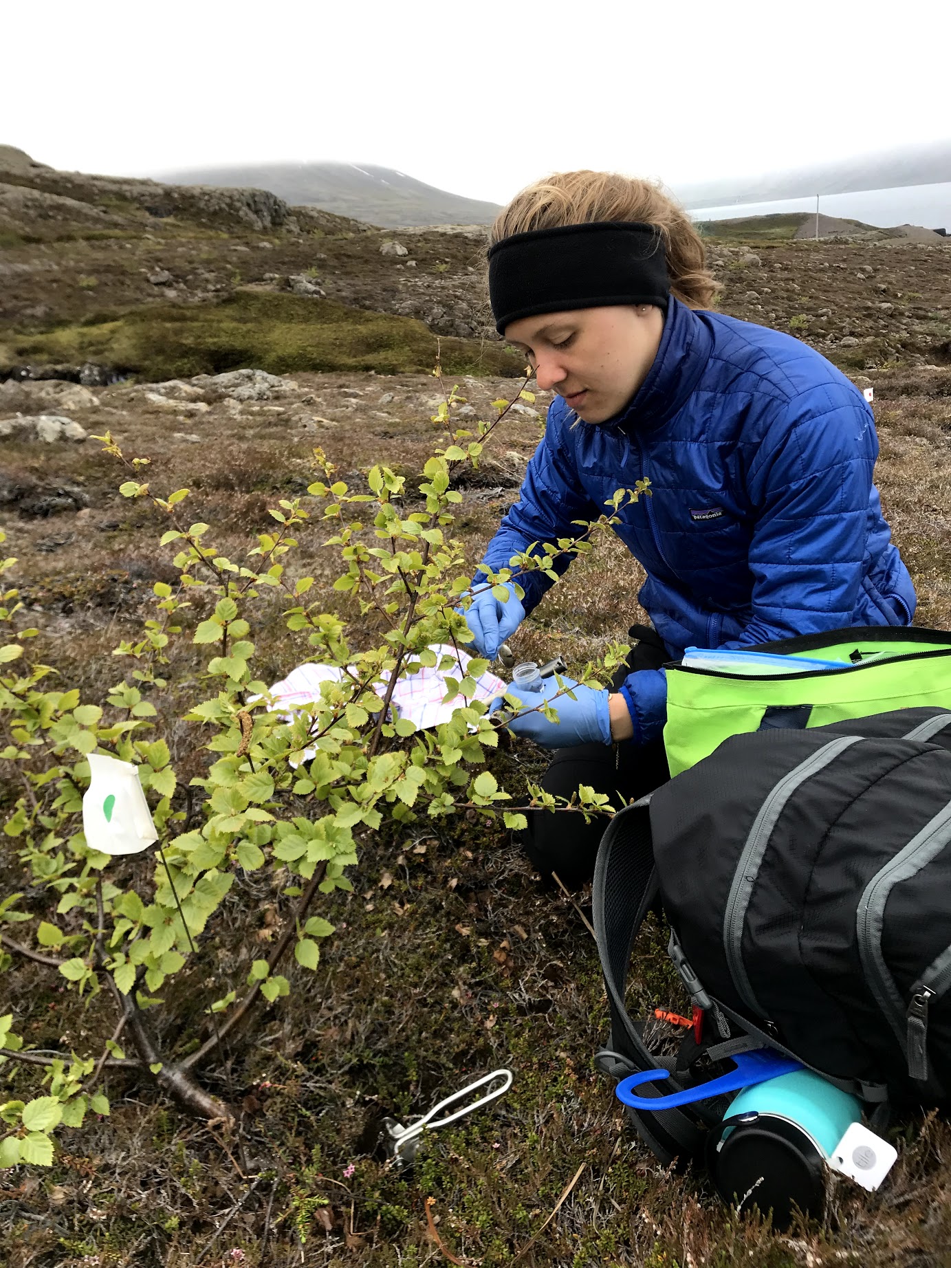
We took all the samples under the area covered by a tree crown, the trees we met here are 50 cm tall in average, no more than 2 meters, even if they’ve been growing for a decade or more. For each sample taken under the tree, we took a control group sample on the ground away from the tree. I assume the analysis of the sample can show the difference of the soil affected by the tree or not.
In order to get to the other side of the waterfall, instead of going all the way down, we chose to cross the river directly. The river is wider than it looks from above, it is also harder to cross than I expected. Yet everyone got excited crossing the river as it reflected a great group work between us and marked our job in the afternoon is halfway done, and we made it!
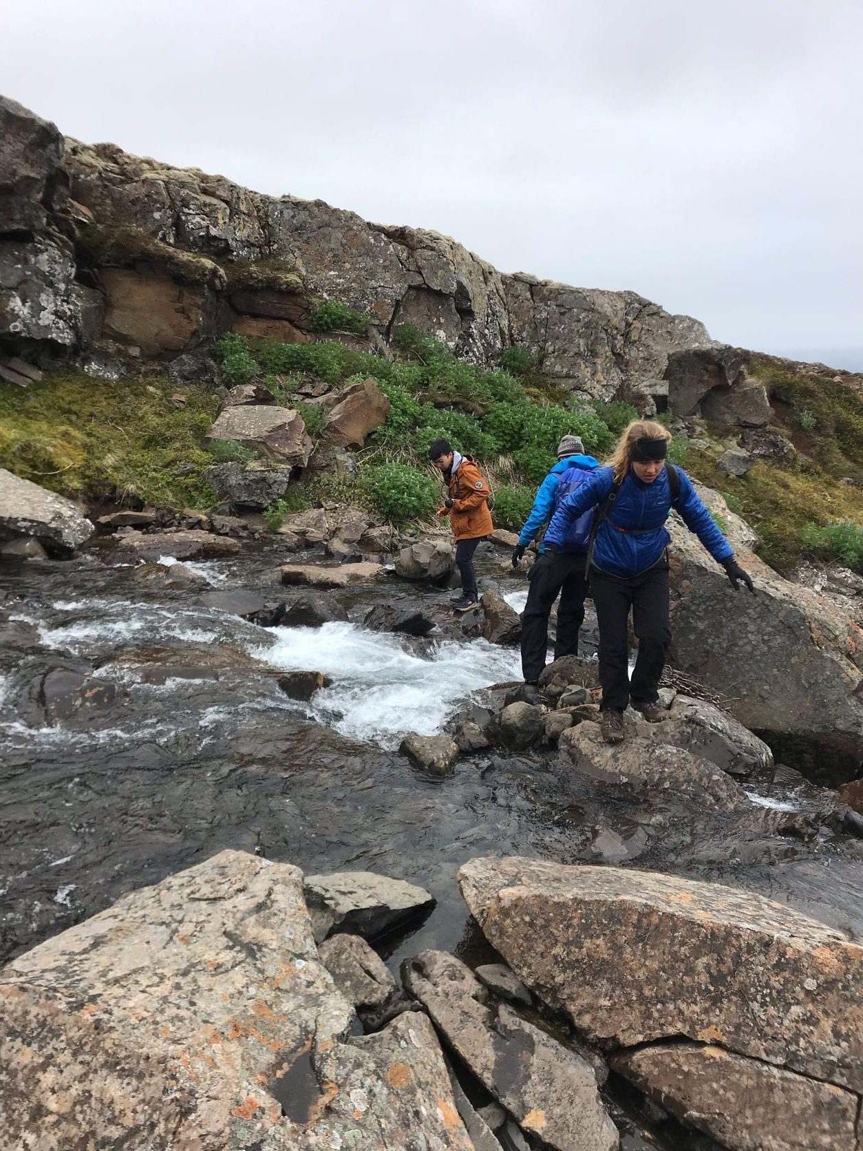
The whole process took longer than we expected, but everyone feels perfect after the task been accomplished. I am glad to see that we can work so well in as a group to contribute to the project, I also feel more bonded with my beloved team members.
On the other hand, the drone flying group is also having a hard day, lots of flight plans need to be finished which cover a large area. Especially Jordan is almost having a non-stop. Cheers to super hard-working Jordan!
It’s all worth it when we were rewarded by Charlie’s roast lamb at dinner 😉
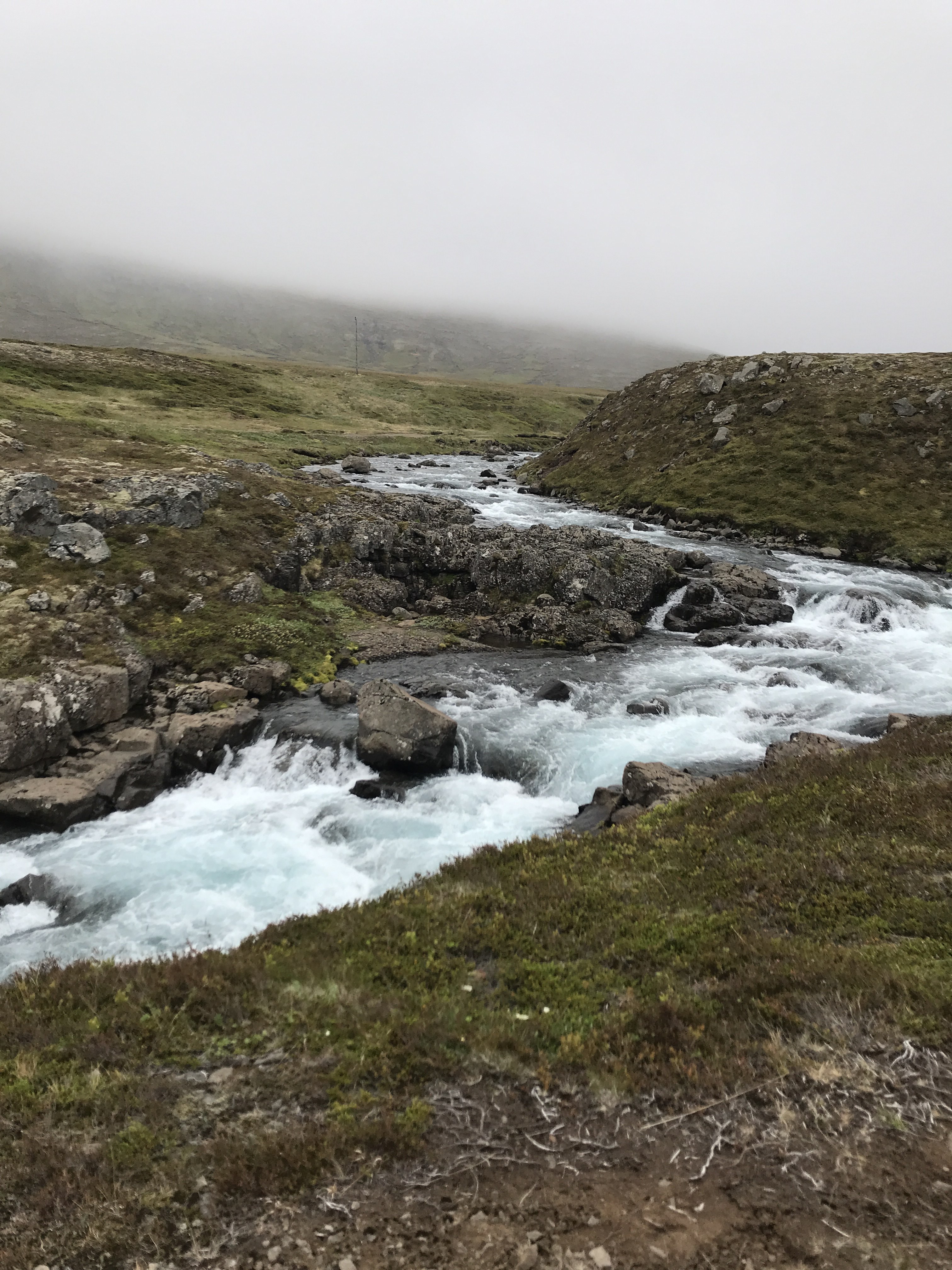
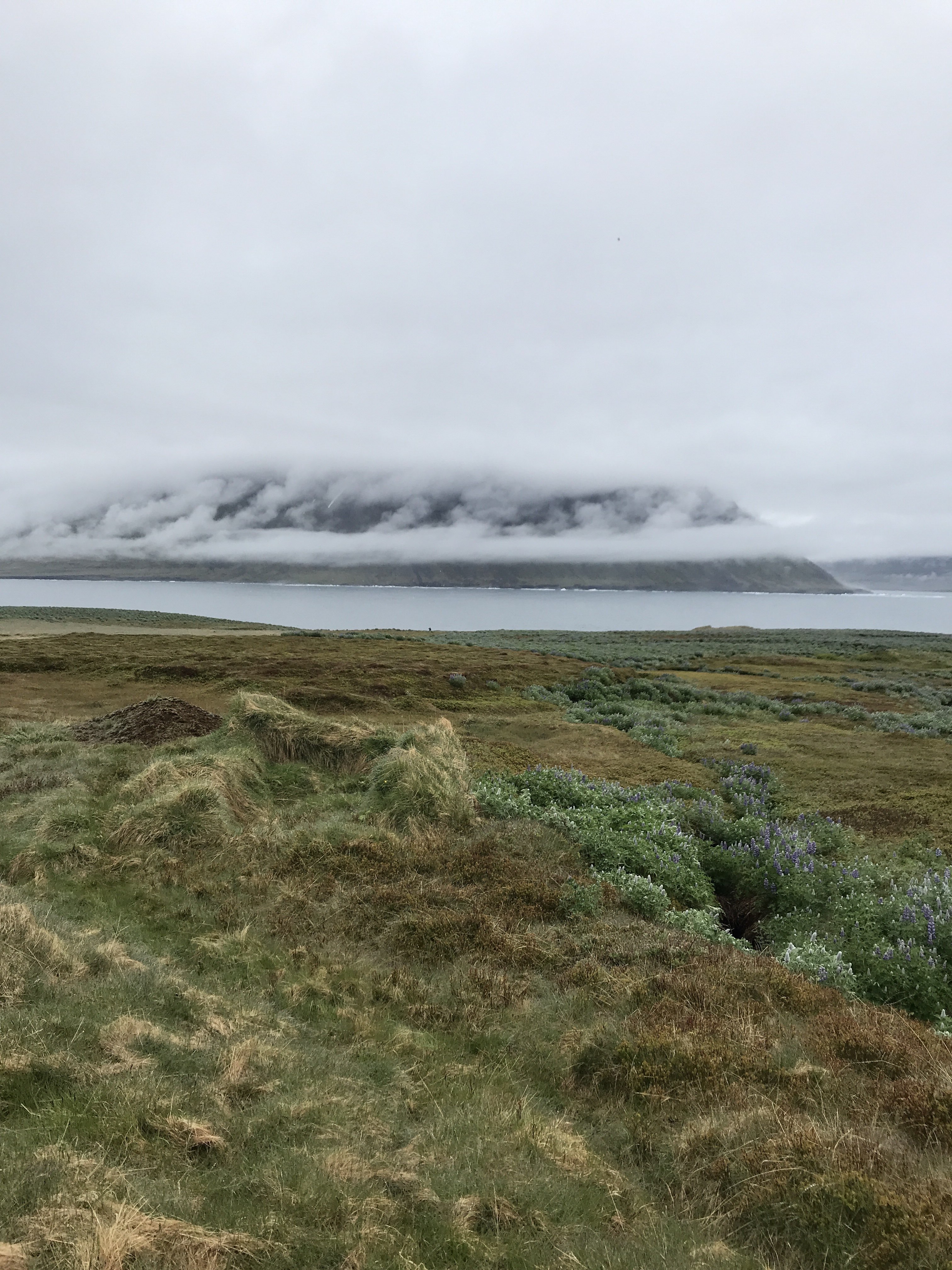
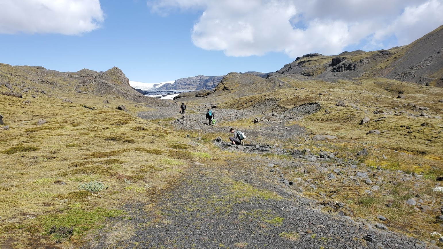
Hello faithful blog readers. Today was pretty foggy, so we were unable to fly any drones due to condensation on the electronics. However, folks got other projects to work on like analyzing the data we had already collected and working on monitoring the flow of one of the rivers, to assess its potential for hydropower. The fjord is beautiful in the fog, though, and many of us appreciated it by taking hikes, both long and small.
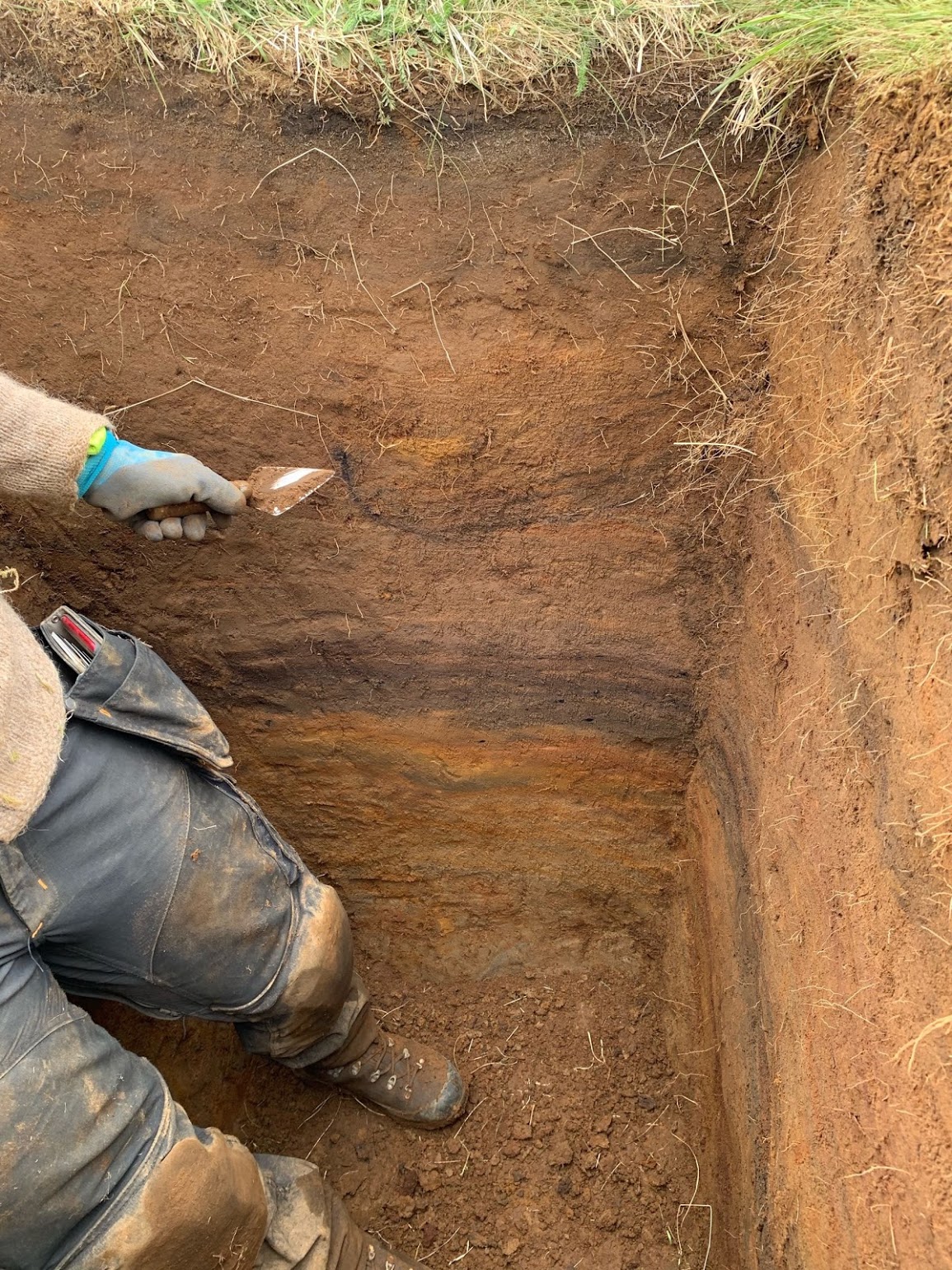
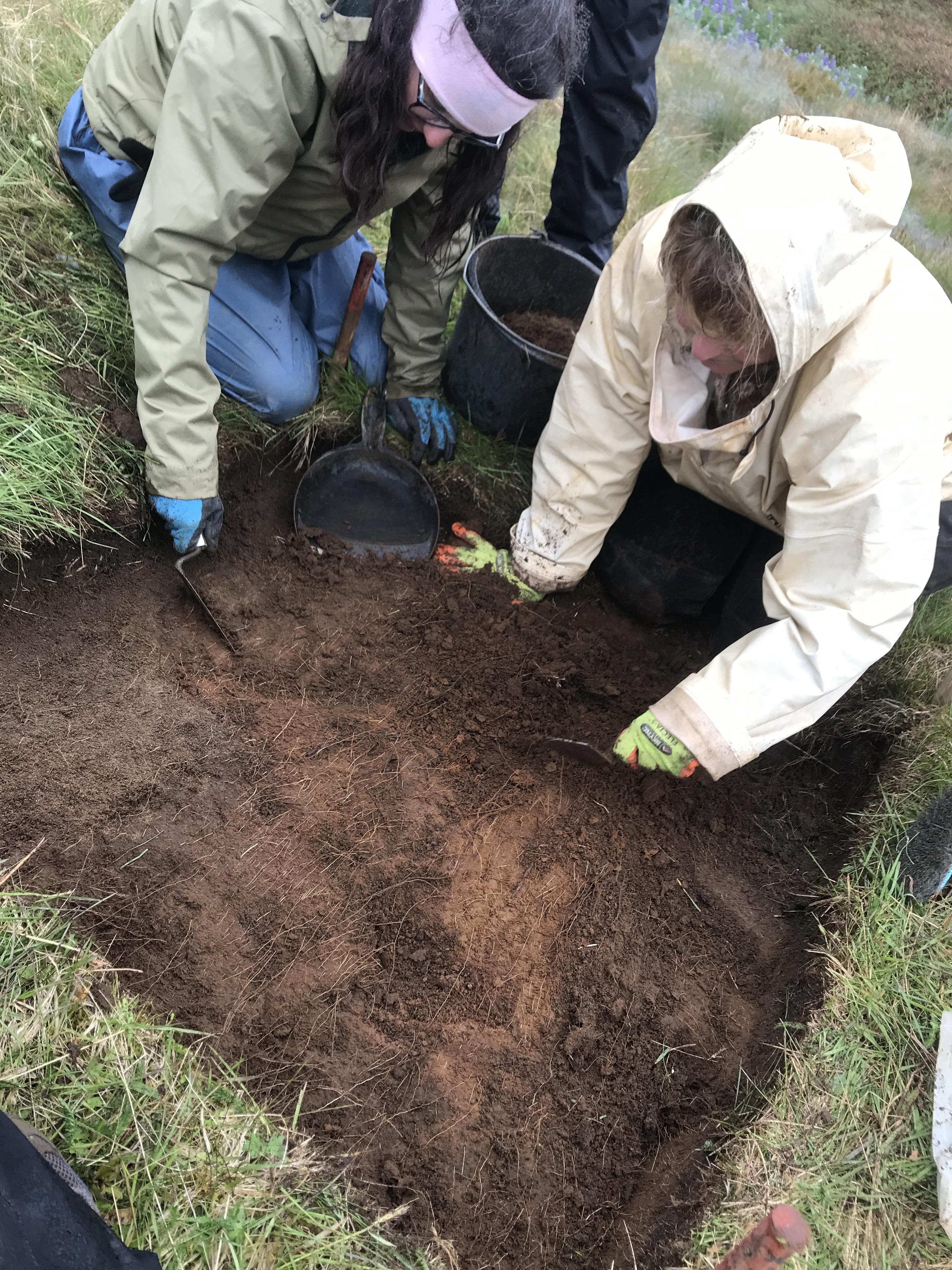
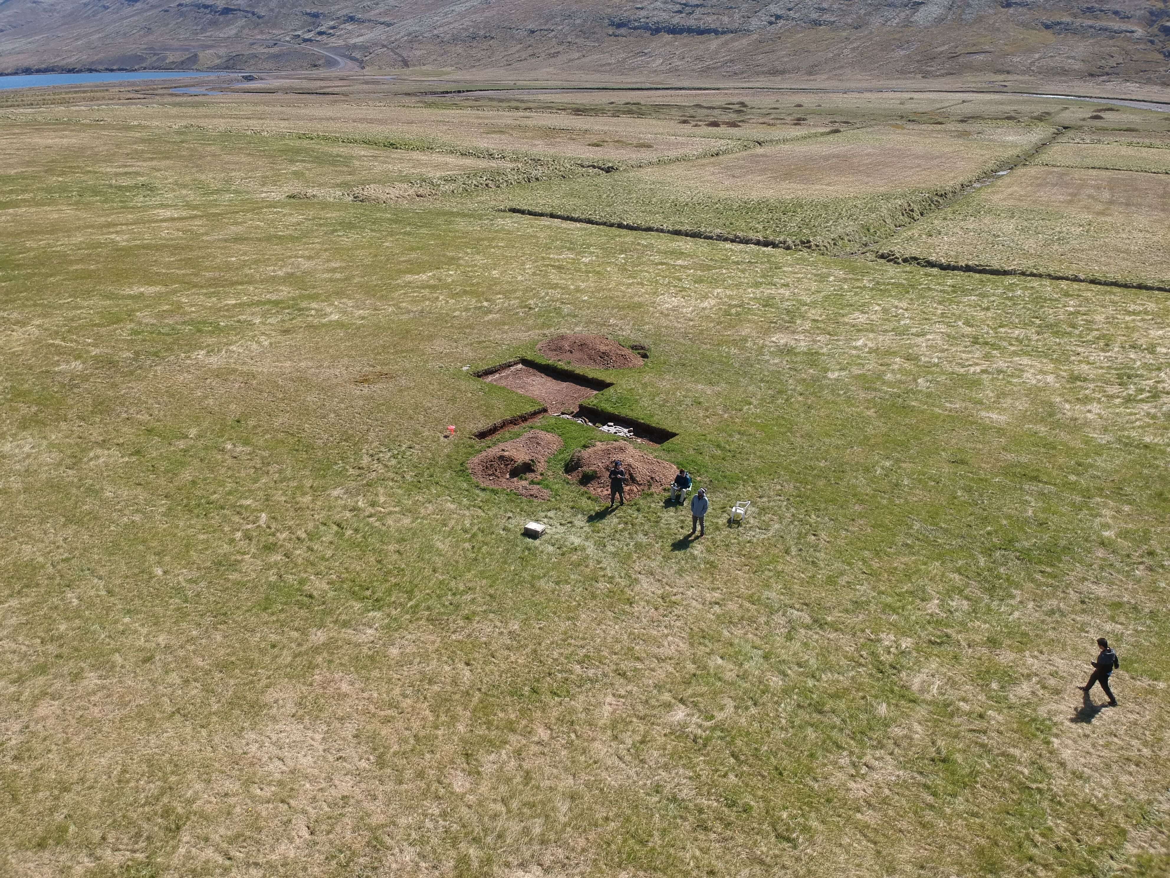
An exciting test pit was dug – over 1 meter of soil was removed from a square meter of land in a known previously habitated site at Skálanes. Óli and Rannveig worked hard to excavate the area, and then we took 13 samples – one for every 10 centimeters. We hope to measure the amount of sheep DNA in each layer – we assume that settlers brought sheep with them, and so sheep DNA should be present in habitated layers and not present in layers that are not habitated. We’re also working to identify the tephra layers (soil horizons which were layed down by volcanic eruptions). It’s not clear out here which layer is which.
Tomorrow is Icelandic Independence Day! We will continue to collect soil samples and drone imagery in the morning, since it is supposed to begin to rain in the afternoon.
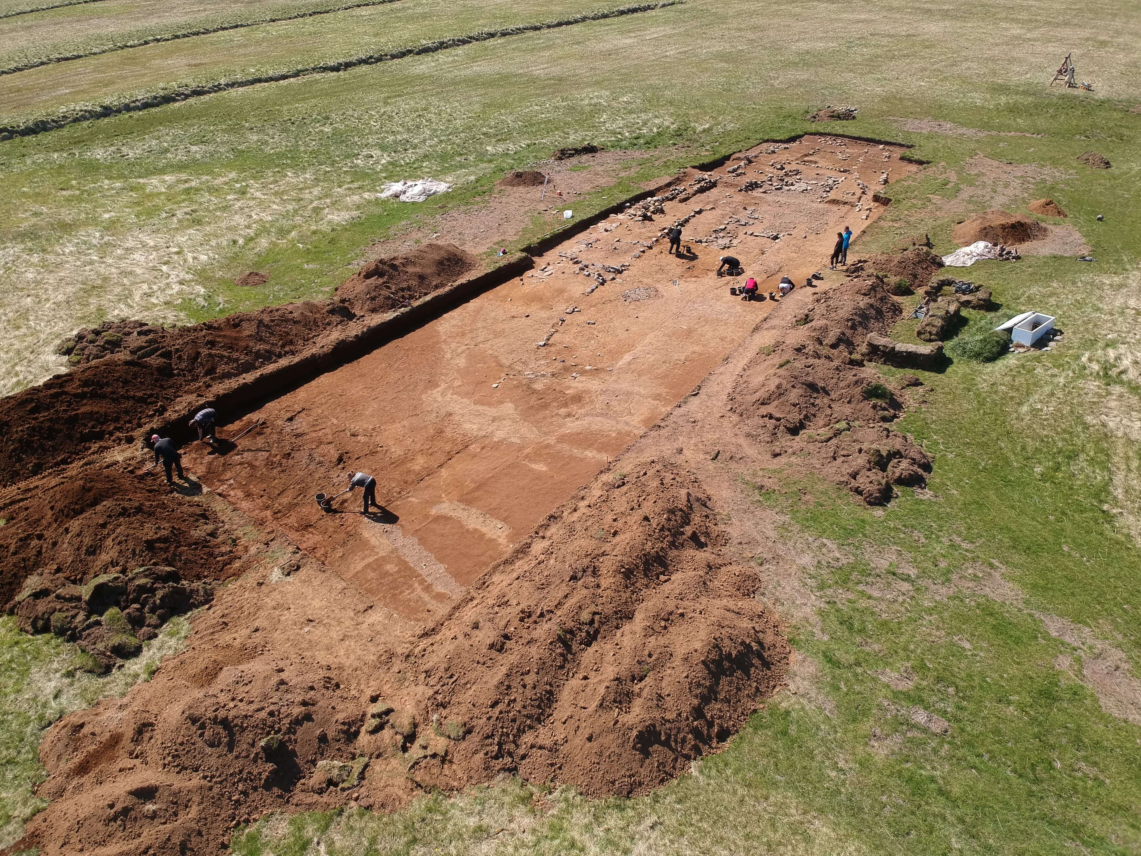
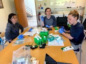
Another day in paradise, and a bunch more science. Our group has a number of on-going projects at Skalanes: aerial surveying (near infrared and visible light imagery) for archaeology and ecology, soil parameter analysis and DNA extraction in different types of habitats for ecology, and DNA extraction and tephra analysis for archaeology. Today the diggers went to the test pit and continued digging, measuring, and preparing to take horizontal soil cores in the pit tomorrow. The flyers continued to survey two large areas (~1 square km each) in both light modes. These flights generate hundreds of images each which are harvested to our laptops and then run through Open Drone Map to create composite images of the entire area. Lastly, Faith Jackobs (EC ’18 and IFS ’18) arrived from Texas to help Em and I with our 16S rRNA and ancient DNA analysis workflows. She and I are working through our ancient DNA analysis of the samples we took at Stod last year to confirm that the analysis was done correctly. This includes measuring the amount and nature of the damage to the fragments as part of establishing their age. Stay tuned for the results.
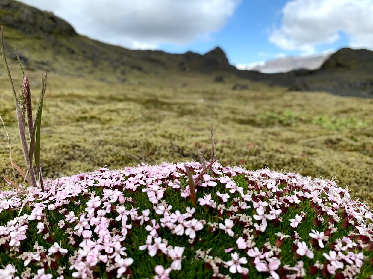
Insert obligatory picture of the amazing natural world at Skalanes here…
Hello! My name is Sydney, and I am a rising senior majoring in chemistry and minoring in math and physics. While in Iceland, I have been doing work with soil analysis and archaeology.
If you are interested, our research in Stöð was recently featured on the Icelandic news starting at 5:23.
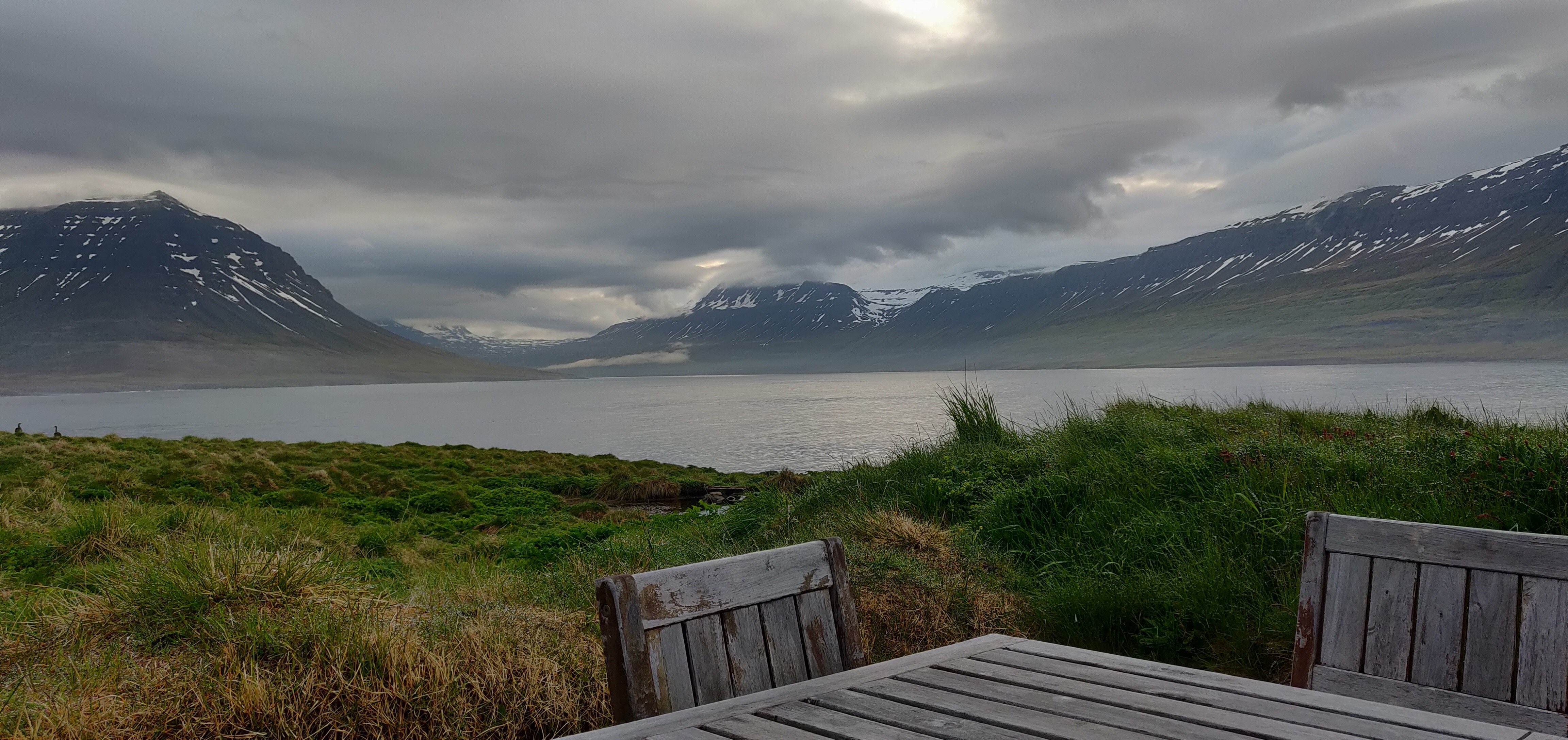
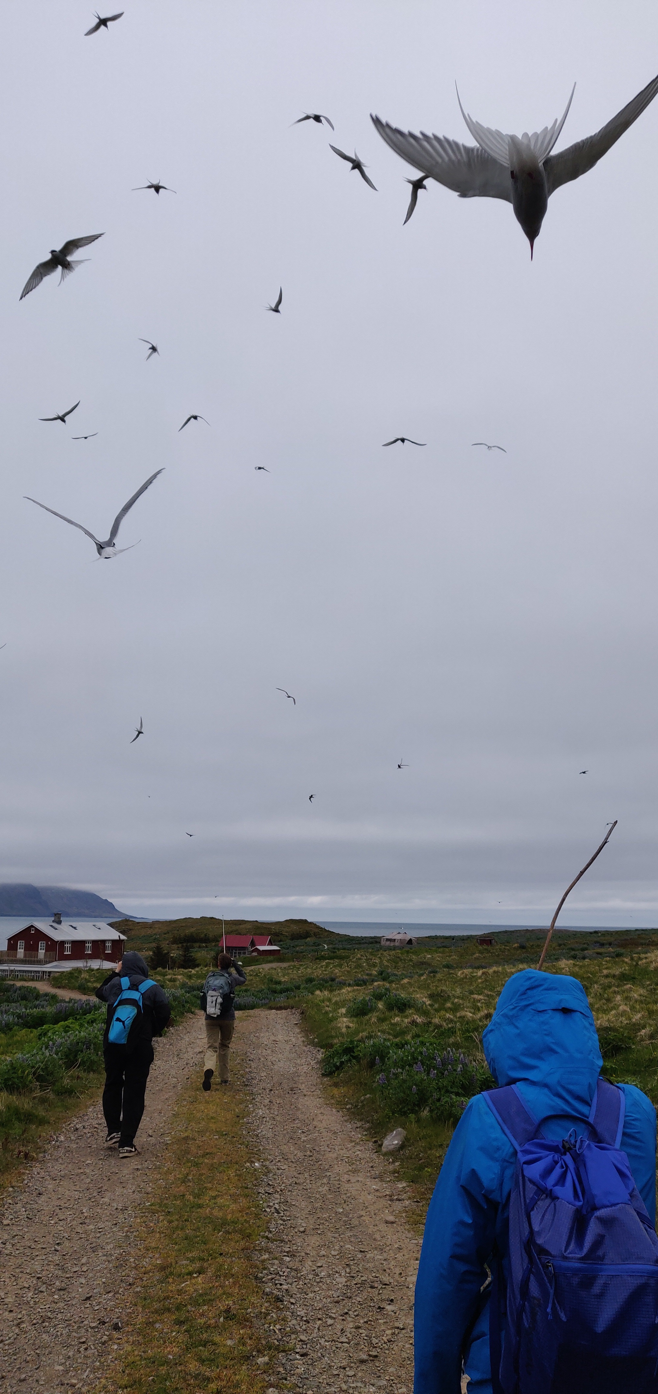
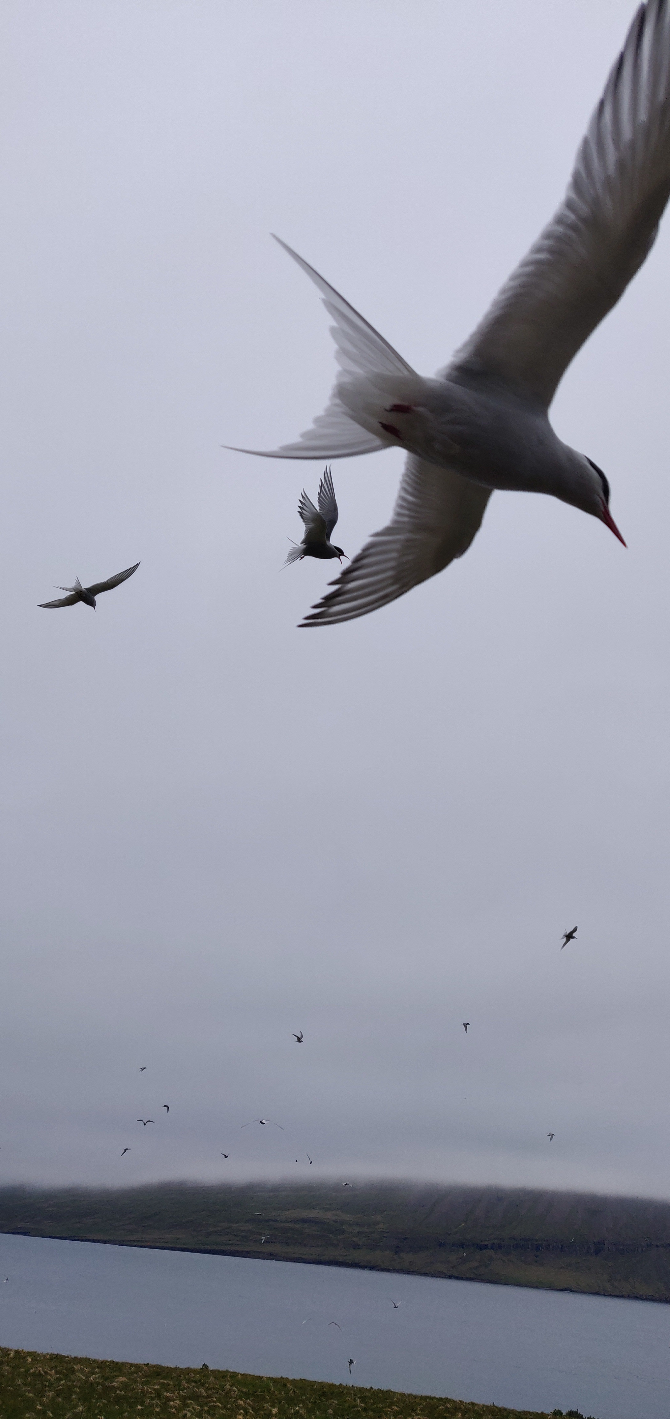
The last few days we have been at Skálanes, where we will be for the next week doing scientific research. Skálanes is owned by Óli and Rannveig and is located at the mouth of the Seyðisfjörður fjord. On the property one can find many creatures such as seals, whales, reindeer along with several species of birds including arctic terns, eider ducks, and puffins. Skálanes also has several registered archaeological sites, which is what our program is really interested in studying. The house has a lab for scientists that come stay on the property, and several rooms with beds amongst the home. The property makes money by letting scientists stay on the property, performing tours of the house, and selling eider duck down.
To get to Skálanes we left Seyðisfjörður, where we spent a night, then we drove out of town and crossed three rivers before arriving at the house. The car dropped us off at the first large river and then we hiked 4km to the house with our day pack. Our larger bags were brought to us by a car that crossed the rivers.
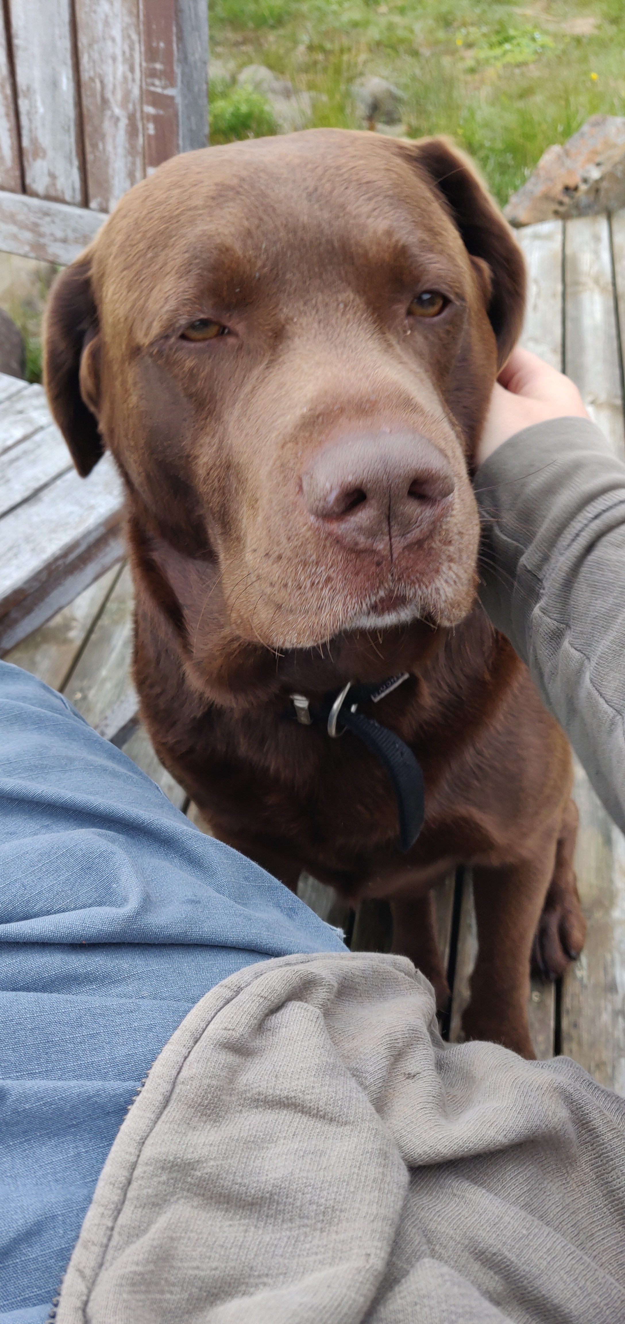
Our first day we unpacked, met Freyr (a cute chocolate lab that lives on the property), and a group of six student from Glasgow university in Scotland. The computer science group did work on ODM (Optical Drone Map) and prepared the drones for the trip tomorrow. They hope to make some images of the area that will give the soil group a promising area to collect data.
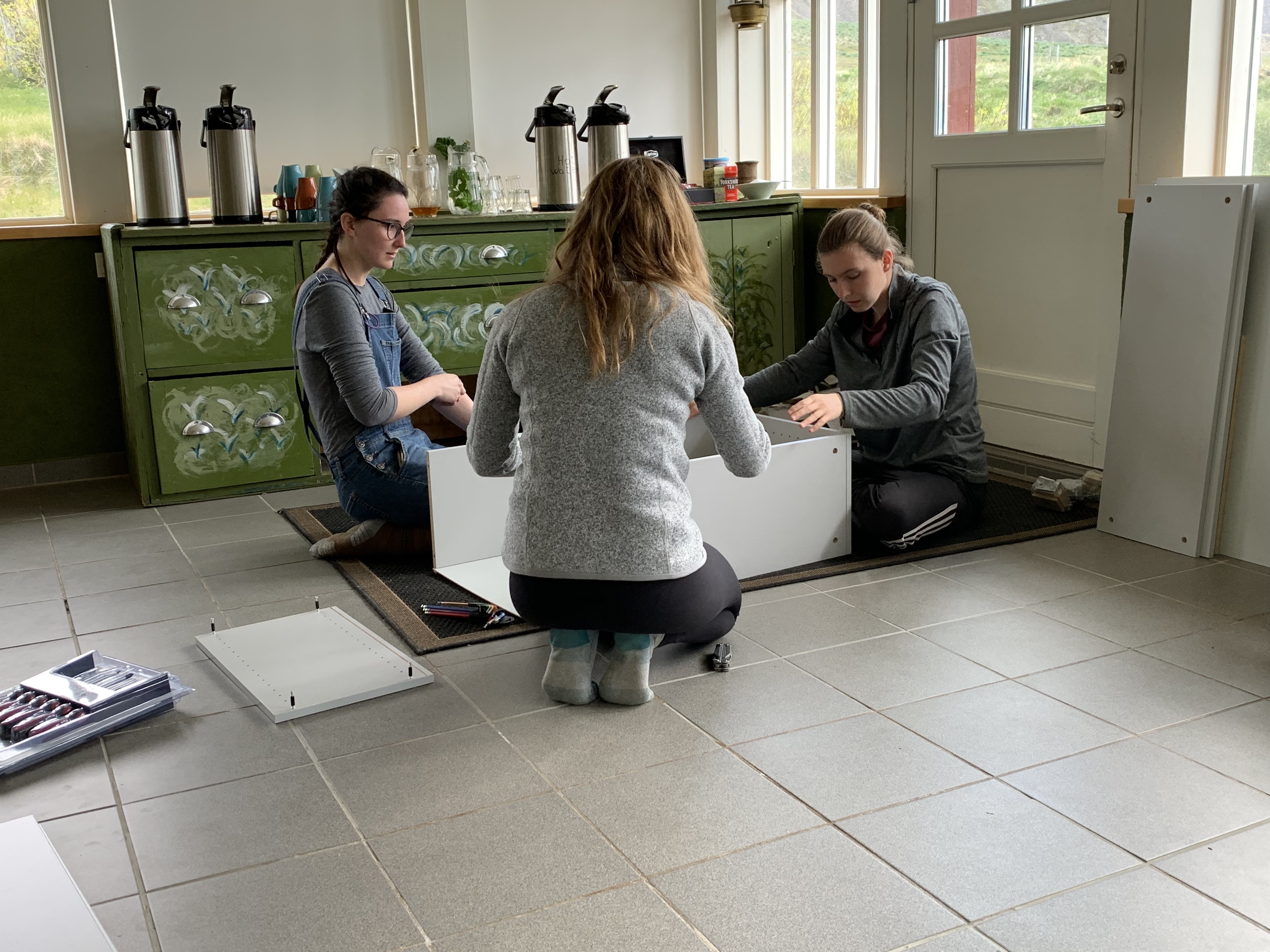
I built shelves for the wet lab in the house for Óli with Kathryn and Kaela.
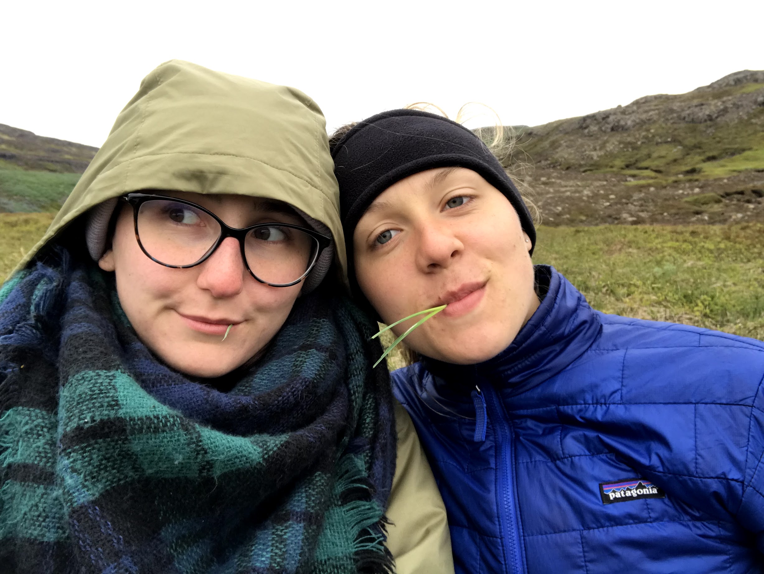
There was a lot of down time our first day, and we got to enjoy the peaceful atmosphere and learn from the other students living here. There is a possibility to camp if we want, so I hope to be able to do that.
Our second day, it was unfortunately was too foggy and wet for the drones to fly, but it gave the computer scientists more of a down day than they’ve been having and they were able to focus on coding more of the programs we have been using. The soil group did research on how to distinguish between the tephra layers in the soil. Tephra layers are formed volcanic ash, and we can link them to certain eruptions, and hense have a dating tool.
The soil group then joined Rannveig after lunch to start preparing the site where we will be excavating soil from one of the 96 (I think that’s the right number). Rannveig was really excited since it was the first time she had applied for permission to excavate a site of her own. Freyr hadn’t seen her in two weeks and followed us so he could be with her. To prepare the site, we used a GPS to mark the area we were excavating and Rannveig chose a square meter she thought looked promising. We pulled the grass off of the top and then started excavating by gently scraping at the soil layers with a trowel and putting the dirt created in a bucket to dump nearby. We had to be careful that we weren’t disturbing any potential artifacts. We found charcoal, so there was definitely human activity in the square chosen, and Rannveig thinks it could be a midden heap, so I’m excited to see what we keep finding.


When we got back to the house, Kaela and I made banana bread with the bananas that are way past ripe. It was ready in time for dinner and turned out better than I was expecting considering we multiplied the recipe by 10.
Today we left from the archaeological site at Stod and moved to Seydisfjordur.
We were sad to leave such a welcoming, wholesome town, but excited for the next place/adventure.
We are only here for the night, but it is another nice break from our scientific work, which has been pretty constant in the last few days. Seydisfjordur is small, but it is a cool place to explore with lots of hiking trails and places to walk to.
Tomorrow we will head out to the end of the peninsula to Skalanes, where we will be working for the last week of scientific projects. Skalanes is, to some degree, the focus of our work here, so it has been nice to rest up before working hard for the next 7 days to finish our data collection and process samples.
A lot had to be done today, but when did that ever bother anyone getting their stomachs full and tastebuds stimulated?
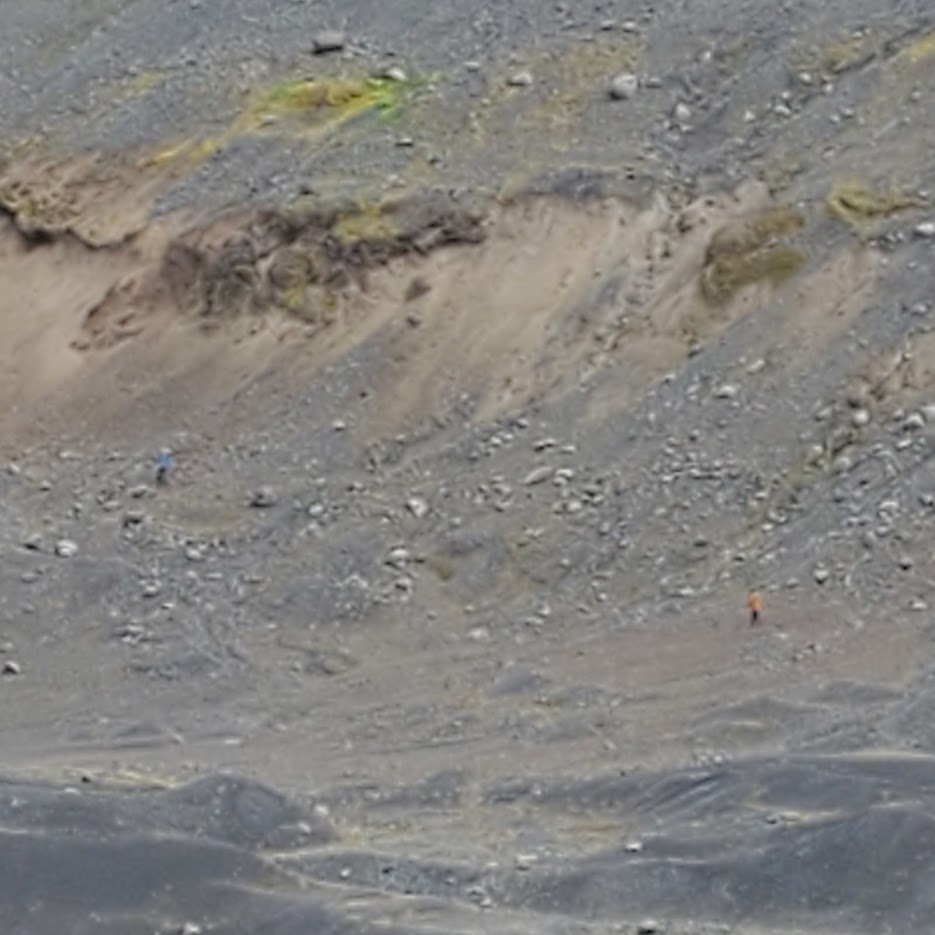
After an early rise, a group of us headed out to the field at 8 AM to capture imagery from the drone, while the others stayed back at the schoolhouse to finish testing the soil samples collected earlier at the Sólheimajökull glacier. Being part of the group on the field, I was flying the drones through the flight paths we had previously made to capture two different types of imagery, Visual Lens Imagery (VLI) and Near Infra-Red (NIR), of the sites of interest. We planned to use the imagery captured from the drone flights to analyze the sites further, which would give us information regarding earlier settlement on the sites; for instance, the NIR imagery allows the camera of the drone to visualize the land in terms of colors that the average human eye cannot detect and thus, it proves to be useful for detecting differences in vegetation of the land.
Following the morning session of flying, we headed back to get some lunch and were already expecting a great meal based on what we were served yesterday, but our expectations were again exceeded with amazing food: beef meatballs with cheese, white rice, salad, creamy cheese sauce (I don’t know the name but it’s really good, I swear!). Given the satisfaction earned from this meal, we were determined to finish all the remaining work we had, so we headed back onto the field and stayed till 5:30 PM, with some delays experienced due to technical difficulties with one of the drones.
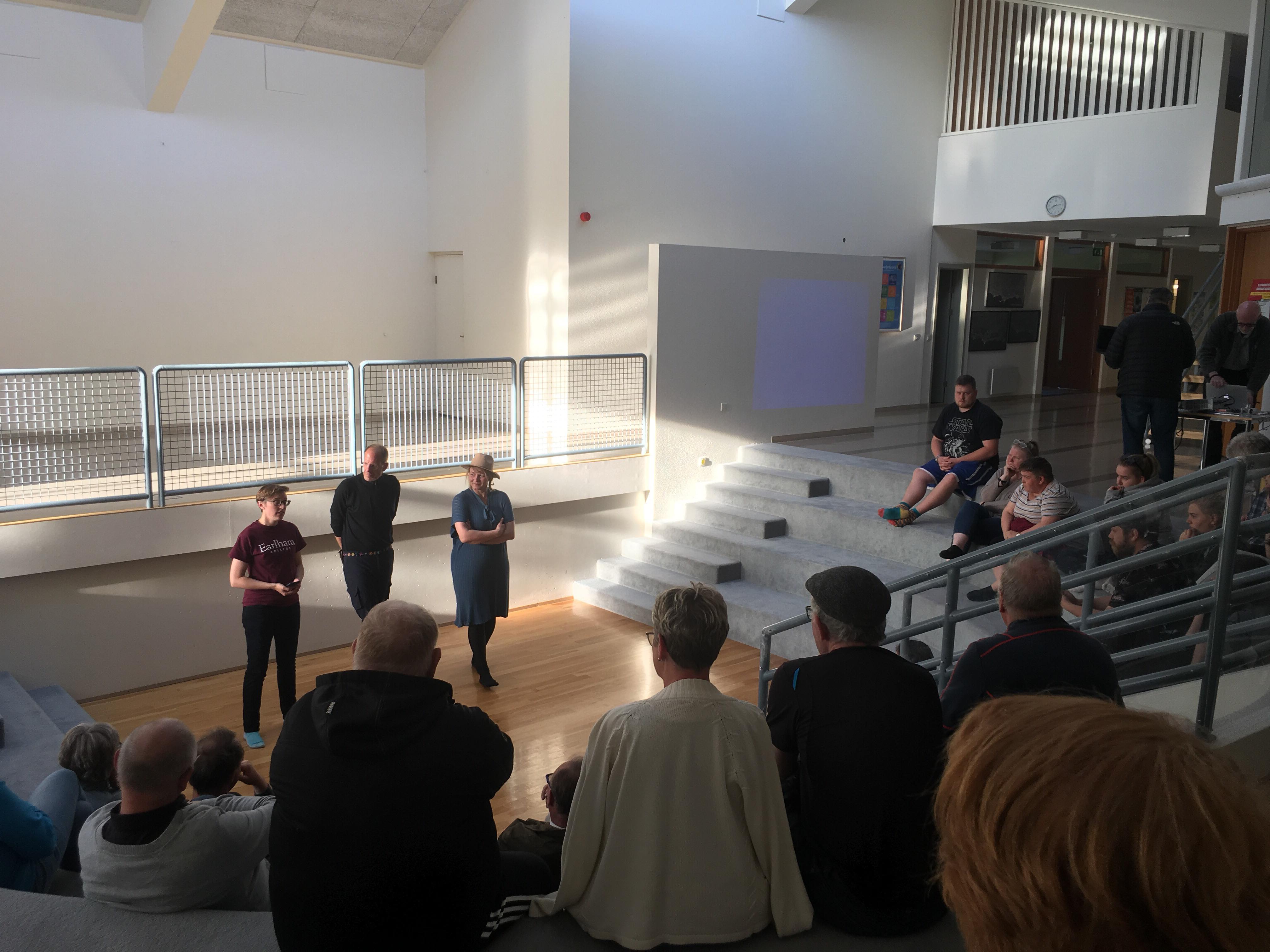
Further proof of hospitality we received from Stodvarfjordur: Brekken offered to serve us dinner when they learnt that we will not be around for lunch tomorrow! And guess what? We stuffed ourselves again with the delectable pizza we were served. To finish off the day, our beloved faculty leaders E & C gave a brief presentation in the schoolhouse about the whole project, with the main audience being the local crowd.
Camping is always an adventure, even if said camping is in a schoolhouse.
The schoolhouse in Stöd is both clean and cozy, with a carpeted little atrium–that has become a kind of common space–and plenty of little nooks and crannies (like the upstairs foosball table, or the little office space I am currently using to write this blog post). Everyone has been impressed with the living situation, enjoying the space to roam and the opportunity to get a little bit of personal space during the quiet moments.
The day started busy, a quick but enjoyable breakfast and then a hop over to the dig site at Stöd. The site has been, thus far, a four-year venture– with multiple hands and great minds involved. The day before, Rannveig expressed that coming to work at the site was like a holiday, she only does it one month out of a year–so, the equivalent of four months of excavation. While four months may not seem like a lot of time, the site itself is exceedingly impressive. I am an Ancient Classics Major with a Medieval Archaeology minor, thus, the dig at Stöd was like walking into a candy store. While this is the first archaeological dig site I have viewed in progress, I have seen the final product of excavations and know a little bit about the process; I was very impressed by the amount the Stöd team had uncovered and how intact a lot of it appeared to be. Yes, the site does look like barebones to the naked eye–however, the number of walls and floors they have excavated and the length is surprising. You can actually imagine the structure there–whereas, there are a lot of sites (mostly older) that just look like a pile of rocks or scattered artifacts.
We were met at the site by Rannveig and Bjarni and educated on the history and rough outline of information about the site. What they have found is that there are the remains of two separate buildings, one bigger and older building and a smaller and newer building built inside the older. It is assumed that whoever created the smaller structure found the ruins of the older and found it more convenient and maybe offered more insulation to build within it. Additionally, the question that hangs in the balance is whether or not it was truly a settlement or just a waypoint (the latter being more common for Vikings to build). This depends on what DNA they find (especially in Midden heaps), if there are remnants of cattle then it is more likely that it is a settlement and not a waypoint.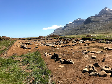
After we were all caught up we parted ways, separating into teams. We had Porter, Lilli, Jordan, Li, and Mubi working on drones–flying the flight plans and collecting visual data on the site (the first batch of photos were high definition photos which will later be used for a 3-D display of sorts; the second half was with the NRA camera, to help see if there is anything below the surface by capturing the UV light from the plants). Another team (E, Katherine, Joyce, and Sydney) was in charge of the soil samples we collected at Solo. Meanwhile, C ran around answering questions and helping as the Jack-Of-All-Trades and vehicle driver. And I was left to soak up as much information about the site and feed my passion–getting a feel for what a dig looks like, meeting everyone, asking questions, and observing the excavation as it is and what it will hopefully turn into.
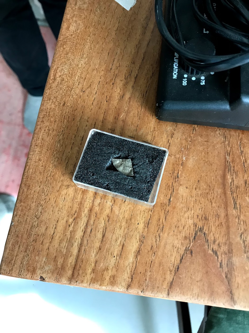
Since it was a holiday (Wit Monday, following Pentecost), the Stöd team was not digging today, however, they were available for questions and willing to share information. By about lunchtime I had been shown the artifacts (AMAZING! There are stones, a nail head, a part of an Arabic coin, some beautiful beads, etc.) and I had discussed the finds in their newest test pit (they found a bit of a wall and a hearth); while also asking some basic questions about identification of settlement and what the work looks like on a normal day.
Again, it was a holiday so all the businesses were closed today. Except, there was a wonderful restaurant/gift shop called Brekkan which welcomed us in and served us lunch. It was a fabulous meal! Baked Fish with a cream sauce, fries (or chips), some sweet dark bread, and salad with grapes. It was all delicious and very much appreciated. Everyone at the table had their fill (maybe even a little too much–I certainly felt like I had to be rolled out the door afterward) and sat, very satisfied. 
We came back to the schoolhouse to gather more layers (the wind was biting cold and the sun was just not warm enough to make up for it like our previous nine days) and to split up again. This time Lilli stayed behind to work on uploading the available drone photos, while the rest of the drone team headed back out to take the NRA photos. Soil people stayed behind to continue their diligent work in the dining room area of the schoolhouse kitchen (you gotta do what you gotta do).
I left with the drone group to continue my archaeology observation. I worked for a time creating a (ROUGH) sketch of the site, sitting in the grass and feeling the brisk cold wind. I certainly appreciated the blanket scarf I had picked up after lunch and the warm sun on my back. As I sat I heard unique bird calls, though I was unable to identify where they were coming from and what species was calling out. It is fascinating to observe the variety of birds that live in Iceland, so many species that are different from the ones I am used to in the States (in addition, I’ve grown up in Alabama and Indiana my whole life, which limits my avian knowledge to a limited area).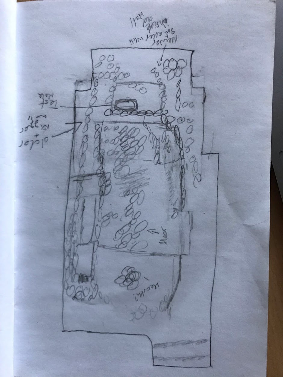
After sketching, I sat in Rannveig’s “office” (the back of a huge van, with camper chairs and a tiny table). This is where we discussed the different sections of the site (using my sketch as a reference), how it compares to other sites, the work she has done in the past, my research knowledge of Norse raiding and settlement in Ireland, and about the different jobs and activities Rannveig has done or is a part of throughout a year’s time. It is interesting to note, there are several positions open for archaeologists to become consultants for the government or building/electricity organizations, but it lasts about half the year due to weather constrictions.
The drone group finished up around 3:15pm (15:15) and we packed up. We were all eager to take showers in the pool facility and looking forward to taking a dip into the hot tub or swim in the pool.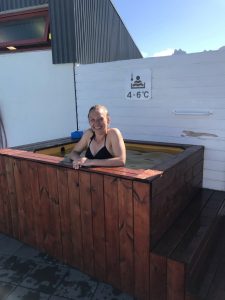 The facilities did not disappoint. We were all able to rinse off and enjoy the hot tub or pool, whichever suited the fancy. I noticed Joyce, Roger, C, Mubi, and Katherine floating around in the pool– while Sydney, E, and Lillian lounged in the hot tub (Rannveig joined the hot tub later–as did most of those swimming in the pool).
It took a bit of encouragement from Sydney to get me out in the open–the wind was still freezing, but this time I was wet from the shower and in a bathing suit. The hot tub appeared way too far away and when I opened the door the first time, and the wind hit me like a wall of ice. E later commented on how it appeared as if watching a cartoon– the door opened, I yelped, and the door was quickly closed again. However, nothing was colder than the 4-6 celsius cold tub. Sydney dipped inside first, staying in long enough for a photo! She later said it was as cold as the glacier runoff she had waded through at Solo (after dipping into the tub myself, I have a newfound appreciation for the determination Sydney, C, Jordan, and Porter had to science that day, at Solo– jeeeeez, it’s cold!). After a bit, most of us at least tried the cold tub– including Lilli, C, Rannveig, and I– which, honestly, really added to the whole swimming in Ice(land) experience.
In a minute, we are going to be treated to Grilled Cheeses and Tomato Soup made by Lilli and Porter. And C has recently collected all the NRA photos and pieced them together–now we wait for the code to be able to adjust the light according to the native plants.
Exciting new developments in Archaeology!!! Hopefully more is revealed as we continue to explore and experiment.
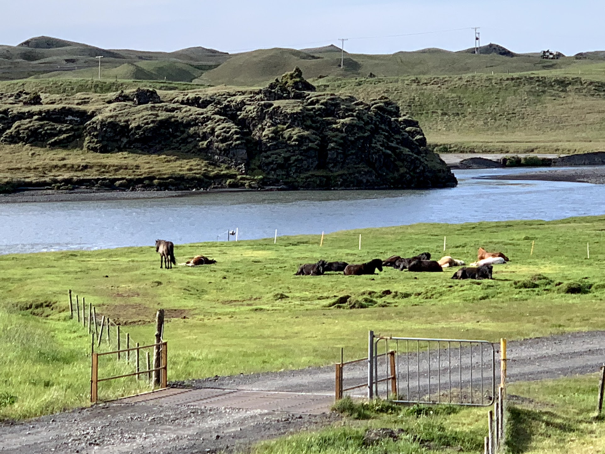
Hello dear readers! We awoke to another day of beautiful weather and warm sunshine, which was enjoyed by the small herd of napping horses along the river. Charlie and I can’t figure out what we’ve done right to have 9 straight days of sun but the students are starting to doubt they need all that rain gear we emphasized so strongly …
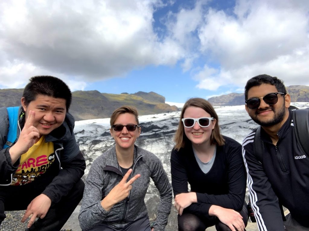
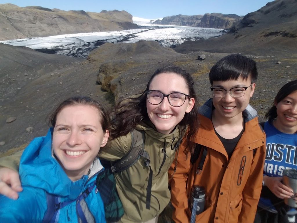
Today we drove from Kirkjubæjuarklauster to Stöðvarfjördur with many stops in between. This drive took us from the south coast of Iceland to about half way up the east coast. Our first destination was to another glacier coming from the Vatnajökull ice cap (the largest in Europe) called Kviárjökull. We are scouting this glacier to see if it’s a good candidate for additional sampling in the future, so we can compare data from Sólheimajökull with another Icelandic glacier.
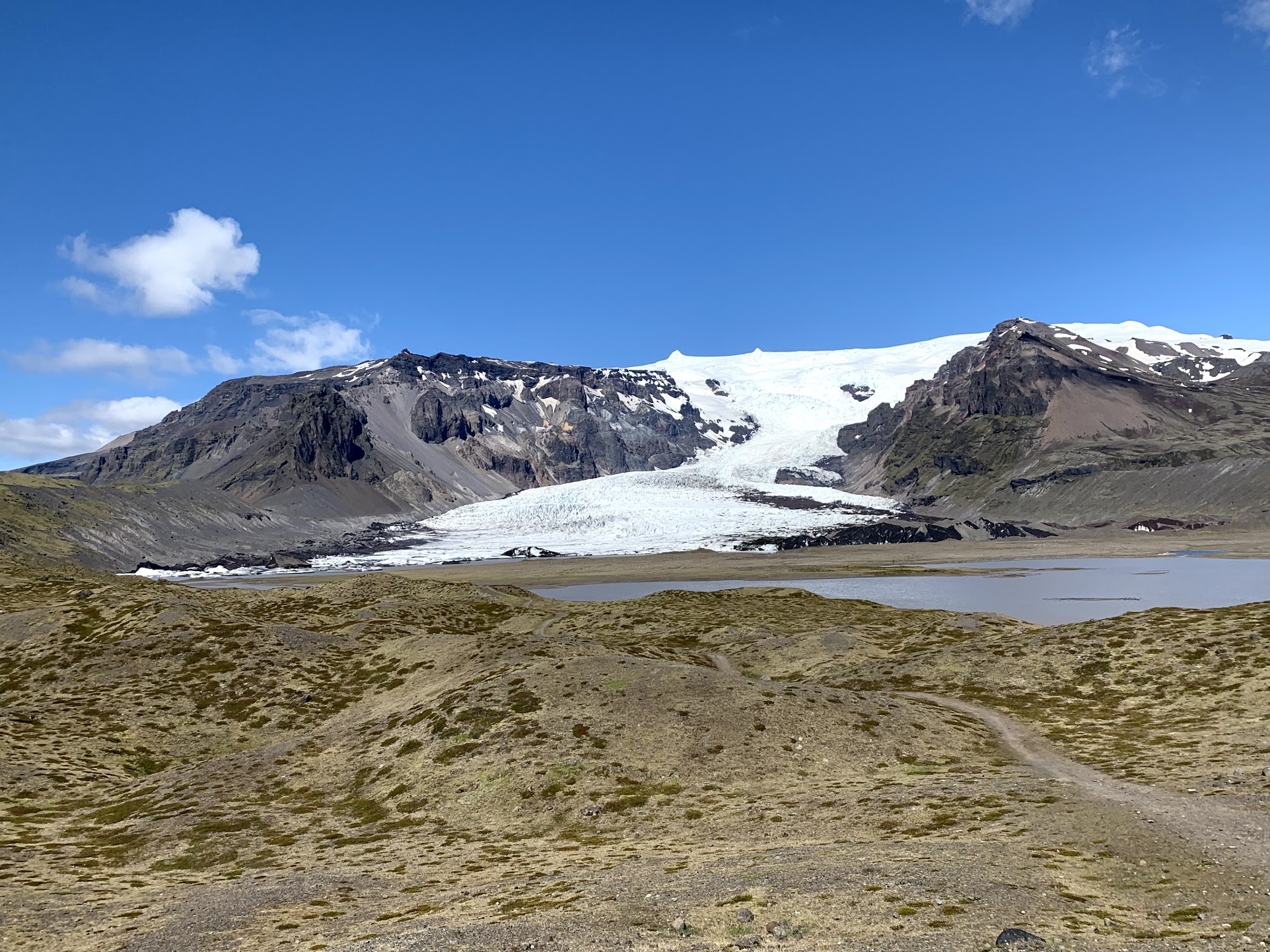

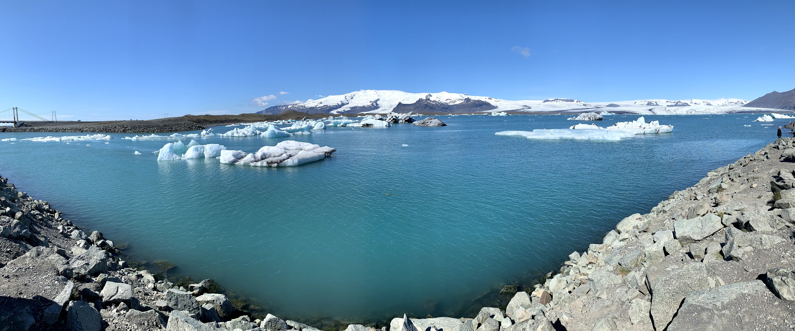
Our second stop is the lovely “Glacier Lagoon,” or Jökulsárion, where the Norðlingalægðarjökull glacier calves into the sea. This is the only glacier that calves directly into the sea in all of Iceland. We saw seals swimming in the lagoon along with eider ducks, gulls, Arctic terns and a few foolish/brave humans in kayaks!

After driving past 3 other outlet glaciers, we took a brief detour to the fishing town Höfn, where we were treated to a fabulous view of Vatnajökull and its outlet glaciers.
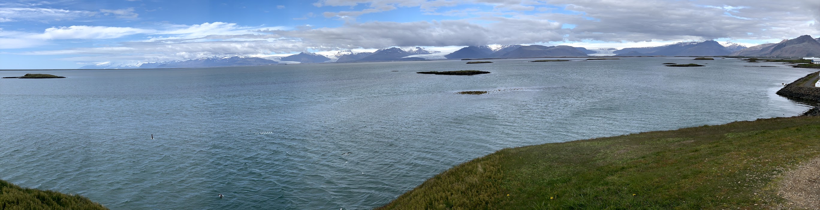
The day was getting more cloudy (finally!) as we drove another stretch of Route 1 to the small village of Djúpivogur for a bathroom break and important re-caffination. Yours truly also acquired a traditional Icelandic doughnut. Yum! The town is quite old and has a number of buildings dating from the late 1800s and early 1900s. They are also, apparently, quite proud of their toilets.

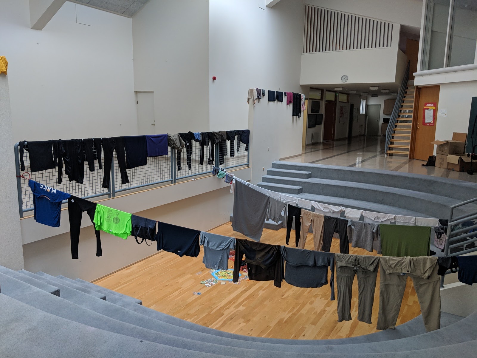
After journeying along a few more fjords and twisty roads, passing a number of camping vans along the way, we arrived at our destination – a schoolhouse in the small village of Stöðvarfjördur, a 5 minute drive away from the archaeological site we’ll be working at Monday and Tuesday. This site is significant for a number of reasons, which you can read about here and here. Tomorrow we will work with the drones, flying over the site and gathering information such as Near Infrared, which can point us to locations that were previously populated by humans. On Tuesday we’ll use that information to collect soil samples and test differences between microbial populations in soils that have been previously inhabited versus those that have not. But perhaps most importantly, the school has a washing machine, which has allowed us to finally get some clean clothes.
Good thing tomorrow is a holiday and school is not in session!
Wish us luck on all our work in the next few days. Signing off, your friendly neighborhood molecular biologist!
The first thing we did today was pack and travel. We left our hostel in Vik early this morning, making a stop to collect groceries for the next few days, and set out north-east to Klaustur.
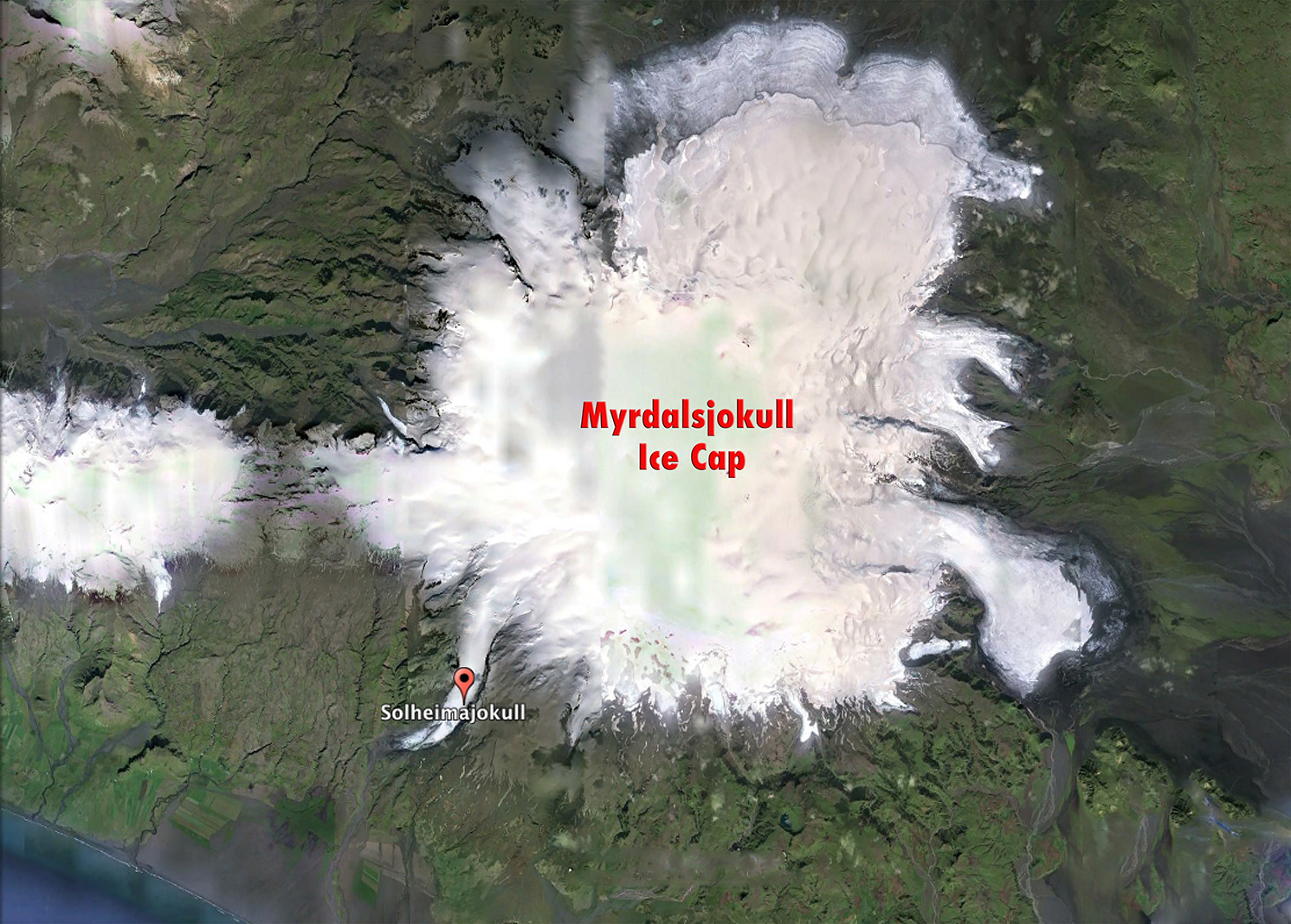
Klauster is a small town, right between Mýrdalsjökull, the glacier we worked at yesterday, and Vatnajökull, which is the second largest glacier in Europe. In Klauster we learned a lot about the history of the region, especially about the 1783 eruption of the volcanic fissure Lakagígar, a devastating natural disaster that we read about in the semester leading up to the trip.

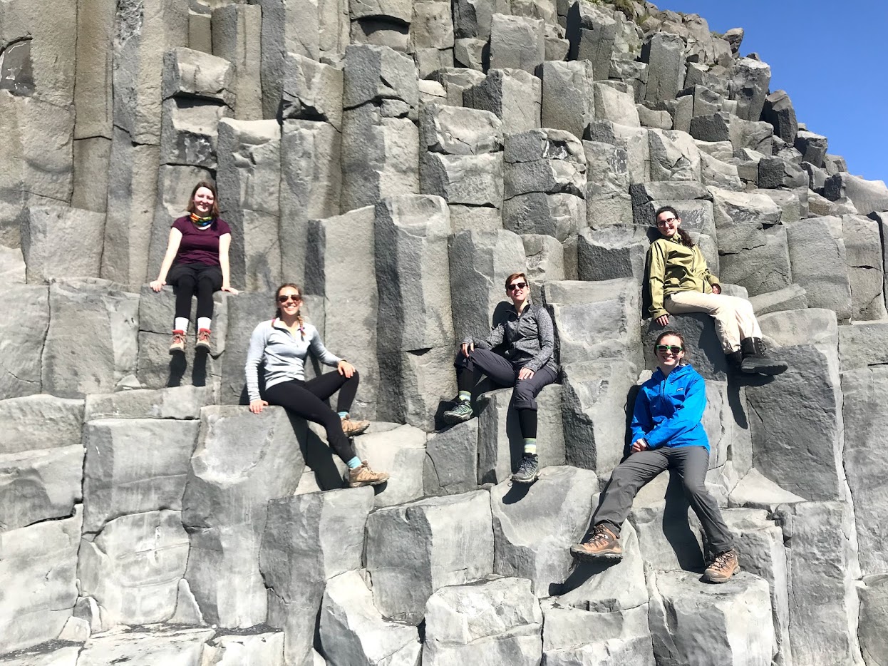
After a short film about the eruption in a local visitor center, we went on a hike around the nearby cliffs, getting an excellent view of the ocean and the town below, as well as Systravatn, a beautiful lake at the top of the cliffs. At the end of the hike, we were about to see Kirkjugólf (The Church Floor), a formation called columnar basalt which forms when a lava flow cools under the right conditions.
Today was mostly a historical and cultural day, and a break from our scientific work, but it was really cool to see the places and landmarks we have studied in person.
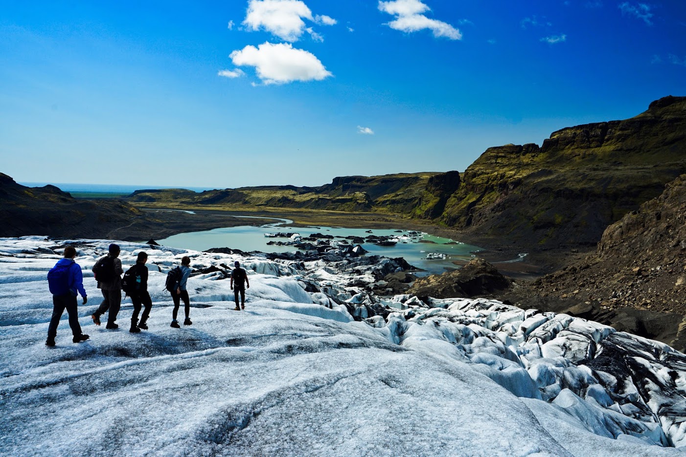
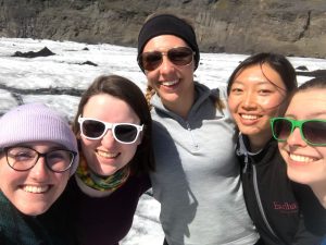
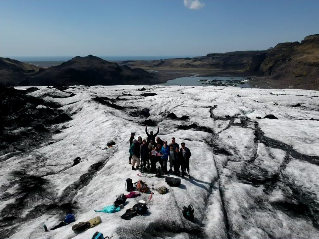
Its Lillian again with our second and final day at Sólheimajökull! Today we took soil samples around the glacier.
After having a great breakfast of egg fried rice using the dinner leftovers, we headed again from Vik to Sólheimajökull. Then we split up into three teams to take soil samples. We use the samples to measure microbial DNA. This can show us how the environment has changed after the glacier has receded. C and E had a map they created of sample sites that covered a wide range of years that the glacier receded from each spot. Then they split the spots up into three sets based on location.
Charlie, along with Sydney, Porter, and Jordan volunteered to take the most demanding set of samples, which required more strenuous hiking, including crossing rivers! The remaining two groups were led by Roger, who was the student leader of the day, and Em.
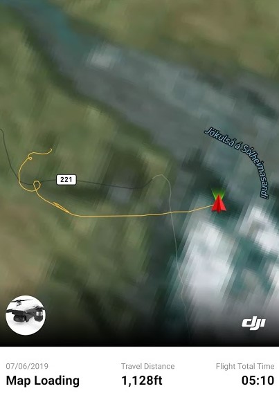
All the groups were able to make it to most of the sample sites. However, we are sad to say that we lost one of our drones, Carmen, during the sampling. Carmen encountered errors while flying, and we were unable to control it. We used the last image it captured to try and find it to no avail. Later, I found more data of the flight on the app we use to fly the Spark drones, and it is most likely that Carmen flew into the lake by Sólheimajökull. We are hoping to find funds to replace Carmen soon.
After we came back to Vik, we had a great dinner of chili made by Kaela! Then we packed up our things as we prepared for driving to Klauster the next day.
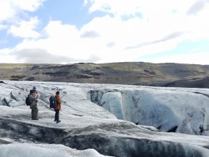
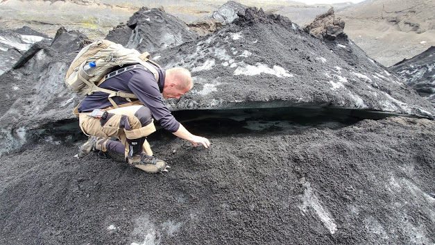
Hello! My name is Lillian and I’m a senior Computer Science major. Today we hiked the glacier Sólheimajökull! Sólheimajökull is an outlet glacier of the glacier Mýrdalsjökull, meaning that it originates from Mýrdalsjökull through a valley. Sólheimajökull is also interesting in that it is covered in lots of ash from the eruption of Eyjafjallajökull in 2010.
We woke up in Vik to the sound of roosters. For a few people in the group, this was a nice reminder of home! Then we piled into the vans for the half-hour drive to the glacier.
Gummi and Oddur lead us on our hike on Sólheimajökull. They both work in Reykjavík and have lead the IFS group on Sólheimajökull for multiple years. We divided into two groups, one with Gummi and Em and one with Oddur and Charlie. Then we split up with one group walking along the northwest side and one group walking the southeast side of the glacier. Before walking on the glacier, we had to put crampons on our boots in order to hike the glacier with more traction.


After the two groups met on the top of the glacier, we ate lunch and did some drone flying!
After lunch, each group climbed down the glacier opposite the way we came.
After thanking and saying goodbye to Gummi and Oddur, we left to travel back to Vik. On the way, we stopped by Reynisfjara Beach, famous for its basalt columns, and for being the site of multiple films and movies, including Rogue One and Game of Thrones!
After arriving back in Vik, we had an amazing Chinese dinner cooked by Li with the help of Joyce, Roger, and Mubi! Then we prepared to take soil samples around Sólheimajökull the next day.
The first thing we did after waking up was hiking up the 2nd mountain. For me, it was Helgafell, which is older compared to Eldfell, and is located towards the southeast part of the island of Heimaey. While hiking, we continued monitoring the altitude we were measuring yesterday with elevation platforms.


We returned to the hostel to feed ourselves lunch and to pack up for our ferry back to the mainland. Then we all got into our vans and drove towards Vik, a town close to the southern coast of Iceland, where we planned to stay for the next 3 nights. To finish off, E made some delicious veggie soup with bread and salad that had to be devoured.
Tuesday, June 4, 2019 No rain = beautiful weather, again
For the morning, the group of students walked to the Eldheimar museum and learned about the volcano eruption in Heimaey in 1973. It is a very cool museum where we walked around with audio guides that sense our location and play the corresponding audio. It is built around an excavation site after the eruption. We were able to see the ruin of a house, the model of the path of the lava flow which almost closed the port of the island, learn about what people were doing during the time and a newly created island by lava, Surtsey.
In the afternoon, we split up into two groups. One group hiked the Helgafell and the other hiked Eldfell. I hiked Helgafell. It was really fun with loose rocks and steep slopes. Despite being forecasted to be around 0 Celsius and windy, it was so warm and we had to shed layers during our hike. Our little science exercise for the hikes was to measure the pressure at sea level and at the top of each mountain that we hiked, and compare the margin of errors between devices and with the elevation marked (the accurate standard). Tomorrow, we will hike the other mountain and do the same thing.
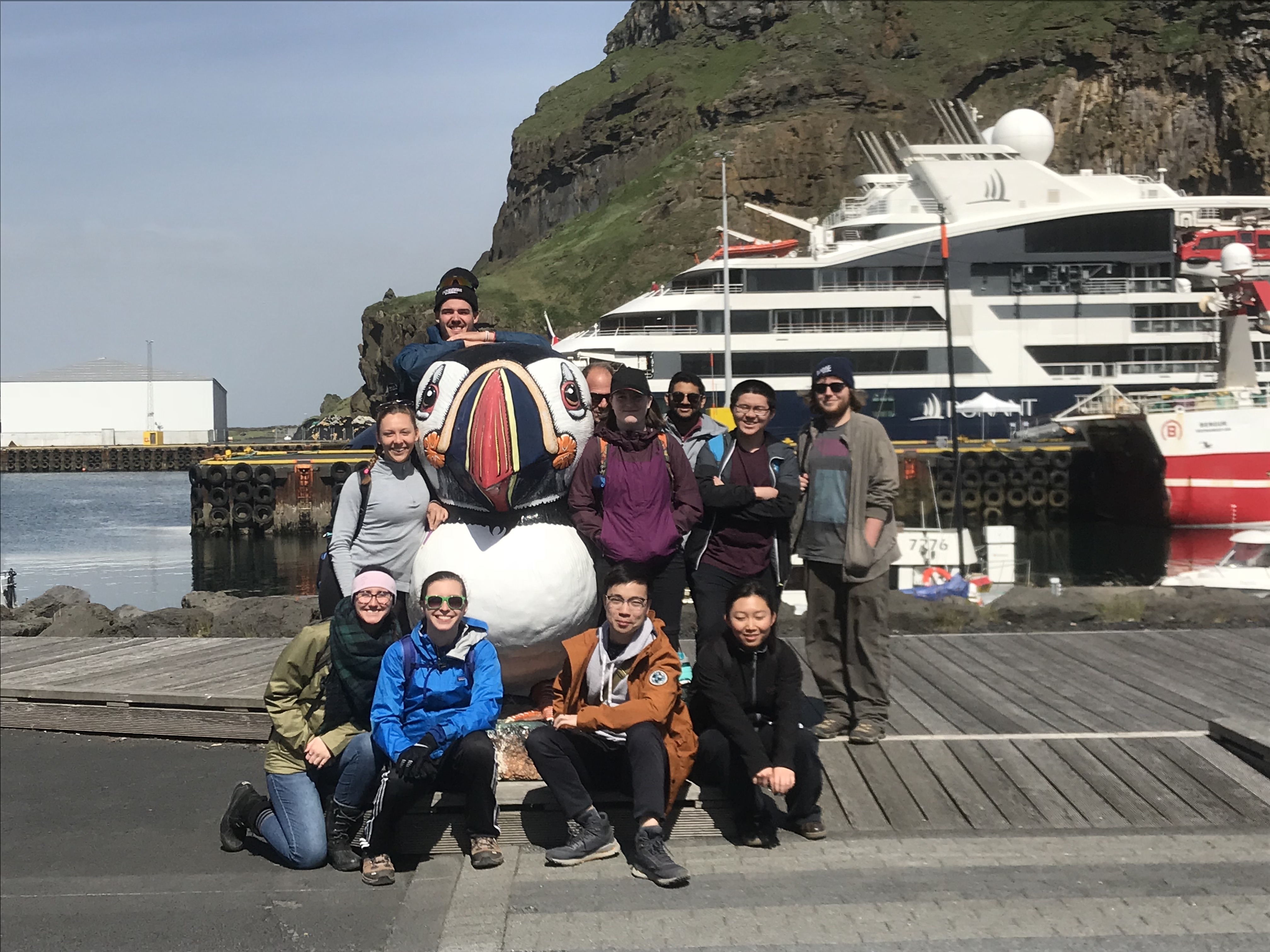
A group photo with the puffin before we split.

The Eldfell group.
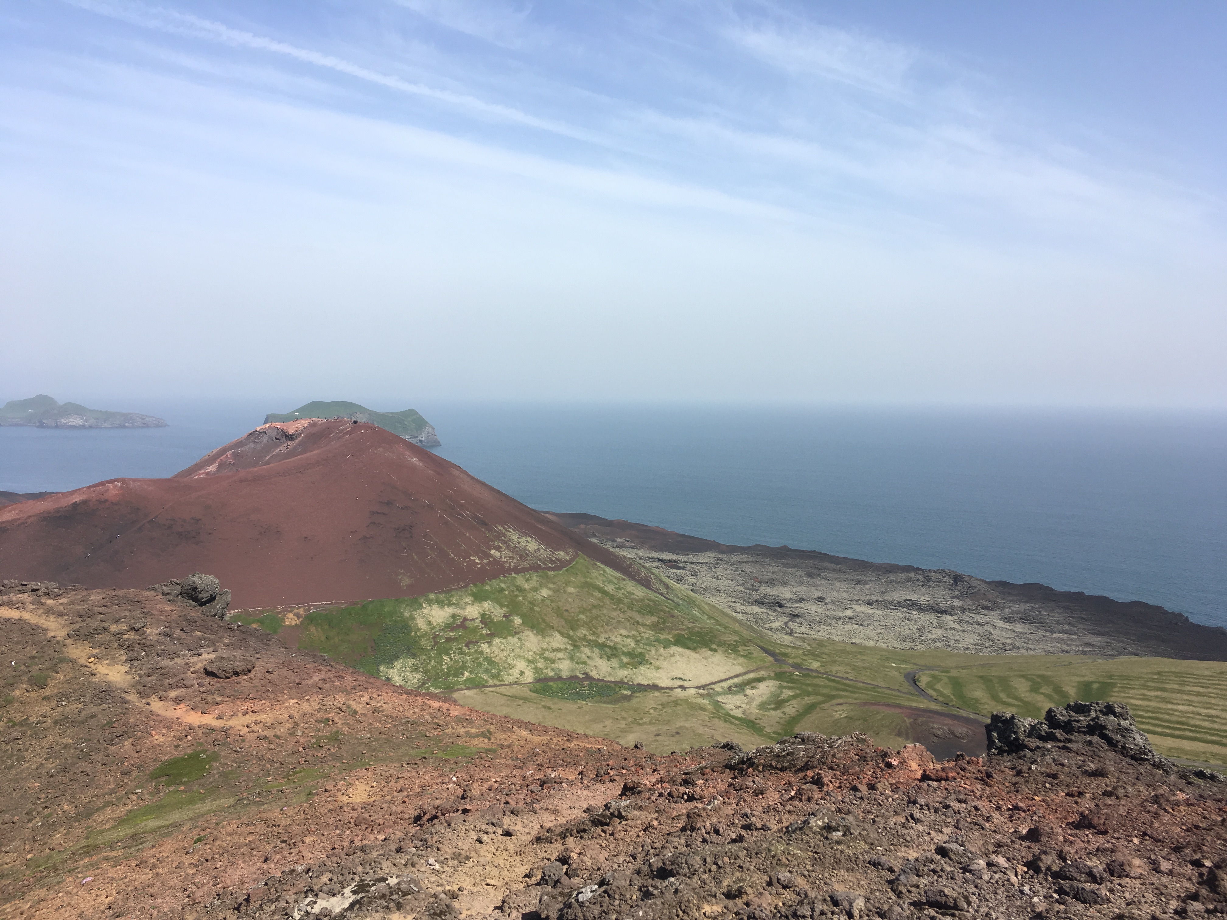
The view from Helgafell. If we look towards Eldfell, we can distinguish the new land that was created by the lava.
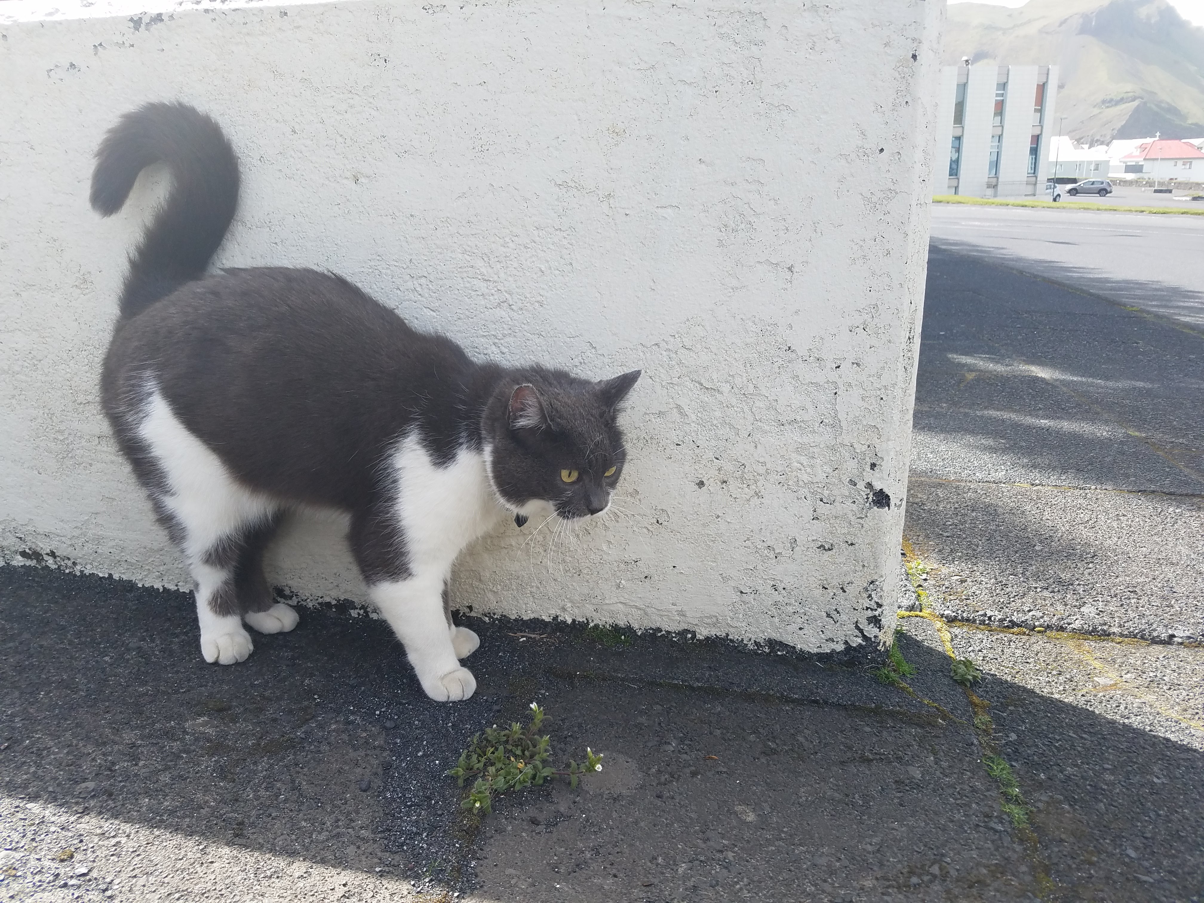
Cat of the Day! We met this cute little cat on our way back from Helgafell.
After dinner at Gott (a very nice restaurant), we (people shown in the picture above) biked to the south side of the island to see puffins. It was a rough bike ride! But it was worth it. Sheep and horses also became our friends for the ride.
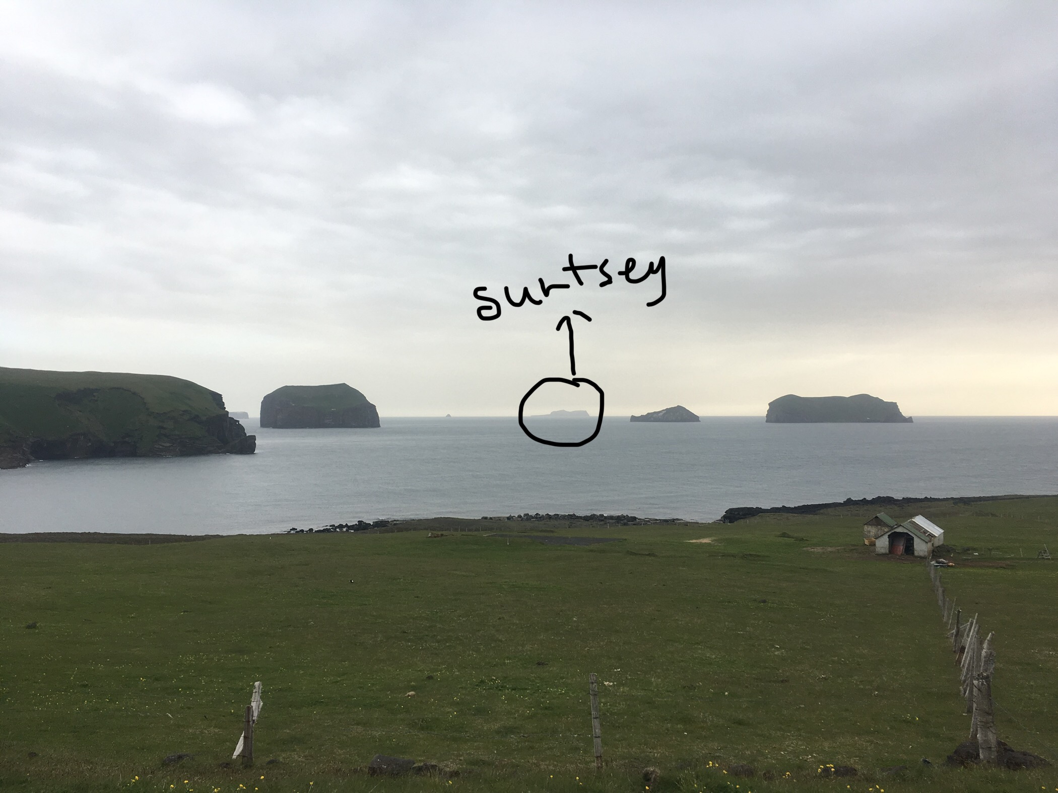
Since we were on the south of the island, we hypothesized this was Surtsey.
The weather has been unbelievably fabulous for three days on a roll. On the morning of Monday, June 3, 2019, the IFS group said goodbye to the Igdlo Hostel in Reykjavík and headed southeast. Our final destination for the day is Heimaey, a small island to the south of Iceland that can be reached by ferry. On our way to the ferry station, we stopped at the Commonwealth farm and a dam.
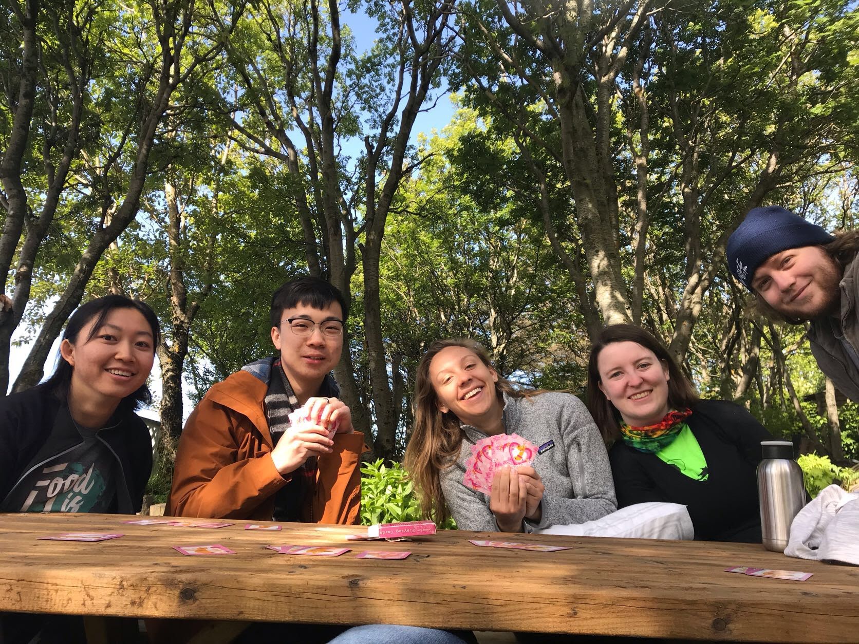
After packing and loading the van, we played cards while waiting for the people who went shopping to come back at the Igdlo picnic table.
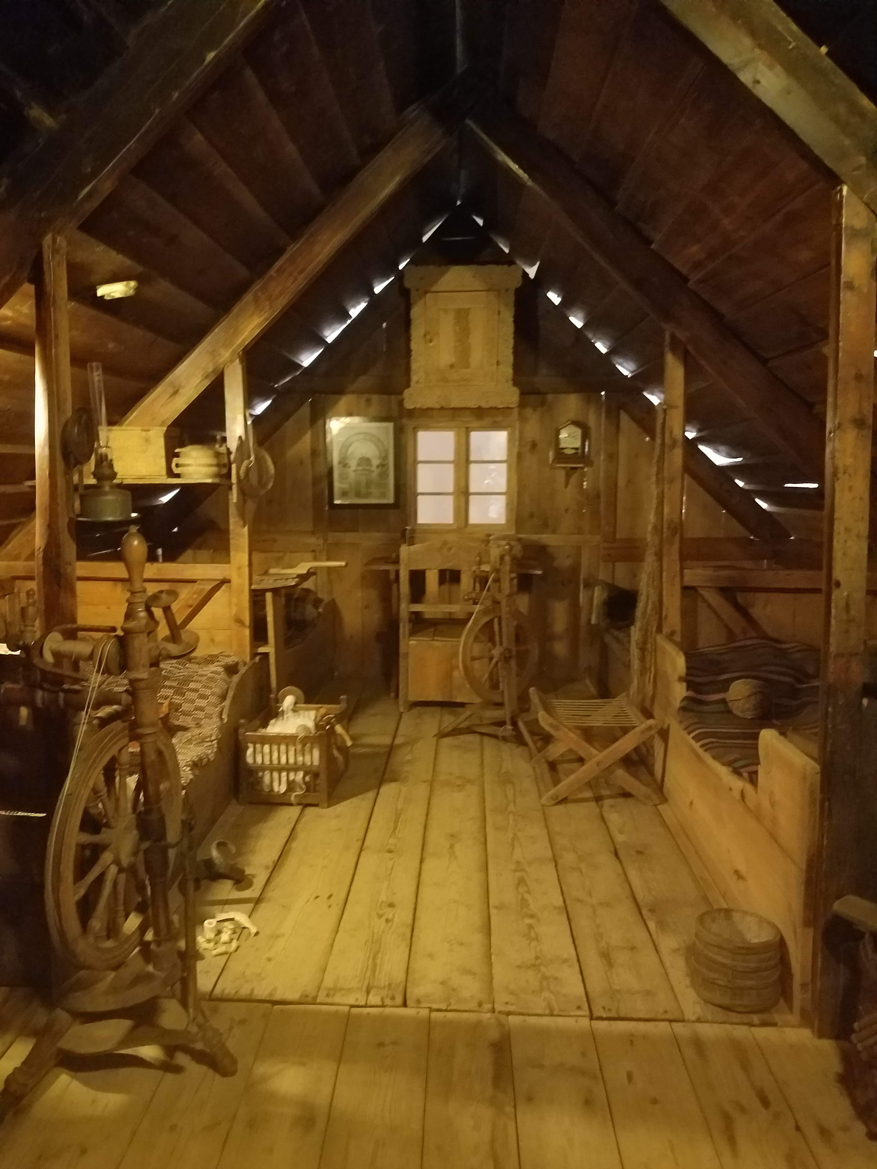
It was noon and windy when we got off the car! The Commonwealth Farm is a replica of what has been dug up at the archeological sites in Iceland. We visited with the goal of getting a better idea of what we will be working with at the archeological site in Stod. The replica consists of a turf house and a small church next to it. In the turf house, we found items such as clothing, swords, wools, benches, and “bedrooms.” It shows how people back then might have lived and worked. Some of us commented it as no privacy because mostly everyone slept on a long bed bench altogether, with the one or two exceptions of high-status people sleeping in a small closet with space to lay down.
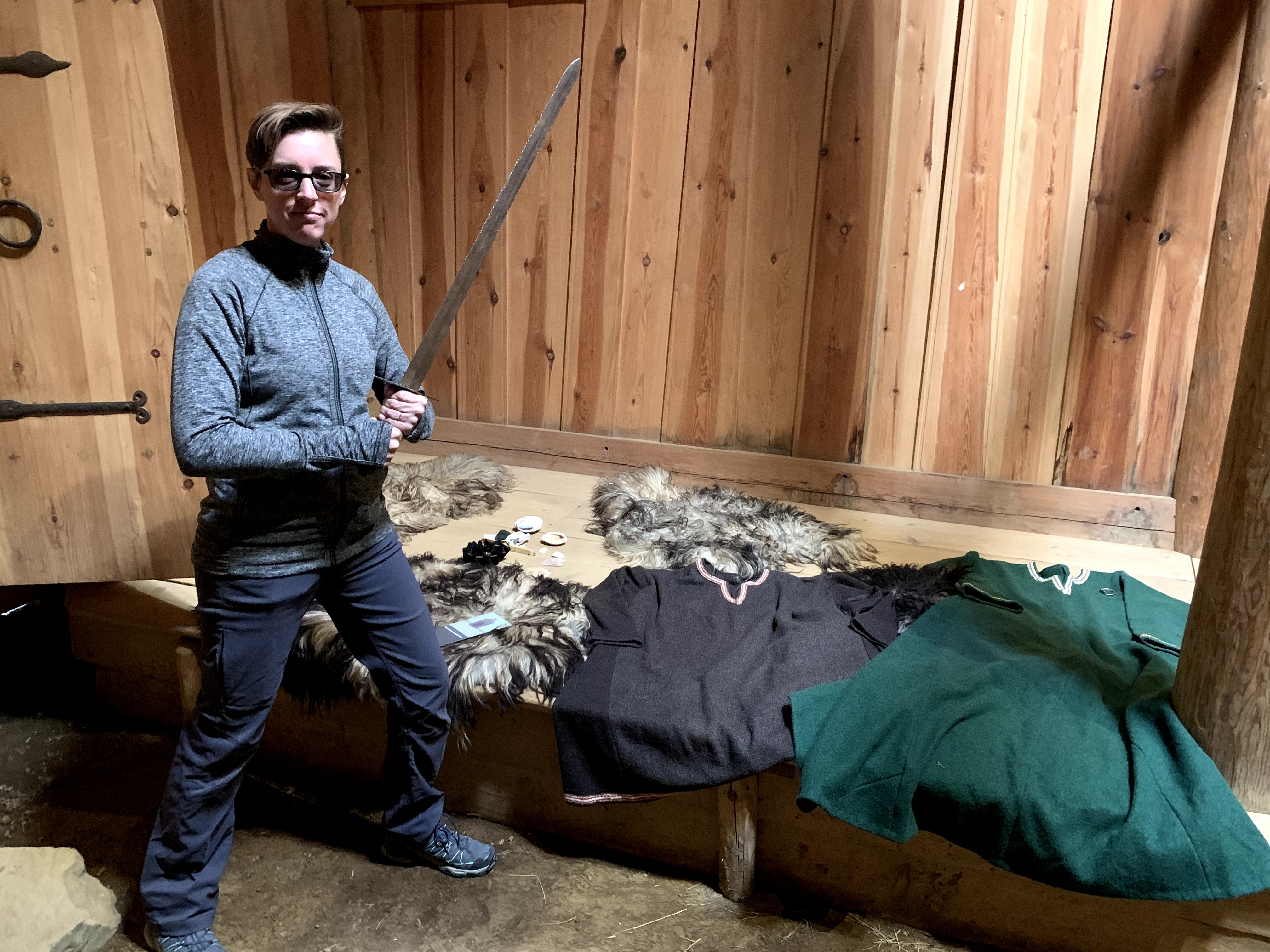
E is holding a sword in the turf house.
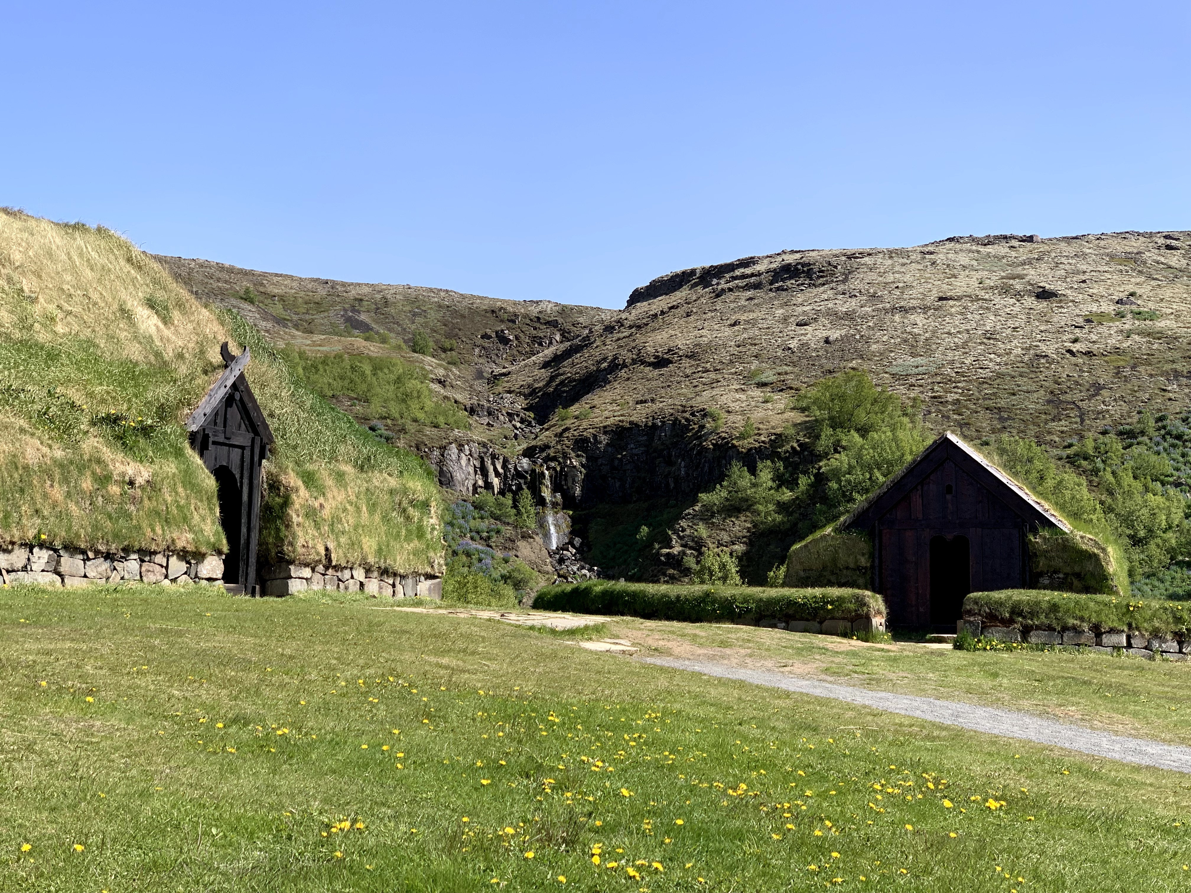
The right is the small church and the left is the turf house.
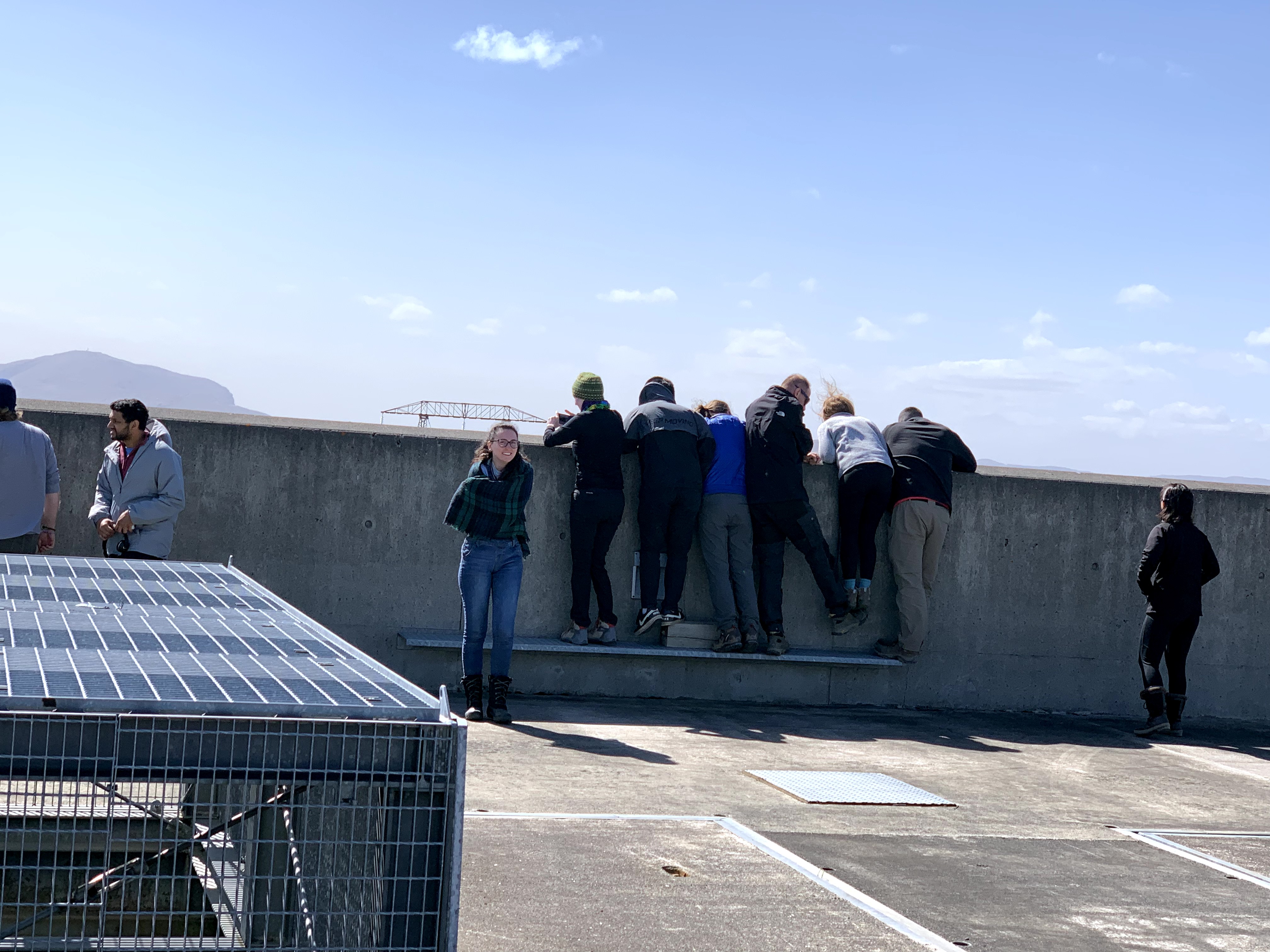
What are they looking at?
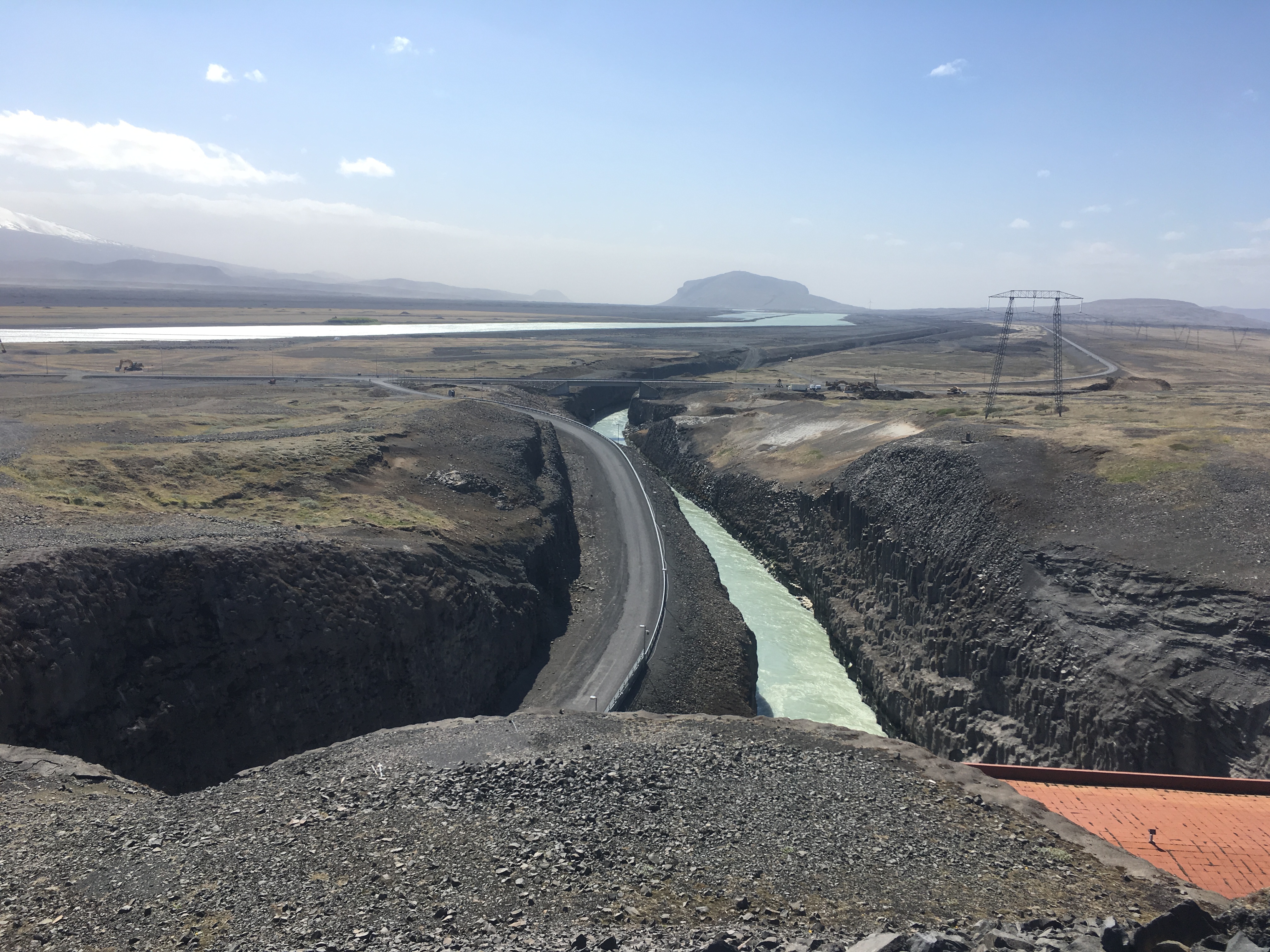
The dam!
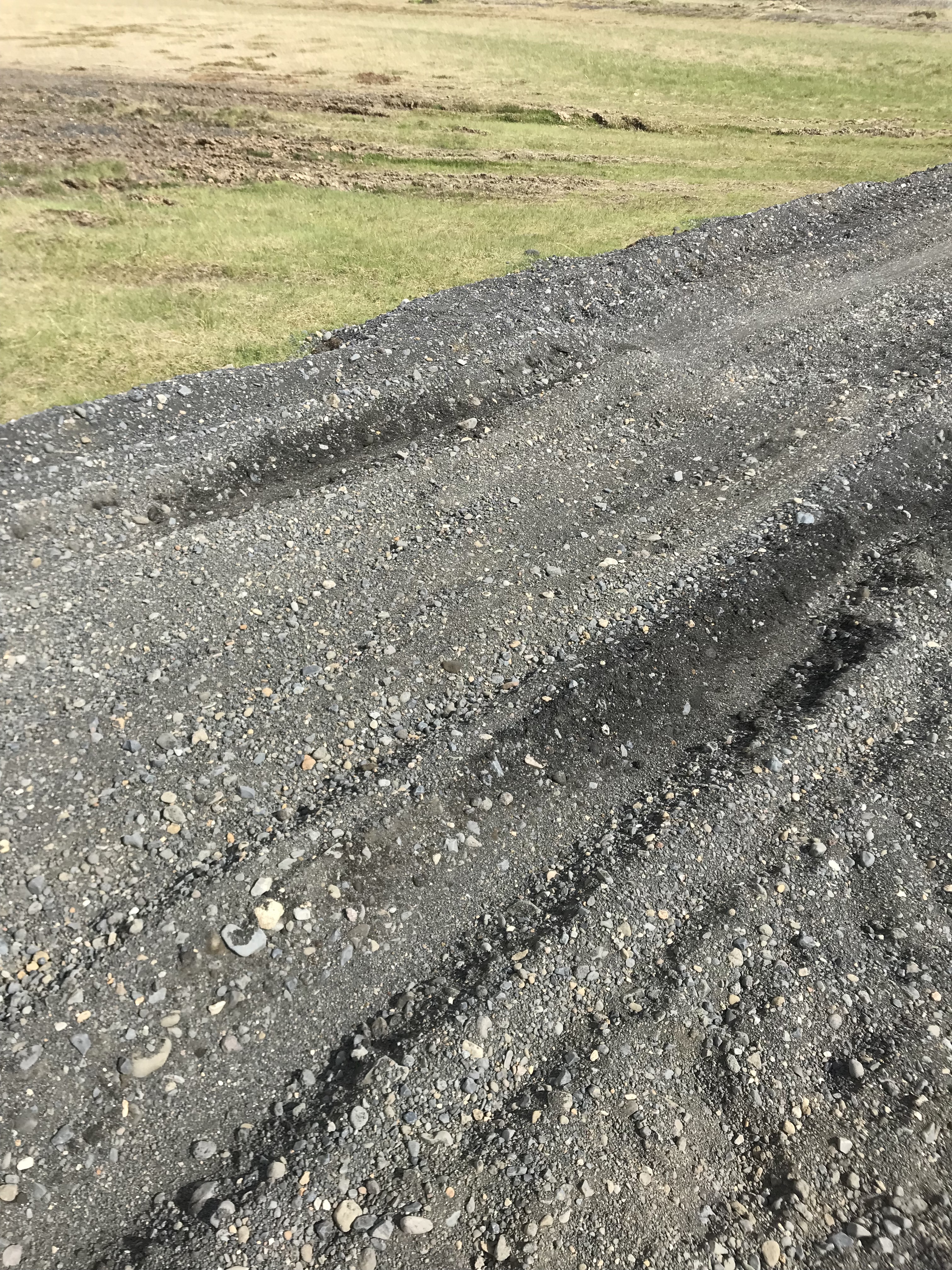
Then, we had very much fun searching for a former forest that was destroyed by the eruption of Hekla in 1104.
Why was it fun?
Our van almost got stuck in the soft gravel. Fortunately, everyone got off the van except Charlie, the driver, and we were unstuck. The image below shows the track.
Our search for the forest was stopped by a small creek, so we enjoyed the view and played skipping rocks.
It was time to hop on the ferry. The experience was exciting for some of us, but not so much for those with motion sickness. I enjoyed bird watching with binoculars and the ocean breeze!
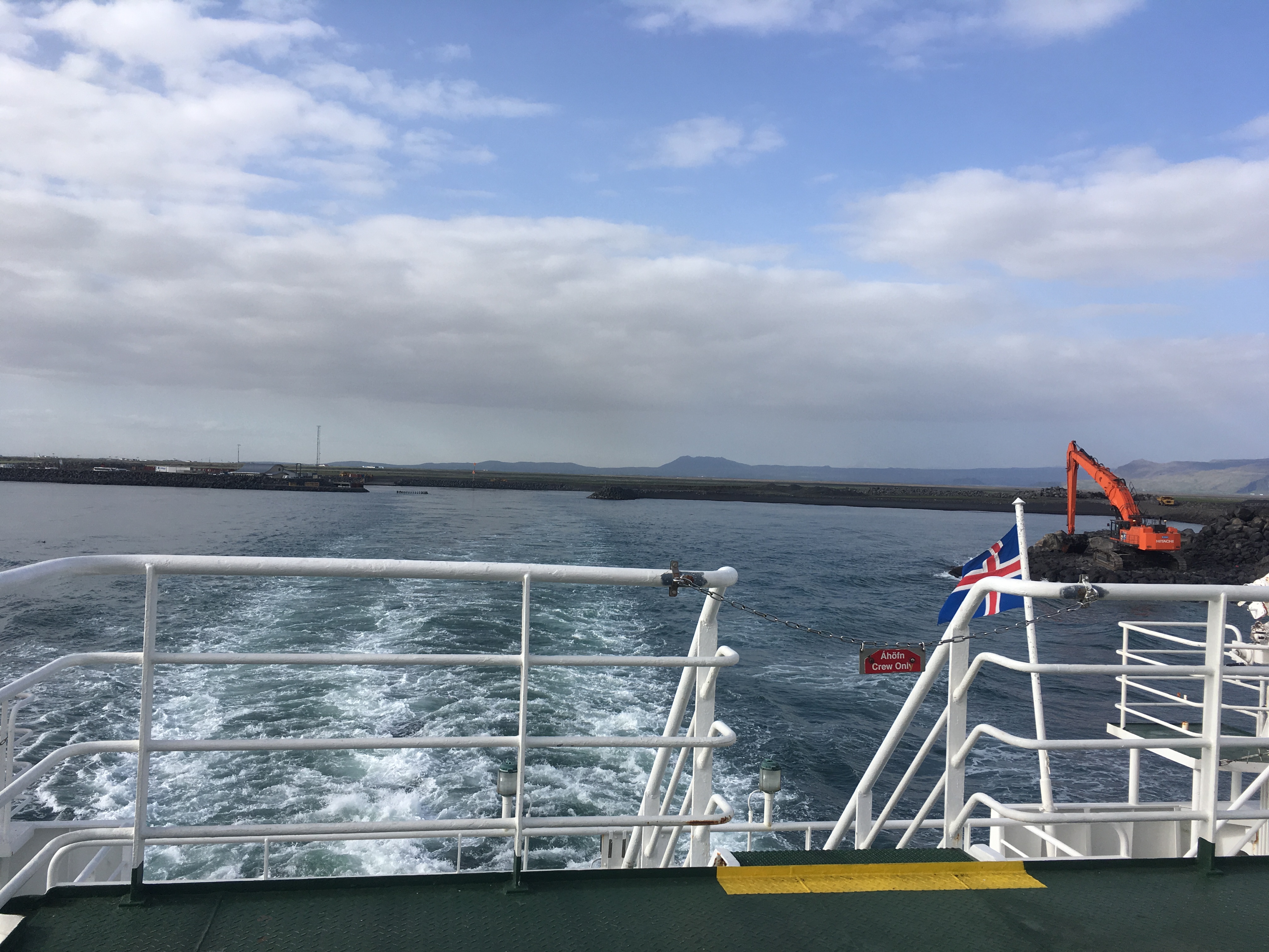
The tail of the ferry producing waves.
We arrived at the Heimaey Hostel save and sound. Thanks to Kathryn and Jordan, we had delicious pasta to fill our stomach before going to bed!
Hello all, it’s me again, Kathryn! Today we put our tourists caps on again and went to the National Museum. The museum was incredibly informative, it told the story of the people of Iceland (how they got there, who they were, and what they became). My favorite exhibit in the museum was of the bath-house (I don’t recall the name in Icelandic). What is interesting about the bath-house is that it slowly evolved into the main-house because it was the warmest place to be. My favorite place in the museum was this little corner on the second floor where there was a chess table next to some books with some extremely comfy couches (I almost feel asleep there!).
This is the bath-house that in it’s later stages no longer resembled one.
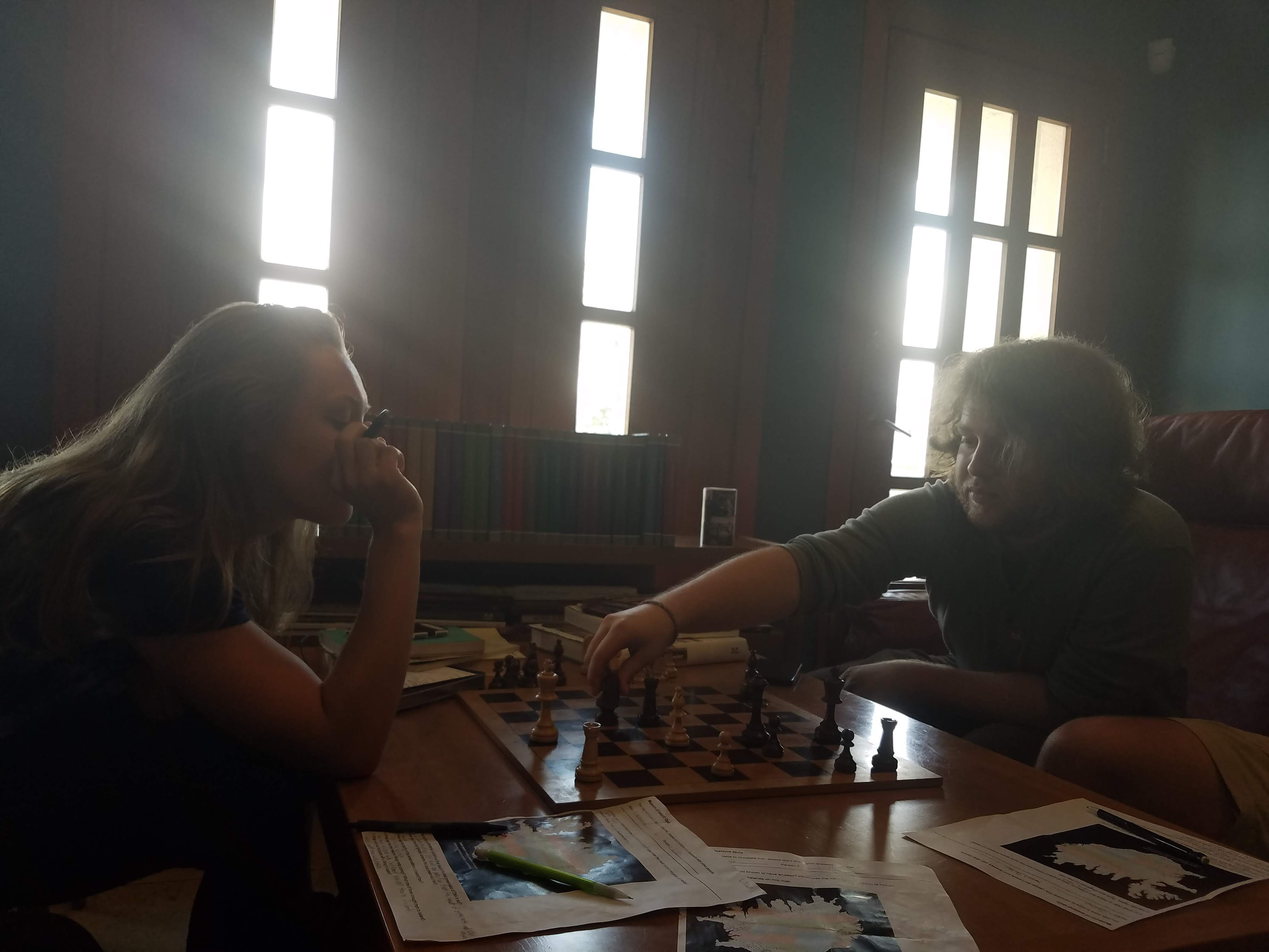
This is the little nook I mentioned above. Sydney and Porter played a game of chess. You can take your guess on who won.
After the museum we headed to the Althing (the oldest and first form of Icelandic government). The location of the Althing is important for both historical/cultural reasons and geological ones. The Althing is where the North American and European plates are separating to form new land.
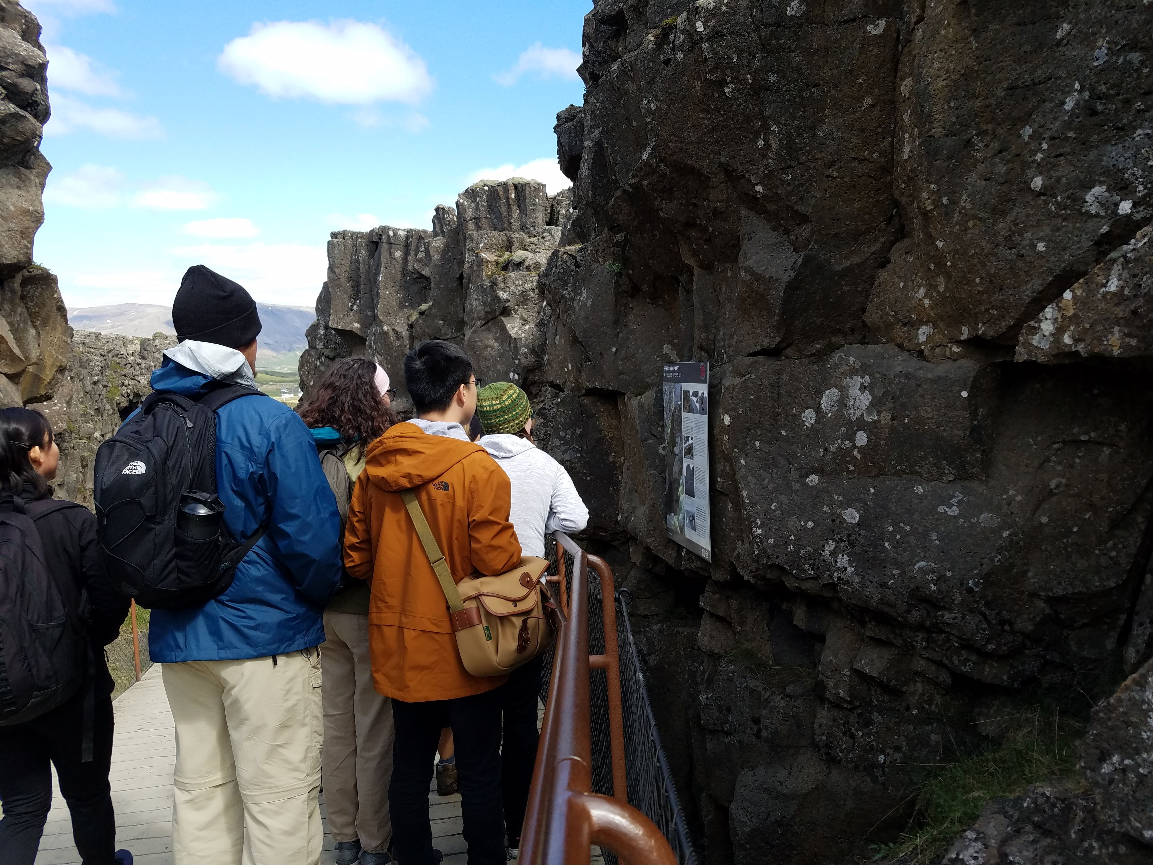
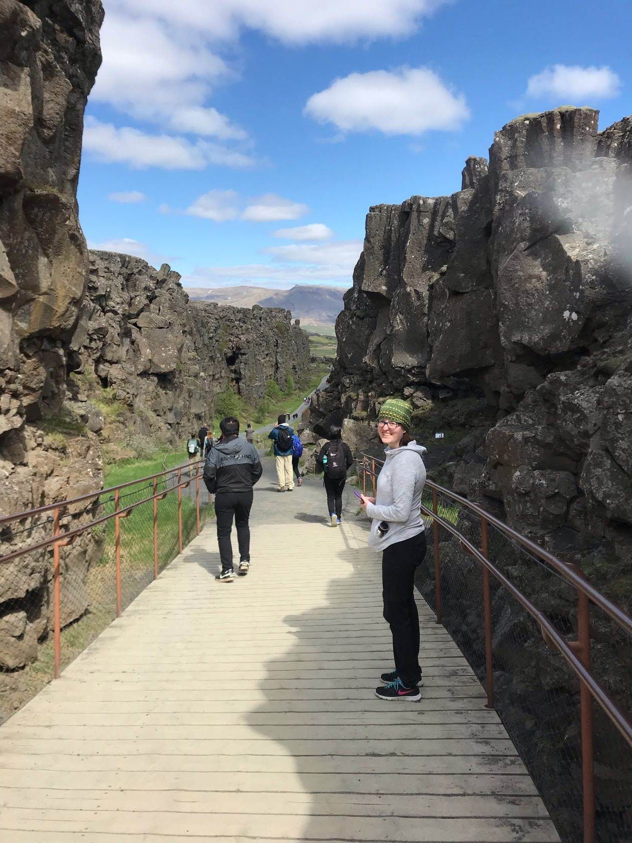
Currently Lilli is between the North American (right) and European (left) plates. This walk way leads to where the Althing was held.
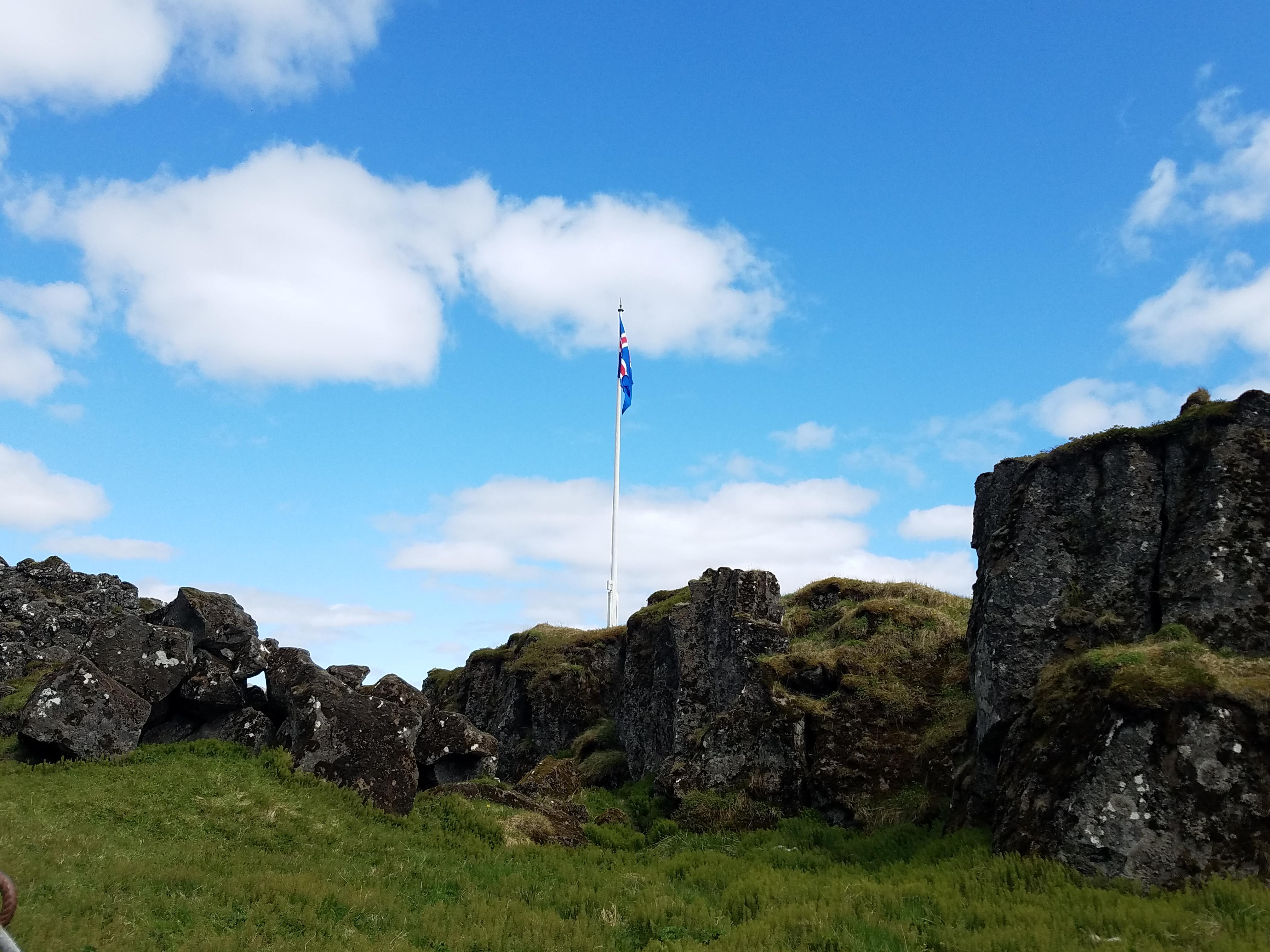
This is flag is where it was held. The Althing was a long event and folks would set up tents to claim their spot, and you can still see those imprints in the ground.

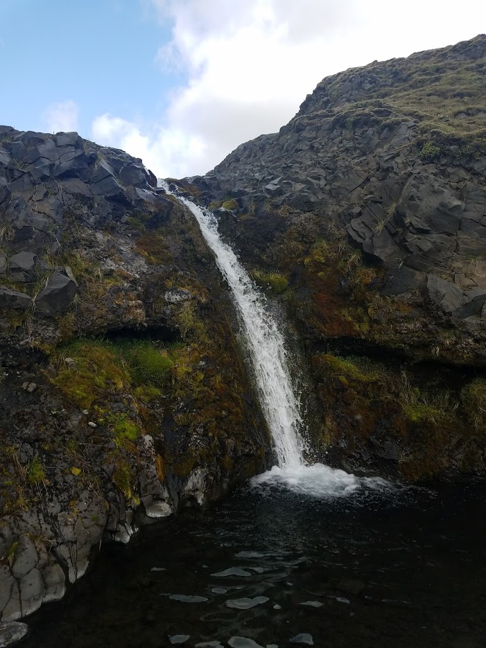
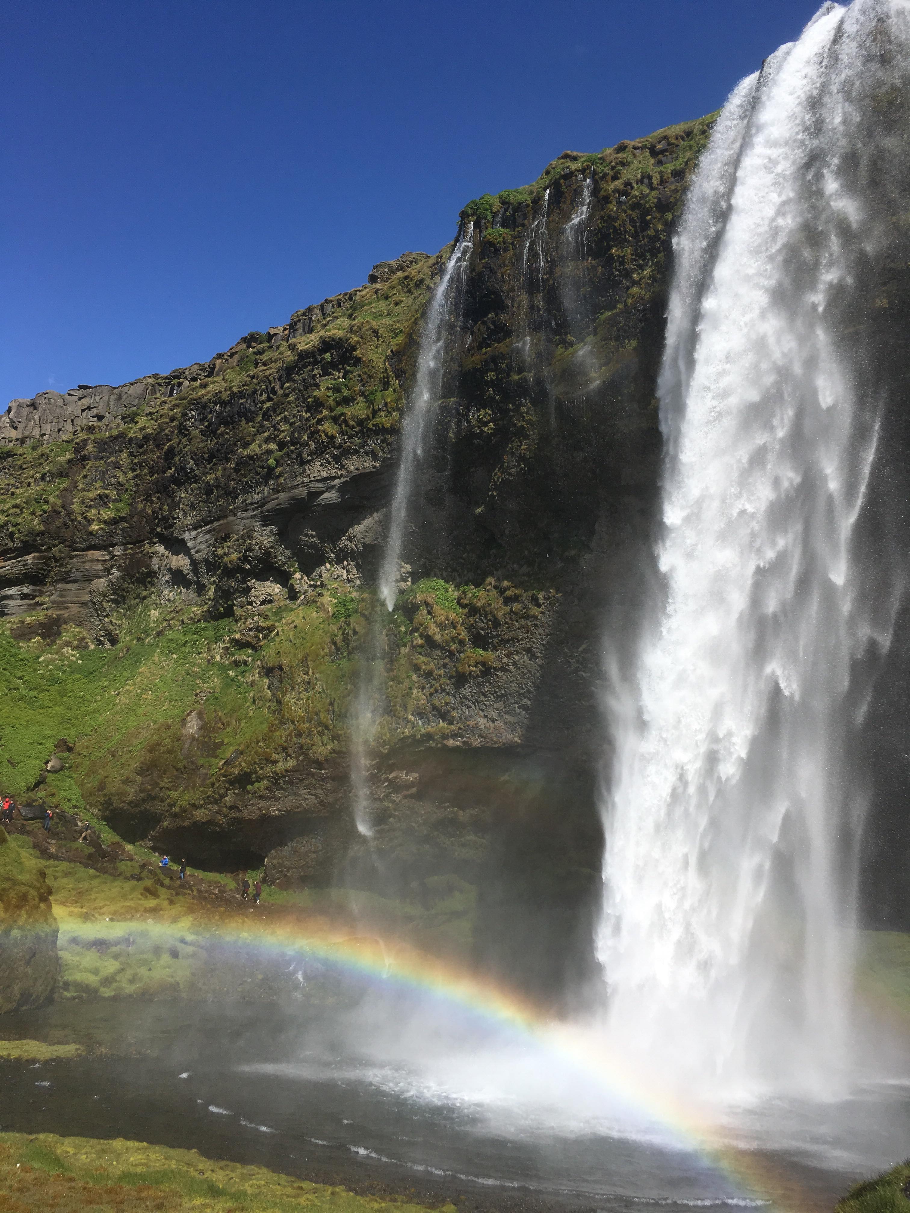
A little past the Althing is this beautiful waterfall, the first one I’ve seen in Iceland (I have been told that there are many waterfalls in Iceland). The nice thing about Iceland is that because the water is so clean, you can re-fill your water bottle there. And I can tell you that it is the best water I’ve ever had.
After finish touring the Althing, we left to go see another, much bigger waterfall. On the way, we were able to see Hekla (by some miracle) through the haze, and drove through the town called Geyser. Interestingly, geysers (the geological phenomenon) is named after the town because there are so many of them. We did not stop there because according to E and C, it is just a tourist trap.
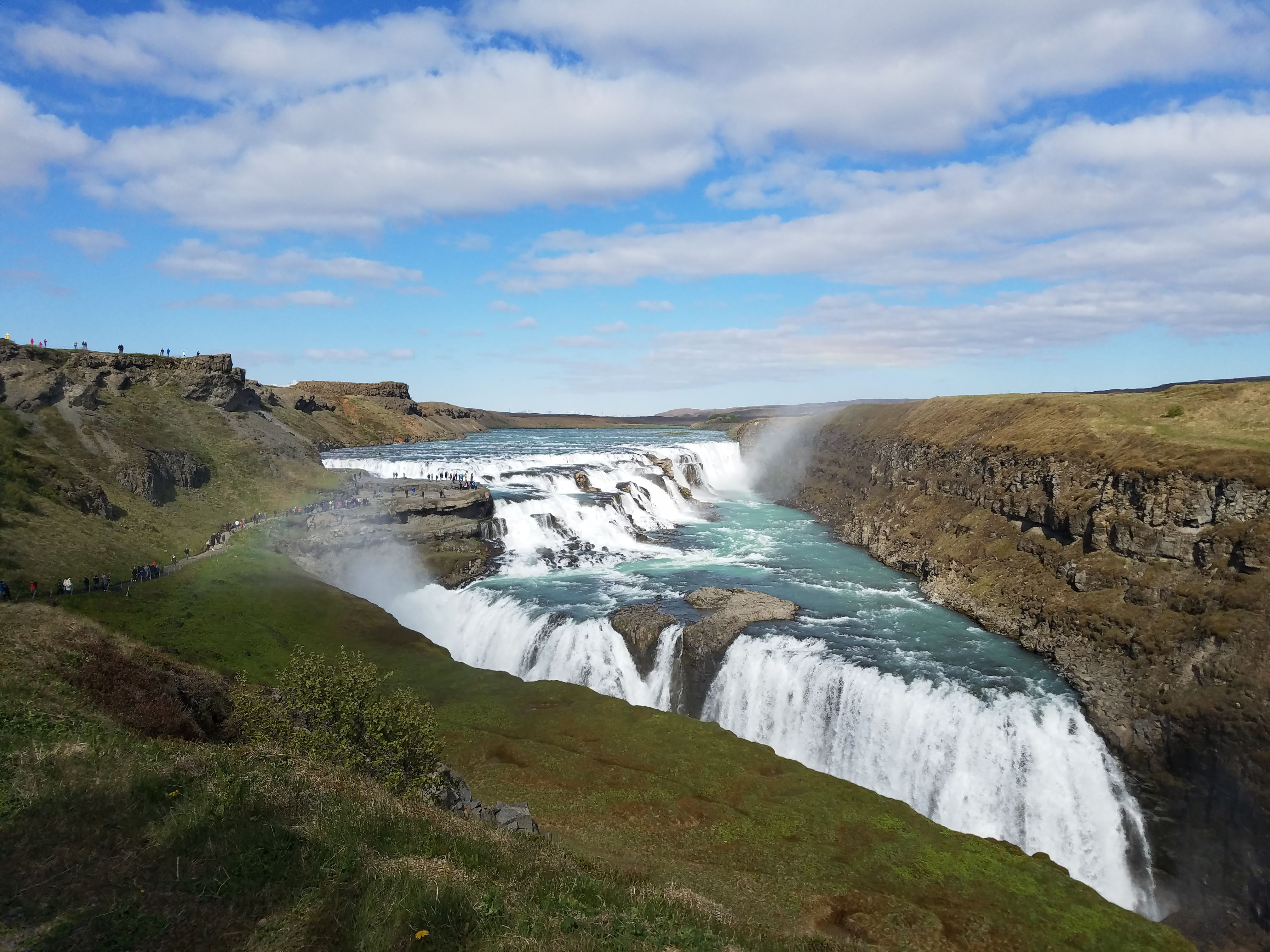
For size reference, there is a trail on the right side of the photo where people are walking.

This is a much nicer photo of the waterfall courtesy of Roger and his fancy camera.
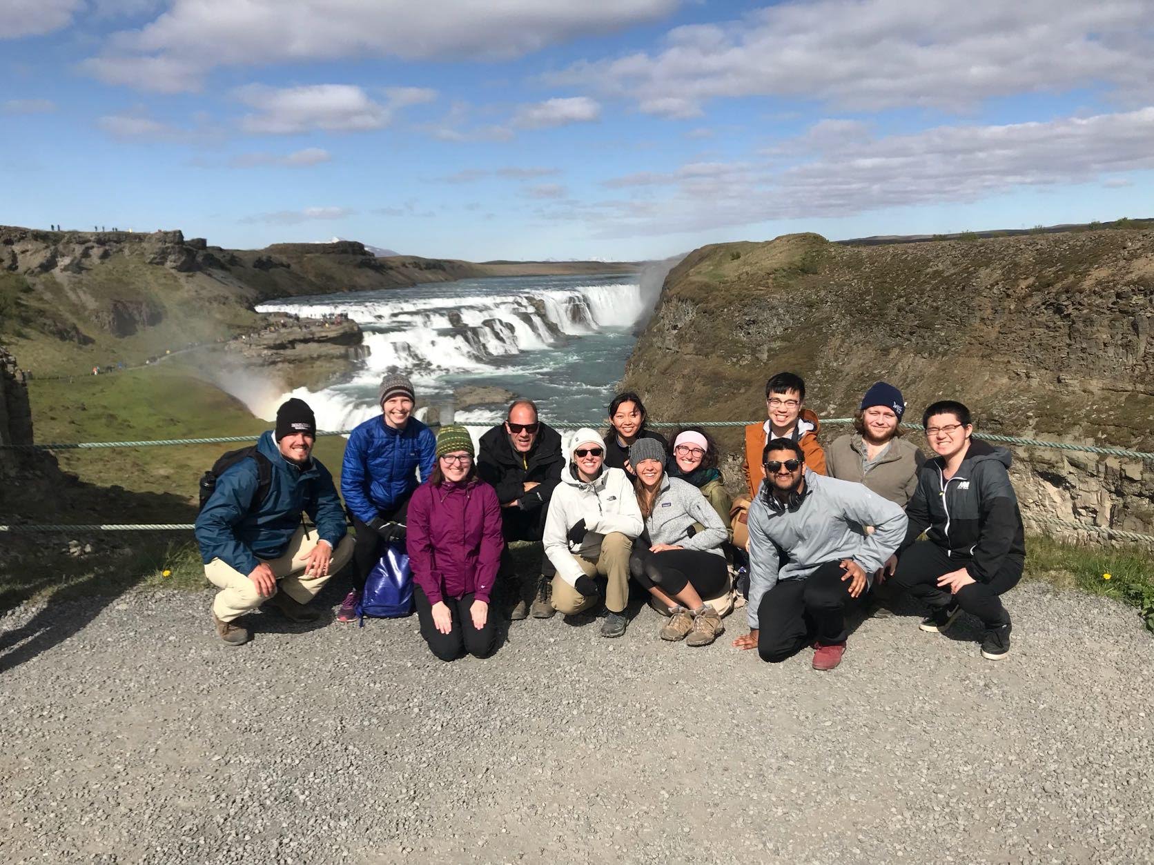
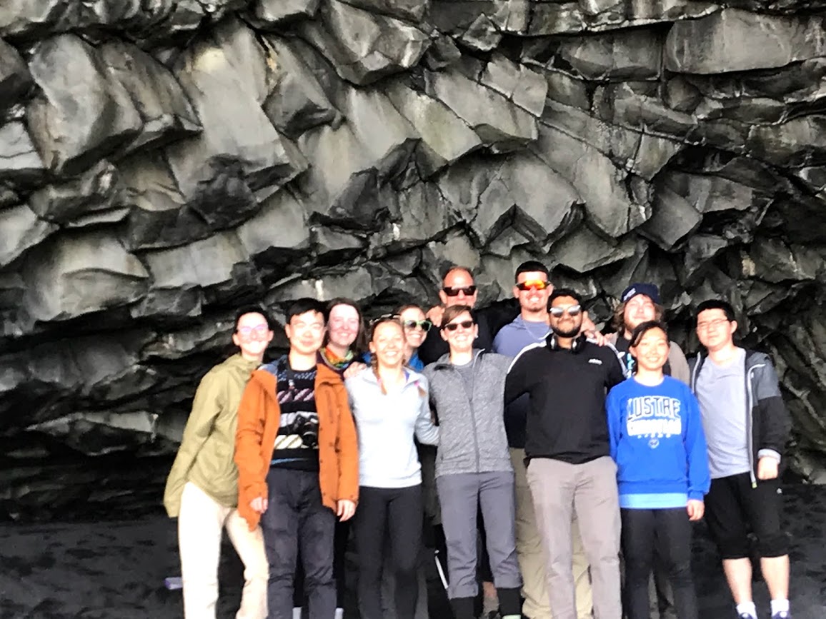
And the obligatory group photo and a rainbow in the background.
To finish off the day Mubi served everyone an absolutely delicious meal of stir-fry ramen. Well, it’s time for bed for me, even though it’s still light out (that’s going to take some getting used to).
The Iceland trip is officially in progress! I should probably introduce myself (and everyone else) before I continue on, I’m Kathryn Hulleman and I am a biochemistry junior.
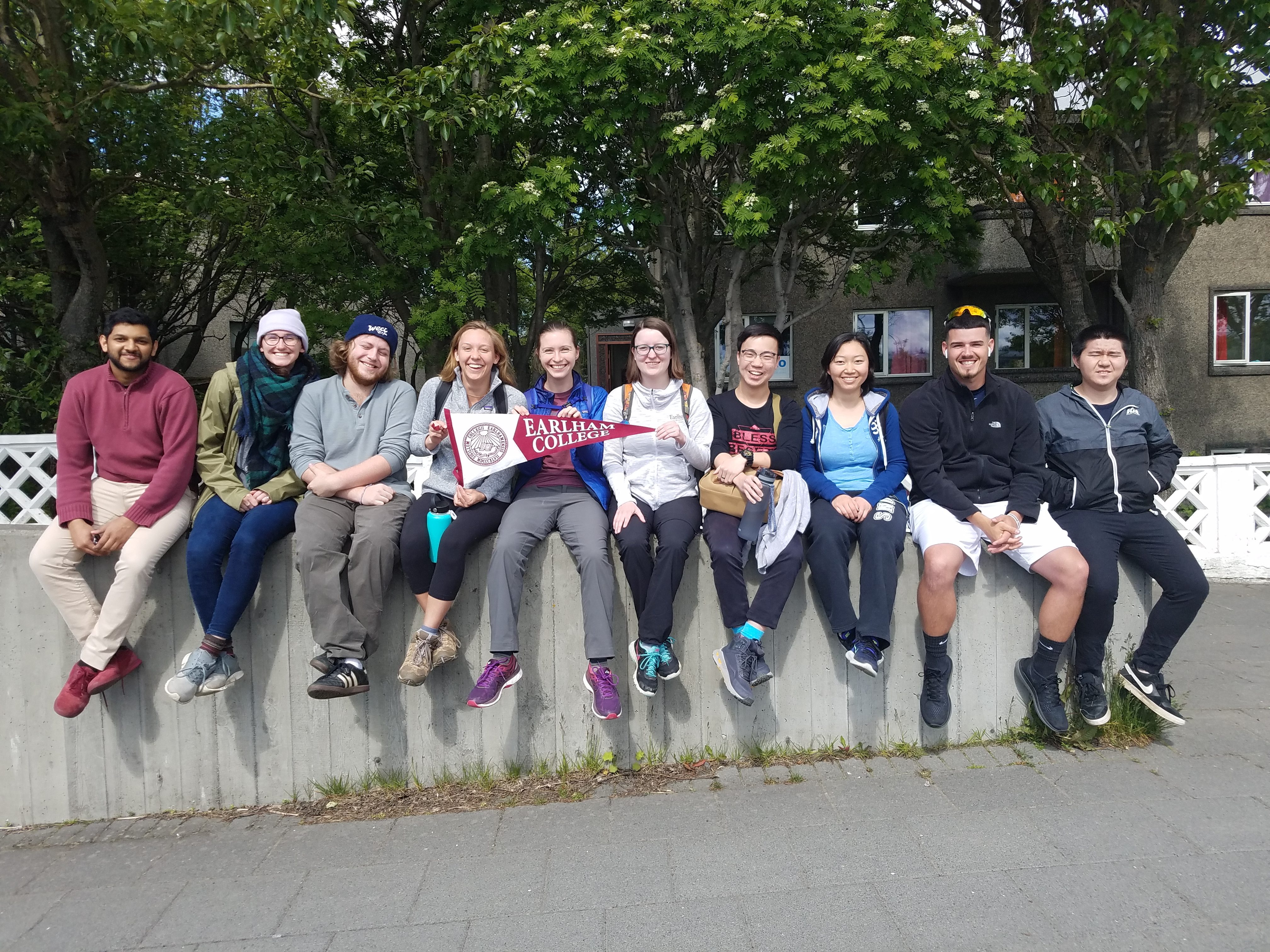
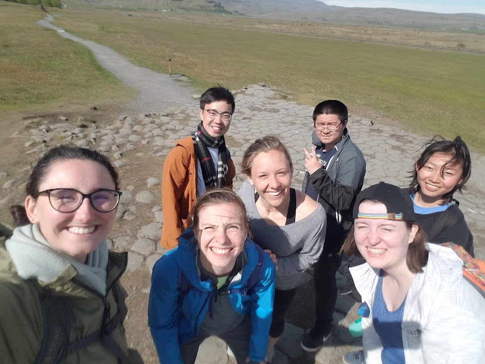
This is all of us students on the trip, and from right to left: Li, Jordan, Joyce, Roger, Lilli, Kathryn (me), Sydney, Porter, Kaela, and Mubi.
Today was a long day (or two depending on how you count). Fortunately for us, all of the flights went smoothly (no missed flights, delays or people). We passed the time in the Minneapolis airport by playing codenames. On the way into Reykjavik, there was interesting statue. That is wait for it… An egg with a jet hatching out of it.
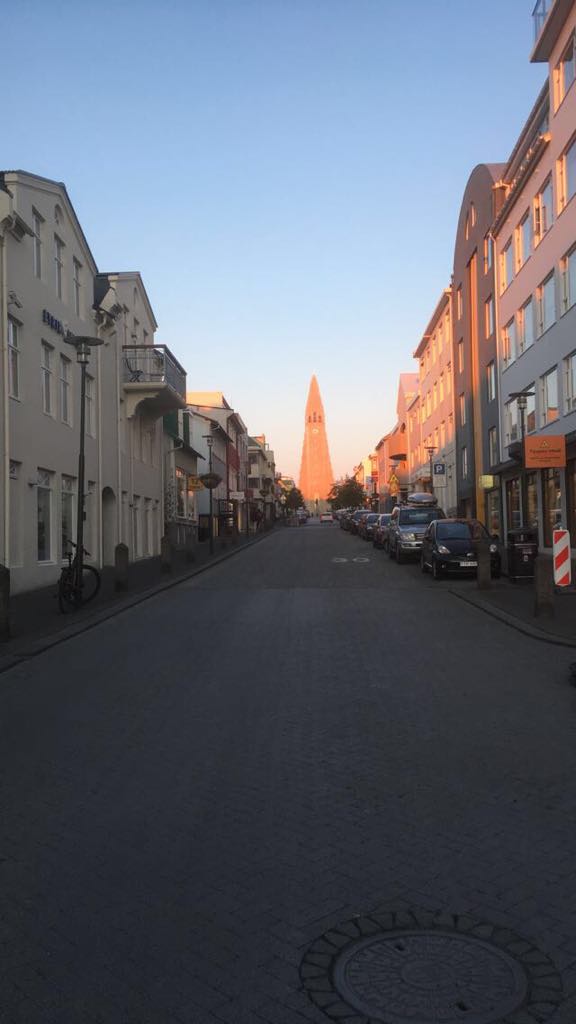
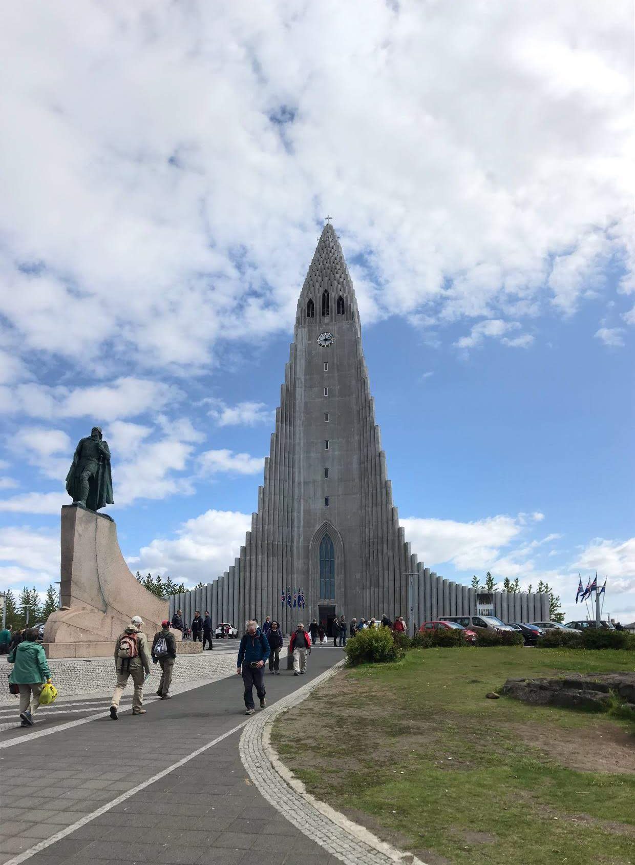
Luckily for us, the weather was beautiful when we arrived in Iceland— nice and sunny, no rain, and a minimal breeze. To start off the trip, E and C (plus me) went out shopping for food while everyone else took a nice, needed nap. After lunch, which was sandwiches with smoked lamb and some Swiss cheese, and with full bellies, we started out on adventure to the downtown area lead by Em. Em’s tip for not getting lost in Reykjavik is to know how to get home from the concrete church, because it is visible in from most of the downtown area.
Some highlights from our walk around Reykjavik included:
Charlie and Jordan cooked a delicious meal of baked cod with leaks, mashed potatoes and a salad. And now for the photos!

This is the beautiful cat Kisa who graced our presence this morning!

Here is Sydney (with Porter and Mubi in the background) on the street of downtown Reykjavik. As you can see the sun is out and there is almost no wind! This nice of weather probably won’t happen again on the trip, but one can hope!
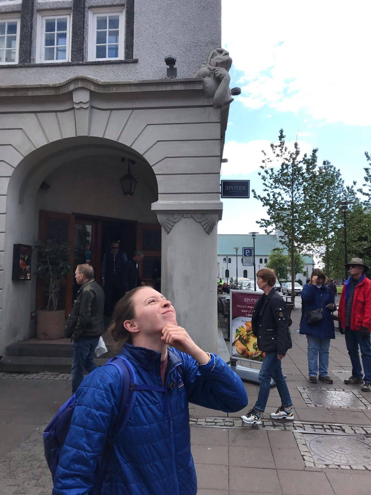
Porter and I have started a trend of imitating statues throughout the city (with much goading on Kaela and Sydney’s part) which we hope to continue throughout the trip.
And that concludes all that we did for today. I for one am ready for bed and can’t wait for what tomorrow brings!