Building a 3D Model of Ta’an’s Egyptian Sarcophagus

with No Comments

Did you know that the only two ancient Egyptian mummies in Indiana are located in Richmond? One is in Wayne County Historical Museum, and the other is right here at Earlham College as a part of the Joseph Moore Museum. We are excited to introduce you to an exciting project we had been working on, in cooperation with the Computer Science Department and the Joseph Moore Museum.
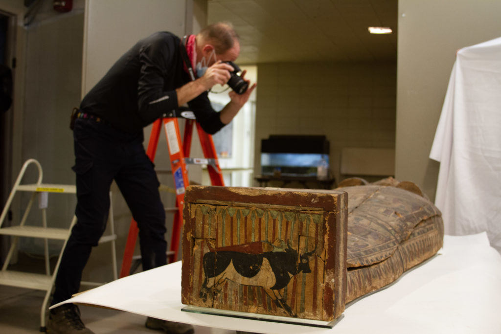
Charlie taking photo of the Egyptian sarcoph
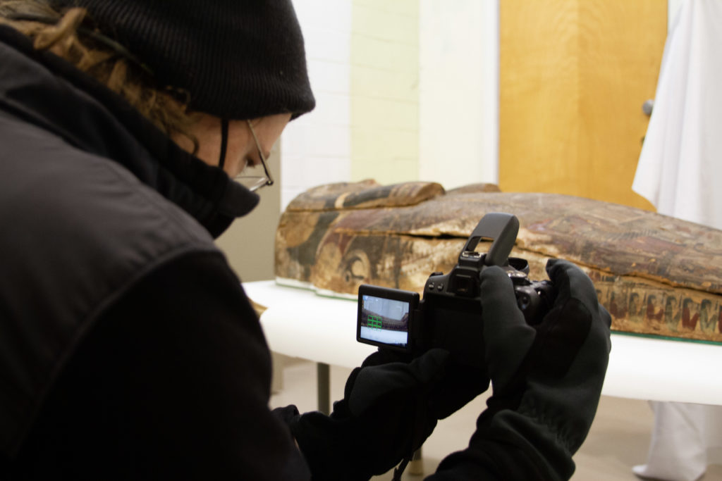
Charlie takes photographs of the sarcophagus. Ann-Eliza is holding the white backdrop.

Despite the museum’s closure to the public since the pandemic, Joseph Moore Museum has been working to bring better and improved exhibitions to the public when it reopens. With an Indiana humanities grant, students in the Exhibit Design class redesigned the ancient Egypt exhibit. Over the winter break, the existing exhibit was demolished. For the first time in 10 years, the sarcophagus was taken out of the display case before the demolition and moved to a safe location.

As soon as the Spring semester started, Charlie, Craig, and Yujeong went down to the museum for a rare opportunity to digitize the sarcophagus. With the goal to build a 3-dimensional digital model of the sarcophagus, Charlie and Craig took about 180 overlapping photos of the sarcophagus from the top and its four sides using a basic digital SLR camera. We then used the open source 3D modeling software OpenDroneMap (ODM) to build a digital model of Ta’an’s sarcophagus.
Craig takes photographs of the sarcophagus from its side.

ODM, also known as OpenDroneMap, is a powerful tool for processing imagery into maps and 3D models, e.g. the Icelandic Field Studies program uses it as part of there multidisciplinary research group that collaborates with archeologists in Iceland to build open-source, open-hardware gear for near-Earth surveying. As one of its primary project recently funded by the National Geographic Society, the IFS group has been surveying several ancient Norse sites in Iceland to look for early settlement activity from subterranean features with tools like ODM.
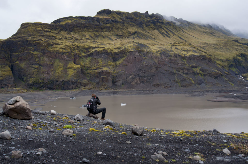
Nic Arnold takes photographs at the Solheimajokull glacier in Iceland during a research trip in 2017.

The digitized 3D model of the sarcophagus can be viewed with MeshLab, and it encompasses an incredible amount of details. Viewers can take a close look at the paintings, textures, and even cracks on the sarcophagus. Furthermore, even after the sarcophagus decomposes past its preservation plan, we now have an accurate visual data of the artifact that future scholars can use to study and honor.
We’re on track for summer

with No Comments

Discussions are ongoing about the viability of summer travel given the pandemic. However, as Charlie has blogged recently, we are “acting as if”. As such, we are trying to maintain our original calendar.

Lo and behold, we have:

Imagine a “You are here” arrow by Spring 1

Here’s the full breakdown of that schedule and our progress:

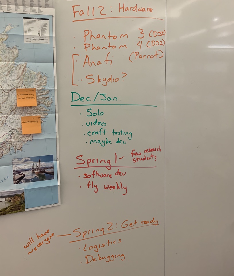
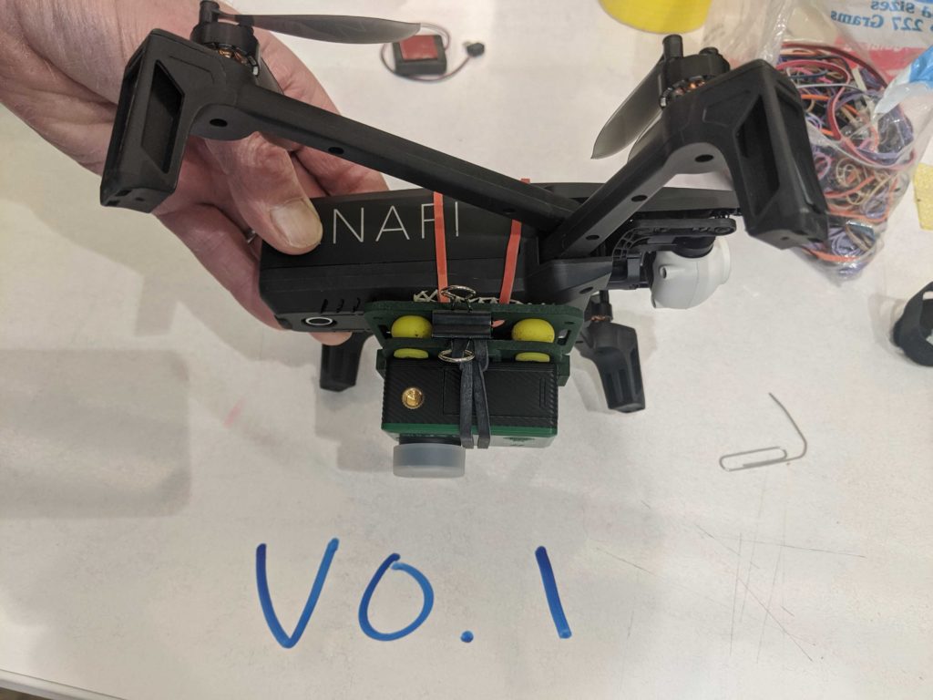
Our plan for the fall was to find and test alternative UAV’s. This proved prudent, as the federal government banned DJI craft late last year. We are happy with both the Parrot and the Skydio craft, for different reasons which we’ll undoubtedly cover here on this blog in the future.

December and January, which were effectively a long winter break for a subset of us, were dedicated to testing the craft, capturing initial video, and possibly beginning development. This was a success as well. Additionally we have begun spinning up a more sophisticated web presence for the stories we’re telling – changes we will be prepared to publish soon.

We’ve now started the calendar for the spring, term 1 of 2. We are moving into scaling up our operation of the craft and developing software to automate that work. It’s a tough problem but one we can solve in the time we have.

We’re optimistic about our ability to meet the moment. If the world continues to make progress on COVID-19, we should be in shape to have a successful research trip.

Cross-posted to craigearley.com

The year in review

with No Comments

For the first two months of 2020 we planned and worked as though we would be working in Iceland during June; once we realized that the Covid-19 pandemic would prevent that, and much else, we re-organized ourselves and our work in the new normal. This included accommodating people working remotely from a wide range of timezones and reprioritizing tasks based on a new timetable. Whenever possible we tried to make lemonade, for instance we were able to re-organize our data storage structures, something we could not have done without the long timeline available this past year. Here is a summary of the other ground we have covered, future posts will have more details about each of these bits.

Craft research – One of the challenges of doing system integration in this space is the fast pace at which the hardware is evolving. We refined our requirements and resurveyed the market, ultimately deciding to add the Parrott Anafi and the Skydio 2 to our kit. In addition to craft-mounted multi-spectral lens we are also working with a MapIR NIR equipped lightweight camera which we will use as payload on the Anafi.

The Anafi with the MapIR camera payload. Image credit Charlie Peck.

ODM configurations – With time and computational resources we have been able to read and experiment with the ODM options that apply to our analysis workflow, and there are lots of them.

GIS integration – Our workflow now incorporates QGIS, this gives us the ability to use the powerful georeferencing plugin to accurately merge each of the data layers (sensor modes).

Storytelling – For many years we have been taking a fairly ad-hoc and often random approach to getting the word out about our work. We realized that we could now take the time to make a more organized run at storytelling, so a few of us have.

Planning for 2021 – We are now deep into the logistical and science planning for the 2021 field season, as I write this in mid-January we are working with the College and our colleagues in Iceland to plan our time there during June. One of our field sites, the Skalanes Nature Preserve, has experienced a number of mudslides this winter, destroying parts of Seydisfjordur and making travel along the fjord very difficult.

View to the North over the Eider colony at Skalanes. Image credit Charlie Peck.

See you next time Iceland

with No Comments

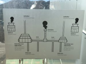
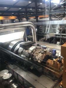
This is our last full day in Reykjavik and in Iceland. In the morning we visited the Hellisheiði Power Plant for the ON Geothermal Exhibition, which gives us a detailed introduction including the history of Iceland using geothermal energy and the significance of geothermal energy to Iceland.

To use geothermal energy, there must exist a geothermal area, which is created by groundwater flowing through hot layers of rock generated by volcanic activities. The geothermal areas are They are categorized based on the temperature of the water in the bedrock into high- or low-temperature areas. The locations of the high- and low-temperature areas is a result of the age and temperature of the bedrock, where production in high-temperature areas focuses on using steam to produce electricity. Eight power plants in total produce 30% of Iceland’s 100% renewable electricity. Whereas within low-temperature areas geothermal hot water can be used for space heating. Approximately 90% of people living in Iceland use geothermal energy for that purpose.

a simplified flow chart of the geothermal plant


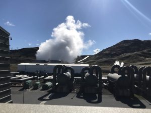
The outdoor view of part of the plant (pipe, cooling tower, steam exhaust)


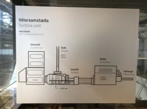
The graph for a high-pressure turbine


the turbine connecting condenser and electricity generator


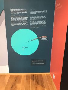
How they deal with the geothermal gas remaining in water such as carbon dioxide and hydrogen sulphide is also impressive. After the method of pumping the water back into the basaltic bedrock to let the gas turned into minerals by chemical combination is introduced, the percentage gets even lower.

We had a free afternoon again after we came back from the geothermal plant. Some of us went to the public pool (heated up by geothermal of course) to release the tiredness accumulated for three weeks. I personally walked around the main street downtown looking for souvenirs.


After dinner together, we all reflected on the whole trip. It is a pleasure to hear what people learned about Iceland from all aspects, how we grow by doing science and living together with each other and to think about what I achieved, accomplished and can do better.


I hope everyone can get some kind of sleep and ready to catch up the 8.30 am flight tomorrow. 🙂

We’re Freeeeeee!!!

with No Comments

Finally, freedom!

We were back in Reykjavik and each of us got the whole day free to do whatever the heck we wanted in the capital. I decided to stay in for lunch, made myself an omelette and some ramen, and then headed to the public pool called Laugardalslaug. Unfortunately, phones and cameras were prohibited in the pool area so capturing pictures was not possible. However, I ended up enjoying the place and the vibe quite a bit as I went around dipping in the hot tub and steambath, completing a couple of laps and then going down a slide (a definite spot of fun for the young ones). There was also a small hot tub in a corner that had geothermal seawater, extracted from a borehole near the coast and heated further. It also had a few interesting salts (6 different ones, cannot recall all of them) – you would be able to feel the difference in texture if you went for a dip in it.

Later, I decided to have dinner at this food court that was within a 10-minute walk from the hostel and I did not regret that decision at all since I got to enjoy some absolutely delicious salmon. It was also the summer solstice, so a lot of people were hanging out in downtown and around the city. I decided to go for a walk, hoping to catch a view of the midnight sun and I was served just right!

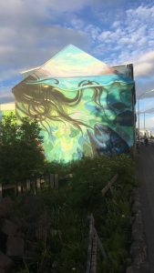
Spotted on a main street, looked very intriguing

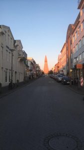
View of Hallgrimskirkja, the largest Lutheran church (probably the tallest building in Reykjavik), under the midnight sun

Program finds itself one hour ahead of schedule, one leader feints from shock…

with No Comments

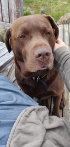
Today was our last day at Skalanes, which is always a bit sad. After spending a wonderful week here doing science, hiking, cooking, and eating together with a group of students from Scotland we are packing-up to head back West for a couple of days in Reykjavik before the program ends on 23 June. Did I mention Fyrir the amazing dog? And Oli and Rannveig the wonderful hosts? We also work with Oli and Rannveig on a couple of science projects related to ecology and archaeology.

Early this morning was a scrum of packing, eating, making lunches, cleaning-up, and saying goodbye. Our travel plan was a trucks to take the gear to the first river, people hiking there, and then a bus to Seyðisfjörðurand and over the Fjarðarheiði mountain pass to the airport in Egilsstaðir. At approximately 10:00 GMT the group found itself completely packed and ready to go, at which point they realized they did not need to leave until 11:00. One of the leaders, who shall remain anonymous, had never been ready ahead of schedule before and feinted from the shock. Hilarity ensued and we Euchre and Carcassonne until it was time to leave.

The trip was uneventful other than the bus trip from RKV airport to the hostel, construction at the hospital has changed the bus route so rather than knowing where to disembark (12 people with baggage and 10 cases of science gear and samples) we were a bit lost. Fortunately a very helpful local explained where we could get off that would be close to our lodgings.

And here are a couple of pictures from Skalanes, which is a place that pictures can hardly do justice to.


Fyrir, local security.


View to the North from the house.

Relaxing Day for Everyone at Skalanes

with No Comments

Hey everyone! My name is Jordan Christian and I am a rising senior with a major in Computer Science and a minor in Global Management. My work here in Iceland has been primarily concerned with networking and configuration for our virtual machine as well as drone flying.

Some science work was completed here at Skalanes yesterday but for the most, it was a pretty relaxing day for all of us here in Iceland. The biology peeps were able to successfully complete some NPK work in the morning and by afternoon were able to relax for the rest of the day. Rain once again deterred the drone group from getting as much flying done as they would have liked, however they were able to capture some VLI imagery over a few spots. Em, Charlie, and Faith went into town to do some independent work on the 16s project and once again could experience the convivial atmosphere any Icelandic town can offer.

Hopefully tomorrow brings us some better weather so we can continue our science work in what will be our last full day at Skalanes!


Peace!

How we celebrate Independence Day? Working!

with No Comments

Today is a quite busy day for everyone. After the script designing and drone flying, I experienced working in a group of four with Sydney, Kaela and Kathryn to take soil samples at two different spots. One next to the coast close to the birds’ habitat, the other one on both sides of the waterfall close to our camping site. The group work was divided efficiently, Kathryn and Sydney took all the samples, Kaela put the data into the database and I am in charge of taking bird view pictures of the sample site with Kari.

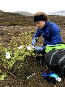
We took all the samples under the area covered by a tree crown, the trees we met here are 50 cm tall in average, no more than 2 meters, even if they’ve been growing for a decade or more. For each sample taken under the tree, we took a control group sample on the ground away from the tree. I assume the analysis of the sample can show the difference of the soil affected by the tree or not.


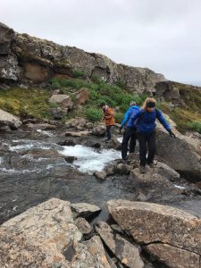
In order to get to the other side of the waterfall, instead of going all the way down, we chose to cross the river directly. The river is wider than it looks from above, it is also harder to cross than I expected. Yet everyone got excited crossing the river as it reflected a great group work between us and marked our job in the afternoon is halfway done, and we made it!

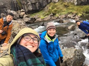
selfie taken right in the middle of the river

The whole process took longer than we expected, but everyone feels perfect after the task been accomplished. I am glad to see that we can work so well in as a group to contribute to the project, I also feel more bonded with my beloved team members.

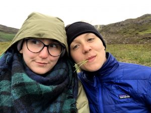
I wonder how’s the taste of the grass


On the other hand, the drone flying group is also having a hard day, lots of flight plans need to be finished which cover a large area. Especially Jordan is almost having a non-stop. Cheers to super hard-working Jordan!

It’s all worth it when we were rewarded by Charlie’s roast lamb at dinner 😉

Sunday Funday

with No Comments

Hello faithful blog readers. Today was pretty foggy, so we were unable to fly any drones due to condensation on the electronics. However, folks got other projects to work on like analyzing the data we had already collected and working on monitoring the flow of one of the rivers, to assess its potential for hydropower. The fjord is beautiful in the fog, though, and many of us appreciated it by taking hikes, both long and small.

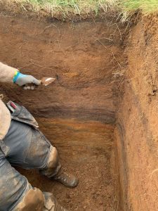
An exciting test pit was dug – over 1 meter of soil was removed from a square meter of land in a known previously habitated site at Skálanes. Óli and Rannveig worked hard to excavate the area, and then we took 13 samples – one for every 10 centimeters. We hope to measure the amount of sheep DNA in each layer – we assume that settlers brought sheep with them, and so sheep DNA should be present in habitated layers and not present in layers that are not habitated. We’re also working to identify the tephra layers (soil horizons which were layed down by volcanic eruptions). It’s not clear out here which layer is which.


Tomorrow is Icelandic Independence Day! We will continue to collect soil samples and drone imagery in the morning, since it is supposed to begin to rain in the afternoon.

Digging, flying, and a lot of ACTATGCACGTC…

with No Comments

Another day in paradise, and a bunch more science. Our group has a number of on-going projects at Skalanes: aerial surveying (near infrared and visible light imagery) for archaeology and ecology, soil parameter analysis and DNA extraction in different types of habitats for ecology, and DNA extraction and tephra analysis for archaeology. Today the diggers went to the test pit and continued digging, measuring, and preparing to take horizontal soil cores in the pit tomorrow. The flyers continued to survey two large areas (~1 square km each) in both light modes. These flights generate hundreds of images each which are harvested to our laptops and then run through Open Drone Map to create composite images of the entire area. Lastly, Faith Jackobs (EC ’18 and IFS ’18) arrived from Texas to help Em and I with our 16S rRNA and ancient DNA analysis workflows. She and I are working through our ancient DNA analysis of the samples we took at Stod last year to confirm that the analysis was done correctly. This includes measuring the amount and nature of the damage to the fragments as part of establishing their age. Stay tuned for the results.

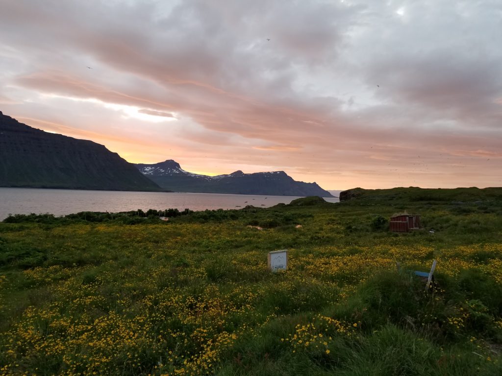
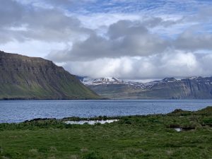
Insert obligatory picture of the amazing natural world at Skalanes here…

1 2 3 4 5 6 7 23