To-do: Figure out to-do list

with No Comments

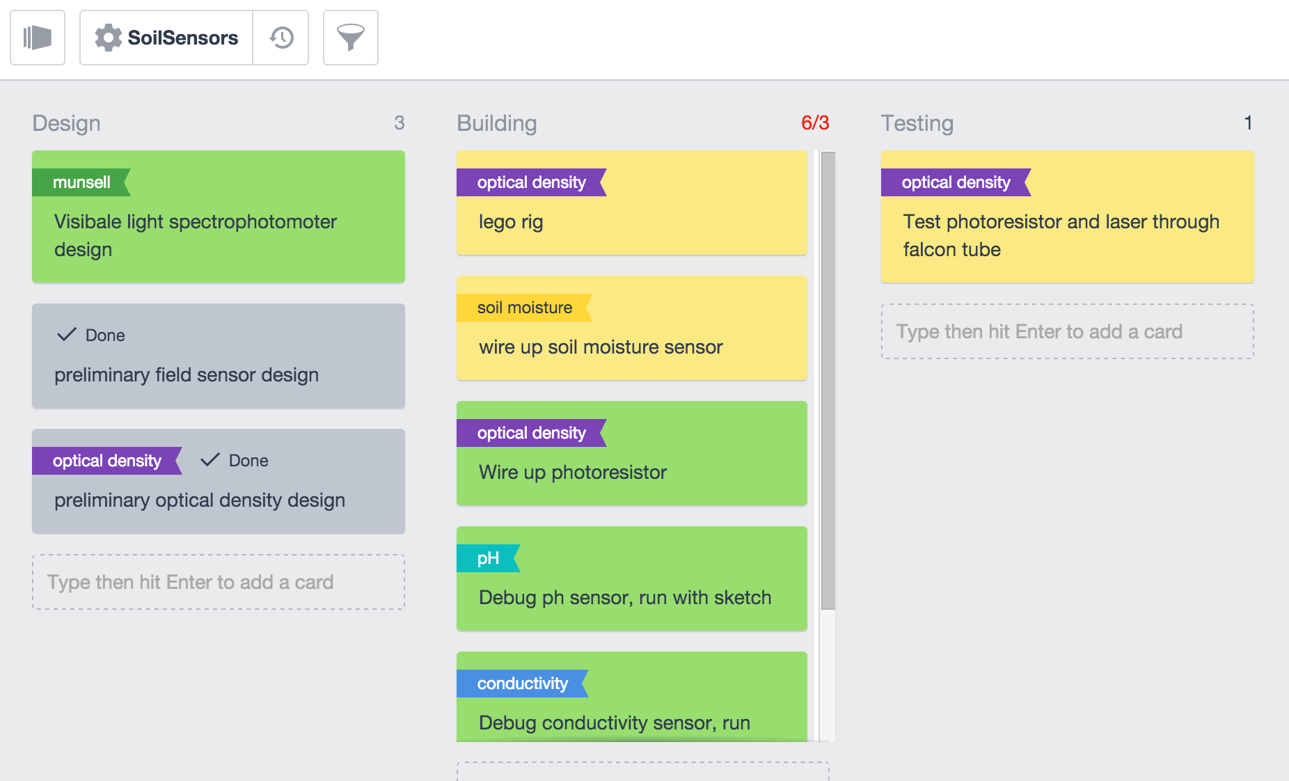
This week Kristin, Charlie, and I met a few times to figure out how to best utilize the Kanbanchi drive app for keeping track of progress on projects. Charlie made sure we had a solid framework of common terms to work with:

project – the level right underneath ‘Iceland 2016’, for example ‘soil sensors’, ‘ambiance’, ‘field day’, ‘bird survey’.

list – the columns in the kanbanchi layout. The different lists within each project are determined at the project level.

cards – the individual items within a list. Broadly speaking, cards are like tasks. They can be assigned to anyone shared on the document. They can contain documents, checklists, and tags. Cards can be given a ‘flag’ that is named by the user. Cards can be given a color. We decided that green will signify tasks we are working on actively, yellow will signify tasks we have not yet started, red will signify tasks that were started but then ran into some sort of trouble (no supplies, something broke etc), and grey tasks we have completed (cards also have a ‘done’ checkbox, for the extra satisfaction factor).

Here is a picture of my kanbanchi layout for the soil sensor platform:

Screen Shot 2015-12-06 at 7.59.21 PM

Sensor-wise, I am working on debugging the ph and conductivity probes. I have not been able to get any serial output from them but arduino isn’t given me any errors. My goal this week is to figure that out and to get the soil moisture sensor and photo-resistor hooked up and working with basic sketches.
 

Progress Report: 10/23 – 11/6

with No Comments

A lot has happened in the last few weeks, so I haven’t really had time to build a kite or really explore that possibility any further. In the mean time, I’ve worked on UAV possibilities we can look into, specifically UAV designs which promote longer flight times. Most of these have been fixed wing designs, which tend to be less of a drain on batteries. One particular inspiration is the Silent Falcon drone, which is designed for LiDAR work, and has 5-12 hour life depending on wing configurations. Building such an aircraft would mean getting carbon fiber moulding equipment in the shop, which I think will be useful no matter what drone we decide to build. Carbon fiber is pretty much the standard for quality UAV solutions, and it will make sense to make as much out of composite materials as we can.

http://www.silentfalconuas.com/Silent-Falcon.html

Energy Survey start

with No Comments

Im taking a short break from android dev to focus on getting the energy survey going. I have weather statistics from weather station 620:Dalanagi which is right across the peninsula from Skálanes. According the these statistics the average wind speeds is 6.4m/s (~14mph) which is good news! Basically we can fly drones no problem! Even the most basic commercial drones are capable of flight in anything less than 7.1m/s winds and because of the average wind speed being 6.5m/s there is sure to be enough days where flight will be possible. Lets start with the non-dispatchable energy sources, those that can’t be throttled on/off. In terms of the energy survey… having dived in to those numbers a bit more… while the average is only 6.4m/s, Skálanes experiences some harsher winds of up to 22m/s during storms. Because of its coastal location it looks as though when its sunny it is relatively calm winds and when theres no sun present its generally windy – 3m/s to 8m/s winds respectively. What this means is that wind and solar will supplement each other quite nicely (at least during the summer). Solar is a little bit trickier of a topic because Iceland has fairly low insolation (measurement of solar energy) because of its latitude. The most practical way of measuring solar will be in field using smaller solar panels, followed by simple math to calculate a full array.

APK naming system

with No Comments

I finally got the APK naming system worked out. Now, whenever we create an APK (both signed and unsigned) the apk will now be named as “FieldDay_username_#githash.apk.” Im now working on the design for our distribution system. The industry standard is to use a version system that will increment with every new APK production. Because we are a group all working on separate development builds that will later be compiled into one production build… there needs to be an easy way to automate the number system so that each production build will play nicely and we will be able to have them all installed independently without them installing over each other. I am also looking into a way to automate the upload system to our WordPress!

Maps & Other Stuff

with 1 Comment

I have been working on finding the maps we need. I found a site, http://shopicelandic.com/collections/maps/topographic which has some maps that could be really useful for us. Charlie also found the Land Survey website, http://www.lmi.is/, which would also be great to get them from, however it is in Icelandic and needs to be translated (google only translates part of the site). I started to gather a list of longitude, latitude coordinates for the places we want to make it easier to put it into this website. The next step with this is to get a more finite list of the places we will be going.

I read an article that supports Oli’s information on arctic foxes as well. Basically, yes red foxes are pushed arctic foxes further north limiting their range and competing for resources. In the long term global warming could bring more resources, but the red fox is pushing out of its habitat because of the warming temperatures. I still do not think we can do much about tracking this for next summer, but it is good to know that populations of arctic foxes are decreases and documenting that could be important information. This article is in the google drive folder for more information.

Finally, as for the bird survey, we really just need to decide if we want to try thermal imaging using a drone/balloon. And how we would do that. If not, we need to just look into other ways of surveying, which are available.

Weeks of 22 and 29 November, 2015

with No Comments

Lots of little things. One item that I would like to resolve sooner rather than later is list tracking, we have a number of on-going projects each of which have 1-3 people working on them and many little bits to track. I think we should also consider choosing a person per project to lead/organize the work for that project.

Over the break I worked on the Android <-> BlueTooth LE <-> Arduino interface. So far I have a working BLE example (with the LightBlue Bean) and I’m integrating that into an Android application that queries the temperature (which doesn’t come from the Arduino side of the chipset). Next is soldering-up header on a LBB so I can attach a sensor on Arduino side.

GIS, fund raising, logistics, and list management will comprise most of what I work on this coming week.

Things are working!

with No Comments

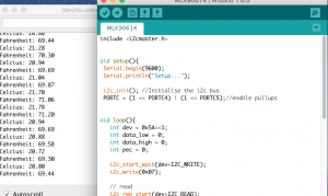
This week I was able to get the IR sensor wired up and working with a basic sketch. Right now it just reports the temperature in degrees C and F every second on the serial monitor. I tested it with different temperatures and it seems to work well.

Screen Shot 2015-11-29 at 5.50.46 PMScreen Shot 2015-11-29 at 7.09.04 PM

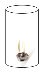
Above left: the output from the IR sensor sketch. Above right: a basic layout for a possible casing for the sensor. I’m imagining it encased in a 3D printed tube with a cap. The tube would be the diameter of a soil corer. After a core sample is taken, the cap could be removed and the tube could be inserted into the soil to take a measurement. The IR sensor measures the temperature of a 90 degree view field.

I was also able to hook up the 5mw red laser with an on off switch over the break. I haven’t been able to test it out with a photo-resistor yet.

The PH and conductivity probes have so far been uncooperative with the UNO, but I am working on debugging the issue.

More Android!

with No Comments

I’ve done a decent amount of work on Android since the previous post. Charlie wanted a ‘Built-In Sensors’ button on to be under the ‘Take a Sample’ button on Field Day. Well, I’ve implemented that.

I’ve written some classes and code where it will query ALL of the available sensors that the device offers. Once it has a list of sensors, it will put them into a ListView and show them to the screen. Most sensors in Android supply 3 values — an x, y, and z. Field Day will query the sensors for values and also display those to the screen. There hasn’t been any work done to the values — they are just displayed as raw.

Implementing this involved created custom ListViews and ArrayAdapters so I was able to show the values and the names of the sensors on the same line. This class, like the other sensors, uses the same geo-coordinates and Satellites and Accuracy values as the other sensors — because it’s a Fragment as well.

I’ve also cleaned up the current code to use the Android suggested changes in Android Studio. Woo-hoo for clean and new code!

Week of 15 November 2015

with No Comments

Another week, another N things moved X distance:

  1. Met with K, G, E, D, and N to continue discussing Field Science/Wilderness Program bits. Notes can be found here.
  2. Ordered bits for the soil platforms, discussed protocols with T (software, sampling, bench).
  3. Assembled the next message for Oli, almost finished processing his most recent message.
  4. Oli sent a GIS file, I’ll unpack it and see if we can work with it.
  5. Considered our scheduled with K, we might want to leave a week or two earlier this year.
  6. Started poking at the Android <-> BlueTooth <-> Arduino interface.

This coming week:

  1. GIS bits.
  2. High-level tour of the most likely projects for this year: glacier measuring, soil platforms (field and bench), sustainable energy survey, avian nest survey, archeological site survey, ambiance platform, Field Day.
  3. Consider where we could teach what in the context of a field science Wilderness Program.
  4. Finish next email to Oli.
  5. Work with Deeksha on data model and current data sets.
  6. Develop initial materials for Institutional Advancement to use with potential donors; meet with SallyS and AvisS.
  7. Work with Eamon on the visualization interface.
  8. Work with Erin and Eamon on the wifi link for Skalanes.
  9. Work on Field Day <-> Bluetooth <-> Platform interface.

Settings

with No Comments

I brought over the settings from Seshat and put it into FieldDay and took the time to go through the code updating and changing it where it needed to be changed. MainScreenActivity was set up to use settings as a fragment, so I went ahead and made that change. I got the “version” to read out correctly, though in the app its set to version 1.0. The version schedule is still in the very early stages, so we can update it as need be. I realized how much of a learning curve android studio has, and I’m only now beginning to learn how to use it efficiently. I tested everything out and it works great! Fragments seem to use up less memory than a regular activity would. I’m having some issues with GIT right now but will push the changes as soon as I get that all sorted out.

1 13 14 15 16 17 18 19 23