Translating a website in another language is actually a very difficult task. Here are a few of the words I translated from the drop down menu for the land survey website. One I had these translated I chose staðfræðikort which translated into topography map however once here there are still a multitude of options, so I have been opening up each one to see where it is and the ones in Austerland (the Eastern Region, where Skalanes is located), are on the Lagarfljot river. I am now continuing to plow through the maps here and will switch keyword if need be.
| atlaskort
aðalkort fjllvegakort aðalkort ferðautgafa ferðkort fornkort fræðslukort gervitunglamynd groðurkort grunnkort göngukort götukort heildarkort heroringjaraðskort jarðfræðikort jarðskjalftalkort kort til serþarfa loftmynd minjakort rettmyndakort segulkort serkort sjokort skipulagskort staðfræðikort sveitargelagakort syniskort |
Atlas map
primary card mountain road map primary card ferðautgafa travel map fornkort education card satellite image vegetation maps mapping A map street overall map heroringjaraðskort geological maps jarðskjalftalkort card for special needs Satelite Historical maps right image map magnetic card serko charts zoning map topography maps Country Argelaga map son maps |
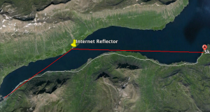
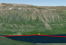
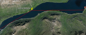
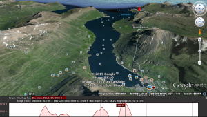 he issue of improving internet at Skalanes I did some research into the topography between the Skalanes lodge and the ferry station where the internet antenna is. I used google earth to draw a line from the ferry station to the lodge. It turns out that the are some mountains over 2,000ft in between which could be a large
 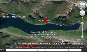 obstacle in the implementation of a balloon. Although the signal ‘curves’ it still seems like it would be hard to make the internet here more reliable this way. The screenshot on the left shows the topographic 3D map from the ferry station, looking down the fiord towards Skalanes.